 Catalogue PIGMA
Terrestrial mapping | Coastline | National Oceanic and Atmospheric Administration (NOAA) | A Global Self-consistent, Hierarchical, High-resolution Geography Database
Simple
- Alternate title
- A Global Self-consistent, Hierarchical, High-resolution Geography Database
- Date
- Identifier
- Terrestrial mapping | Coastline | National Oceanic and Atmospheric Administration (NOAA) | A Global Self-consistent, Hierarchical, High-resolution Geography Database
- Purpose
- Terrestrial Mapping
- Status
- onGoing On going
edmo
National Oceanic and Atmospheric Administration (NOAA)
+1 (202) 482-6090
http://www.noaa.gov/
1401 Constitution Avenue, NW
Room 6217
, Washington , DC 20230 , United Stateshttp://www.noaa.gov/
- Maintenance and update frequency
- Unknown
- Used by challenges
-
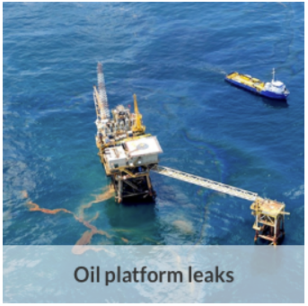
- MedSea - CH03 - Oil Platform Leaks
- Environmental matrix
-
- Marine water
- Production mode
-
- Delayed
- Parameter Discovery Vocabulary (P02)
-
- Terrestrial mapping
- GEMET - INSPIRE themes, version 1.0
-
- Elevation
- Processing level of characteristics
-
- High level analyzed
- Data delivery mechanisms
-
- Online downloading services
- Parameter Usage Vocabulary (other)
-
- Coastline
- Agreed Parameter Groups (P03)
-
- Terrestrial
- Service extent
-
- The datasets are referenced in a public national catalogue, in an international catalogue service
- Visibility
-
- Use of open search engines, searching by name either the data provider or the characteristics
- Policy visibility
-
- There is detailed information provided to understand data policy
- Readyness
-
- Format not proprietary and content clearly specified (e.g. autodescriptive like ODV, NetCDF CF) or at least with appropriate document describing the content
- Access constraints
- Other restrictions
- Other constraints
- Unrestricted
- Use limitation
- Open and Free. No charge
- Spatial representation type
- vector Vector
- Metadata language
- Français
- Character set
- utf8 UTF8
- Topic category
-
- Oceans
- Environment description
-
Oil spill predictions
forecast of the oil spill transport and transformation using the oil spill model (MEDSLIK-II, MEDSLIK); output oil concentration evolution in space and time
N
S
E
W
))
Vertical extent
- Dimension name
- Time
- Transformation parameter availability
- Yes
- Checkpoint Availability
- Yes
- Distribution format
-
-
NetCDF
()
-
Binary
()
-
NetCDF
()
- OnLine resource
- GSHHG ( WWW:LINK )
- OnLine resource
- https://www.ngdc.noaa.gov/mgg/shorelines/data/gshhg/latest/ ( WWW:LINK )
- Hierarchy level
- Dataset
Domain consistency
- Name of measure
- Responsiveness
Quantitative result
- Value
- Online downloading (i.e. a few hours or less) for release
- Attribute description
- observation
- Content type
- Physical measurement
- File identifier
- 8114e8d9-0717-45a6-abeb-8da027d64361 XML
- Metadata language
- English
- Character set
- UTF8
- Hierarchy level
- Dataset
- Hierarchy level name
- MedSea - CH03 - Oil Platform Leaks
- Date stamp
- 2017-08-24T12:27:59Z
- Metadata standard name
- ISO 19115-3 - Emodnet Checkpoint - Upstream Data
- Metadata standard version
- 1.0
Overviews

thumbnail
large_thumbnail
Spatial extent
N
S
E
W
Provided by

Associated resources
Not available