 Catalogue PIGMA
OceanSODA standardised surface ocean carbonate system matchup dataset, version 3.4
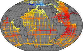
In recent years, large datasets of in situ marine carbonate system parameters (partial pressure of CO2 (pCO2), total alkalinity, dissolved inorganic carbon and pH) have been collated. These carbonate system datasets have highly variable data density in both space and time, especially in the case of pCO2, which is routinely measured at high frequency using underway measuring systems. This variation in data density can create biases when the data are used, for example for algorithm assessment, favouring datasets or regions with high data density. A common way to overcome data density issues is to bin the data into cells of equal latitude and longitude extent. This leads to bins with spatial areas that are latitude and projection dependent (eg become smaller and more elongated as the poles are approached). Additionally, as bin boundaries are defined without reference to the spatial distribution of the data or to geographical features, data clusters may be divided sub-optimally (eg a bin covering a region with a strong gradient).
To overcome these problems and to provide a tool for matching in situ data with satellite, model and climatological data, which often have very different spatiotemporal scales both from the in situ data and from each other, a methodology has been created to group in situ data into ‘regions of interest’, spatiotemporal cylinders consisting of circles on the Earth’s surface extending over a period of time. These regions of interest are optimally adjusted to contain as many in situ measurements as possible. All in situ measurements of the same parameter contained in a region of interest are collated, including estimated uncertainties and regional summary statistics. The same grouping is done for each of the other datasets, producing a dataset of matchups. About 35 million in situ datapoints were then matched with data from five satellite sources and five model and re-analysis datasets to produce a global matchup dataset of carbonate system data, consisting of 287,000 regions of interest spanning 54 years from 1957 to 2020. Each region of interest is 100 km in diameter and 10 days in duration. An example application, the reparameterisation of a global total alkalinity algorithm, is shown. This matchup dataset can be updated as and when in situ and other datasets are updated, and similar datasets at finer spatiotemporal scale can be constructed, for example to enable regional studies.
This dataset was funded by ESA Satellite Oceanographic Datasets for Acidification (OceanSODA) project which aims at developing the use of satellite Earth Observation for studying and monitoring marine carbonate chemistry.
**This version is now superseded by the version 4 with higher spatial and temporal resolution**
Simple
- Date (Creation)
- 2022-03-24
- Date (Publication)
- 2022-03-24
- Identifier
- OceanSODA-MMDB / 3.4
- Cersat - Project
-
- OceanSODA
- Cersat - Latency
-
- Historical
- Cersat - GCMD parameter
-
- /Ocean Chemistry/Carbonate
- /Ocean Chemistry/Ph
- Centre de données ODATIS
-
- CDS-CERSAT
- Use limitation
- None
- Access constraints
- unrestricted
- Use constraints
- Other restrictions
- Other constraints
- CC-BY (Creative Commons - Attribution)
- Other constraints
- IFREMER / CERSAT and PML. 2022. Standardised surface ocean carbonate system matchup dataset for OceanSODA project. Ver. 3.4. IFREMER, Plouzane, France. Dataset accessed [YYYY-MM-DD]. DOI: 10.12770/0dc16d62-05f6-4bbe-9dc4-6d47825a5931
- Spatial representation type
- grid Grid
- Distance
- 100 km
- Topic category
-
- Oceans
))
- Geographic identifier
- Global
- Begin date
- 1952-01-01
- End date
- 2020-12-31
- Reference system identifier
- http://www.opengis.net/def/crs/EPSG/0/4326
- Distribution format
-
-
NetCDF
(
4
)
-
NetCDF
(
4
)
- OnLine resource
-
IFREMER HTTP server
(
WWW:LINK
)
HTTPS
- OnLine resource
- Digital Object Identifier (DOI) ( DOI )
- Hierarchy level
- Dataset
- File identifier
- 0dc16d62-05f6-4bbe-9dc4-6d47825a5931 XML
- Metadata language
- English
- Character set
- UTF8
- Hierarchy level
- Dataset
- Date stamp
- 2026-07-01T14:38:10.814798Z
- Metadata standard name
- ISO 19115-3:2018 - Remote Sensing
Overviews
Spatial extent
Provided by
