 Catalogue PIGMA
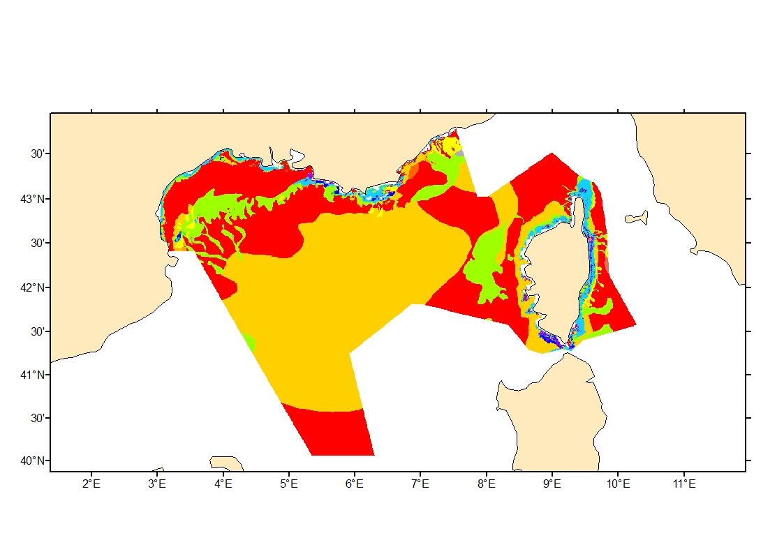
Modelled seabed sediment average grain size in French Mediterranean waters
Simple
- Date (Creation)
- 2020-04-01
- Credit
- Ifremer
- Thèmes Sextant
-
- /Physical Environment/Geology/Seabed Nature
- GEMET - INSPIRE themes, version 1.0
-
- Habitats and biotopes
- DCSMM : Descripteurs
-
- D1: Deep-sea benthic habitats
- D6: Sea-floor Integrity
- Sous-regions marines
-
- Western Mediterranean
- Thématiques - SIMM
-
- /Environmental Status/Geology
- /Environmental Status/Habitats
- Research
- Use limitation
- CC-BY-NC-SA (Creative Commons - Attribution, Pas d’utilisation commerciale, Partage dans les mêmes conditions)
- Access constraints
- Other restrictions
- Use constraints
- Copyright
- Spatial representation type
- grid Grid
- Metadata language
- English
- Character set
- utf8 UTF8
- Topic category
-
- Oceans
- Environment
))
- Reference system identifier
- EPSG / WGS 84 (EPSG:4326) / 8.6
- Number of dimensions
- 2
- Dimension name
- Vertical
- Dimension name
- Time
- Cell geometry
- Area
- Transformation parameter availability
- No
- Distribution format
-
-
(
)
-
(
)
- OnLine resource
- Base de Données Sédimentologiques du SHOM - BDSS ( WWW:LINK )
- OnLine resource
- Sédimentologie - Méditerranée occidentale ( WWW:LINK )
- OnLine resource
- iso 16665 ( WWW:LINK )
- OnLine resource
- Sediment_avg_grain_size_Med_fr ( OGC:WMS )
- Protocol
- COPYFILE
- Name
- Sediment_avg_grain_size_Med_fr
- Hierarchy level
- Dataset
Domain consistency
Conformance result
- Date (Publication)
- 2010-12-08
- Explanation
- See the referenced specification
- Description
-
Sediment average grain size in French Mediterranean waters was generated from sediment categories.
SHOM sediment map in the French Mediterranean waters was used to obtain sediment distribution, grain size range (mm) per sediment group and % fraction of each main sediment group (Rock, pebble, pebble and gravel, gravel,sand, sand and fine sand, fine sand, mud, silt and clay). Upper and lower boundaries for rock, pebble and clay size were derived from iso 16665 description.
- Description
-
Römkens et al. (1997) equation enabling the estimation of average grain size from sediment typologie and fraction was applied:
X = exp[ 0.01 * SUM( fi * ln( mi ) ) ]
where X :average grain size (mm) ; mi : estimated average grain size of ith sediment category (mm) and ; fi : corresponding fraction of mi (%).
Römkens, M. J. M., Young, R. A., Poesen, J. W. A., McCool, D. K., El-Swaify, S. A., & Bradford, J. M., 1997. Soil erodibility factor (K). Renard KG et al., Predicting soil erosion by water: a guide to conservation planning with the Revised Universal Soil Loss Equation (RUSLE). USDA Agriculture Handbook, (703), 65-99.
- Description
- Sediment categories were recoded with the computed average grain size and the layer was transformed in geotiff.
- File identifier
- 5b62e0c9-05ab-4b86-bd04-282fec733f87 XML
- Metadata language
- English
- Character set
- UTF8
- Hierarchy level
- Dataset
- Date stamp
- 2025-05-15T22:32:48.745818Z
- Metadata standard name
- ISO 19115-3 - SEXTANT
- Metadata standard version
- 1.0
Overviews
Spatial extent
Provided by
