 Catalogue PIGMA
Lithology | Type of Sediment | SeaZone Solutions | Hydrospatial One - Natural and Physical Features
Simple
- Alternate title
- Hydrospatial One - Natural and Physical Features
- Date
- Identifier
- Lithology | Type of Sediment | SeaZone Solutions | Hydrospatial One - Natural and Physical Features
- Other citation details
- Hydrospatial One - Natural and Physical Features
- Purpose
- SeaZone Hydrospatial One - Natural and Physical Features
- Status
- onGoing On going
edmo
SeaZone Solutions
http://www.seazone.com
Red Lion House
,
Bentley
,
GU10 5HY
,
United Kingdom
+44 (0)870 013 0607
http://www.seazone.com
- Maintenance and update frequency
- Biannually
- Used by challenges
-
- Atlantic - CH10 - Bathymetry
- Environmental matrix
-
- Seabed - Riverbed
- Production mode
-
- Delayed
- Visibility
-
- Use of open search engines, searching by name either the data provider or the characteristics
- Policy visibility
-
- There is information, but details are available only on request
- Readyness
-
- Format proprietary but content clearly specified
- Parameter Discovery Vocabulary (P02)
-
- Lithology
- GEMET - INSPIRE themes, version 1.0
-
- Elevation
- Processing level of characteristics
-
- High level analyzed
- Data delivery mechanisms
-
- Manual process: Order form/invoice is requested
- Parameter Usage Vocabulary (other)
-
- Type of Sediment
- Agreed Parameter Groups (P03)
-
- Rock and sediment lithology and mineralogy
- Service extent
-
- The datasets are referenced in a public national catalogue, in an international catalogue service
- Validation
-
- Draft
- Access constraints
- Other restrictions
- Other constraints
- Accessible under moratorium
- Use limitation
- Not or not well documented
- Spatial representation type
- vector Vector
- Metadata language
- Français
- Character set
- utf8 UTF8
- Topic category
-
- Oceans
- Environment description
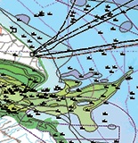
- Analysis of water depth.
N
S
E
W
))
- Begin date
- 2008-12-05
Vertical extent
- Dimension name
- Time
- Transformation parameter availability
- Yes
- Checkpoint Availability
- Yes
- Distribution format
-
-
ESRI Shapefile
()
-
Mapinfo TAB
()
-
Ascii
()
-
Non standard format available upon request
()
-
ESRI Personal Geodatabase (.pdg)
()
-
ESRI File Geodatabase (.gdb)
()
-
ESRI Shapefile
()
- OnLine resource
- Hydrospatial One - Natural and Physical Features ( WWW:LINK )
- OnLine resource
- Hydrospatial One - Natural and Physical Features ( WWW:LINK )
- Hierarchy level
- Dataset
Domain consistency
- Name of measure
- Responsiveness
Quantitative result
- Value
- No information is found on response time
Domain consistency
- Name of measure
- Reliability
Quantitative result
- Statement
- www.seazone.com/marine-maps/product/hydrospatial-one
- Attribute description
- observation
- Content type
- Physical measurement
- File identifier
- 7aedb64c-fcc0-4d17-ab35-4ceaaf278ca6 XML
- Metadata language
- English
- Character set
- UTF8
- Hierarchy level
- Series
- Hierarchy level name
- Atlantic - CH10 - Bathymetry
- Date stamp
- 2016-11-17T12:34:50Z
- Metadata standard name
- ISO 19115-3 - Emodnet Checkpoint - Upstream Data
- Metadata standard version
- 1.0
Overviews
Spatial extent
N
S
E
W
Provided by

Associated resources
Not available