 Catalogue PIGMA
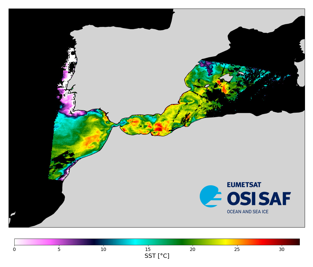
EUMETSAT OSI SAF Full resolution Metop-C Sea Surface Temperature metagranules
Level 2 sub-skin Sea Surface Temperature derived from AVHRR on Metop, global and provided in full-resolution swath (1 km at nadir), in GHRSST compliant netCDF format.
The satellite input data has successively come from Metop-A, Metop-B and Metop-C level 1 data processed at EUMETSAT. SST is retrieved from AVHRR infrared channels (3.7, 10.8 and 12.0 µm) using a multispectral algorithm and a cloud mask. Atmospheric profiles of water vapor and temperature from a numerical weather prediction model, Sea Surface Temperature from an analysis, together with a radiative transfer model, are used to correct the multispectral algorithm for regional and seasonal biases due to changing atmospheric conditions.
The quality of the products is monitored regularly by daily comparison of the satellite estimates against buoy measurements.The product format is compliant with the GHRSST Data Specification (GDS) version 2. Users are advised to use data only with quality levels 3,4 and 5.
Simple
- Date (Creation)
- 2020-11-25
- Date (Publication)
- 2020-11-25
- Identifier
- AVHRR_SST_METOP_C-OSISAF-L2P-v1.0 / AVHRR_SST_METOP_C-OSISAF-L2P-v1.0
- Status
- onGoing On going
- dataCentre
-
- CERSAT
- product
-
- Remote sensing
- Cersat - Processing level
-
- L1
- Specific usage
- Issue
- Date (validityBegins)
- Date (validityExpires)
- Specific usage
- Update
- Use limitation
- None
- Access constraints
- unrestricted
- Use constraints
- Other restrictions
- Other constraints
- Open Licence
- Other constraints
- EUMETSAT Ocean and Sea Ice Satellite Application Facility, Full resolution Sea Surface Temperature metagranules (Metop-C) 2020-onwards, doi:10.15770/EUM_SAF_OSI_NRT_2013, data for [extracted period], [extracted domain], accessed [download date] from [distributor/distribution mean]
- Date
- Spatial representation type
- grid Grid
- Distance
- 1 km
- Topic category
-
- Oceans
))
- Geographic identifier
- Global
- Begin date
- 2020-11-25
- Reference system identifier
- http://www.opengis.net/def/crs/EPSG/0/4326
Spatial representation info
- Distribution format
-
-
NetCDF
(
4
)
-
NetCDF
(
4
)
- OnLine resource
-
Local path on Ifremer/Datarmor
(
NETWORK:LINK
)
Local path on Datarmor (Ifremer restricted) platform
- OnLine resource
-
avhrr_sst_metop_c-osisaf-l2p-v1.0
(
WWW:OPENSEARCH
)
OSI SAF Opensearch service
- OnLine resource
-
Ifremer HTTP server
(
WWW:LINK
)
HTTPS
- OnLine resource
- EUMETCast ( WWW:BROADCAST )
- OnLine resource
-
User guide
(
WWW:LINK
)
Product User Guide
- OnLine resource
- Digital Object Identifier (DOI) ( DOI )
- Statement
- Global AVHRR level 1b data are acquired at Meteo-France/Centre de Meteorologie Spatiale (CMS) through the EUMETSAT/EUMETCAST system. SST is retrieved from the AVHRR infrared channels (3.7, 10.8 and 12.0 micrometer) using a multispectral algorithm. Atmospheric profiles of water vapor and temperature from a numerical weather prediction model, together with a radiatiave transfer model, are used to correct the multispectral algorithm for regional and seasonal biases due to changing atmospheric conditions.
- Date / Time
- v1.0
- Hierarchy level
- Dataset
- Attribute description
- 3-min granule
- Processing level code
- L2P /
- File identifier
- 7c897f47-c893-4f6f-8366-2e539f5d2b21 XML
- Metadata language
- English
- Character set
- UTF8
- Parent identifier
- 84ac5086-2b90-4cbb-97cd-f243f6fb1e5d 84ac5086-2b90-4cbb-97cd-f243f6fb1e5d
- Hierarchy level
- Series
- Date stamp
- 2025-11-01T15:26:06.721646Z
- Metadata standard name
- ISO 19115-3:2018 - Remote Sensing
Overviews
Spatial extent
Provided by
