 Catalogue PIGMA
Transport activity | Vessel Traffic Density | Vessel Finder |
Simple
- Date
- Identifier
- Transport activity | Vessel Traffic Density | Vessel Finder |
- Other citation details
- Historical AIS data available since 2009.
- Purpose
- Based on historical AIS data, this service provides vessel traffic density analysis in critical areas and other paid services. The density analysis is performed for particular area and selection criteria by ship type, size, year of built, etc.
- Status
- onGoing On going
- Maintenance and update frequency
- Unknown
- Used by challenges
-
- Atlantic - CH01 - Windfarm Siting
- Environmental matrix
-
- Human activities
- Production mode
-
- Delayed
- Visibility
-
- Information retrieved upon specific request to the data source
- Policy visibility
-
- There is information, but details are available only on request
- Readyness
-
- Format not or not well documented
- Parameter Discovery Vocabulary (P02)
-
- Transport activity
- GEMET - INSPIRE themes, version 1.0
-
- Transport networks
- Processing level of characteristics
-
- Observation (raw, QC)
- Data delivery mechanisms
-
- Manual process: Order form/invoice is requested
- Parameter Usage Vocabulary (other)
-
- Vessel Traffic Density
- Agreed Parameter Groups (P03)
-
- Human activity
- Service extent
-
- Data sets are not referenced in a catalogue or are referenced in a non public catalogue
- Validation
-
- Submitted
- Access constraints
- Other restrictions
- Other constraints
- Restricted
- Use limitation
- Commercial charge
- Spatial representation type
- vector Vector
- Distance
- 2 Arc second
- Metadata language
- Français
- Character set
- utf8 UTF8
- Topic category
-
- Oceans
- Environment description
-
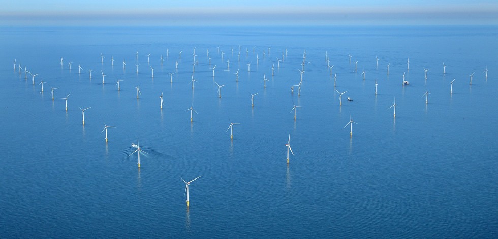
Suitability of OWF siting areas
MarineTraffic maritime database provides information on the marine traffic corridors areal occupation that might conflict with OWF siting.
))
- Begin date
- 2009-01-01T00:00:00
Vertical extent
- Dimension name
- Time
- Resolution
- 1 minute
- Transformation parameter availability
- Yes
- Checkpoint Availability
- Yes
- Distribution format
-
-
KML
()
-
KML
()
- OnLine resource
- Historical AIS Data Services ( WWW:LINK )
- OnLine resource
- Historical AIS data available since 2009. ( WWW:LINK )
- Hierarchy level
- Dataset
Domain consistency
- Name of measure
- Responsiveness
Quantitative result
- Value
- Charged service. Responsiveness not tested
- Statement
- NA
- Hierarchy level
- datasetComponent
- Other
- ATLANTIC_CH01_Product_3_10
))
- Begin date
- 2006-01-01
- End date
- 2015-12-31
Vertical extent
- Minimum value
- 0
- Maximum value
- 0
Completeness omission
- Name of measure
- Horizontal Spatial Coverage
- Measure identification
- AP.1.1
- Measure description
- Horizontal coverage extent of product (eg : surface of the Mediterranean Sea)
Quantitative result
- Value type
- Real
- Value
- 14848
gmd:DQ_DescriptiveResult
- Date / Time
- 2018-01-10T00:00:00
- Statement
- All study area is covered
Completeness omission
- Name of measure
- Vertical Spatial Coverage
- Measure identification
- AP.1.2
- Measure description
- Vertical coverage extent of product
Quantitative result
- Value type
- Real
gmd:DQ_DescriptiveResult
- Date / Time
- 2018-01-10T00:00:00
- Statement
- NA
Completeness omission
- Name of measure
- Temporal Coverage
- Measure identification
- AP.1.3
- Measure description
- Temporal coverage extent of product
Quantitative result
- Value type
- Integer
gmd:DQ_DescriptiveResult
- Date / Time
- 2018-01-10T00:00:00
- Statement
- NA
Completeness omission
- Name of measure
- Number of items
- Measure identification
- AP.1.4
- Measure description
- Count of all items in the dataset or sample. Describe the items which are counted. If the number is determined by sampling unit (density), define the sampling unit (eg size of mesh).
Quantitative result
- Value type
- Integer
gmd:DQ_DescriptiveResult
- Date / Time
- 2018-01-10T00:00:00
- Statement
- Dataset has no metadata.
Conceptual consistency
- Name of measure
- Number of Characteristics
- Measure identification
- AP.2.1
- Measure description
- Number of characteristics in product
Quantitative result
- Value type
- Integer
gmd:DQ_DescriptiveResult
- Date / Time
- 2018-01-10T00:00:00
- Statement
- NA
Thematic classification correctness
- Name of measure
- Horizontal resolution
- Measure identification
- AP.3.1
- Measure description
- Horizontal mesh size or equivalent value for the given scale of product (eg 50m for 1/50 000)
Quantitative result
- Value type
- Integer
- Value
- 11270
gmd:DQ_DescriptiveResult
- Date / Time
- 2018-01-10T00:00:00
Thematic classification correctness
- Name of measure
- Vertical resolution
- Measure identification
- AP.3.2
- Measure description
- Average vertical sampling
Quantitative result
- Value type
- Real
gmd:DQ_DescriptiveResult
- Date / Time
- 2018-01-10T00:00:00
- Statement
- NA
Thematic classification correctness
- Name of measure
- Temporal resolution
- Measure identification
- AP.3.3
- Measure description
- Temporal sampling interval of product
Quantitative result
- Value type
- Real
gmd:DQ_DescriptiveResult
- Date / Time
- 2018-01-10T00:00:00
- Statement
- NA
Quantitative attribute accuracy
- Name of measure
- Thematic accuracy
- Measure identification
- AP.3.4
- Measure description
- Percentage error of the product and description of error concept for the product (100 words max) provided by expert
Quantitative result
- Value type
- Percentage
- Statement
- NA
Temporal validity
- Name of measure
- Temporal validity
- Measure identification
- AP.4.1
- Measure description
- Max elapsed time between last input data records update and product creation date. Minimum value 1/24 day.
Quantitative result
- Value type
- Integer
gmd:DQ_DescriptiveResult
- Date / Time
- 2018-01-10T00:00:00
- Statement
- Dataset has no metadata
gmd:DQ_UsabilityElement
- Name of measure
- Usability
- Measure identification
- AP.5.1
- Value
- Limited
gmd:DQ_DescriptiveResult
- Date / Time
- 2018-01-10T00:00:00
- Statement
- This dataset is a data resource very limited. Moreover, it has a coarse resolution and metadata does not exist to explain the attributes range and their meaning. No free access to vessel traffic datasets was found though paid access sites are available.
- Statement
- NA
Completeness omission
- Name of measure
- Horizontal spatial coverage compliance
- Measure identification
- UD.APE.1.1
- Measure description
-
Percentage to which the extent of the horizontal spatial
coverage of the selected input data is not compliant with the DPS extent in km**2
(UD_AP_1_1 - DPS_AP_1_1)*100/DPS_AP_1_1
Quantitative result
- Value type
- Percentage
- Value
- 0.00033573657976905145
Completeness omission
- Name of measure
- Horizontal spatial coverage fitness for use error
- Measure identification
- UD.FU.1.1
- Measure description
-
Combination of the errors of the product
component Cn with the error of the selected input data set Ud Cn used for this component
- Value
- 0.00033573657976905145
Completeness omission
- Name of measure
- Vertical spatial coverage compliance
- Measure identification
- UD.APE.1.2
- Measure description
-
Percentage to which the vertical coverage of the selected
input data is not compliant with the DPS coverage extent in metres
(UD_AP_1_2 - DPS_AP_1_2)*100/DPS_AP_1_2
Quantitative result
- Value type
- Percentage
Completeness omission
- Name of measure
- Vertical spatial coverage fitness for use error
- Measure identification
- UD.FU.1.2
- Measure description
-
Combination of the errors of the product
component Cn with the error of the selected input data set Ud Cn used for this component
Completeness omission
- Name of measure
- Temporal coverage compliance
- Measure identification
- UD.APE.1.3
- Measure description
-
Percentage to which the time coverage of the selected input data is compliant with the DPS coverage extent in days
(UD_AP_1_3 - DPS_AP_1_3)*100/DPS_AP_1_3
Quantitative result
- Value type
- Percentage
Completeness omission
- Name of measure
- Temporal coverage fitness for use error
- Measure identification
- UD.FU.1.3
- Measure description
-
Combination of the errors of the product
component Cn with the error of the selected input data set Ud Cn used for this component
Completeness omission
- Name of measure
- Number of items compliance
- Measure identification
- UD.APE.1.4
- Measure description
-
Percentage to which the number of items of the selected input data is compliant with the DPS number of items in days
(UD_AP_1_4 - DPS_AP_1_4)*100/DPS_AP_1_4
Quantitative result
- Value type
- Percentage
Completeness omission
- Name of measure
- Error count fitness for use error
- Measure identification
- UD.FU.1.4
- Measure description
-
Combination of the errors of the product
component Cn with the error of the selected input data set Ud Cn used for this component
Thematic classification correctness
- Name of measure
- Horizontal resolution compliance
- Measure identification
- UD.APE.3.1
- Measure description
-
Percentage to which the horizontal resolution or equivalent scale value (eg 50 m for map scale of 1/50 000) data
or mean horizontal sampling interval of the selected input data is compliant not with the DPS horizontal
resolution
(DPS_AP_3_1 - UD_AP_3_1)*100/DPS_AP_3_1
Quantitative result
- Value type
- Percentage
- Value
- -125.4
Thematic classification correctness
- Name of measure
- Horizontal resolution fitness for use error
- Measure identification
- UD.FU.3.1
- Measure description
-
Combination of the errors of the product
component Cn with the error of the selected input data set Ud Cn used for this component
- Value
- -100
Thematic classification correctness
- Name of measure
- Vertical resolution compliance
- Measure identification
- UD.APE.3.2
- Measure description
-
Percentage to which the vertical sampling interval of the selected input data is not compliant with the DPS
vertical resolution
(DPS_AP_3_2 - UD_AP_3_2)*100/DPS_AP_3_2
Quantitative result
- Value type
- Percentage
Thematic classification correctness
- Name of measure
- Vertical resolution fitness for use error
- Measure identification
- UD.FU.3.2
- Measure description
-
Combination of the errors of the product
component Cn with the error of the selected input data set Ud Cn used for this component
Thematic classification correctness
- Name of measure
- Temporal resolution compliance
- Measure identification
- UD.APE.3.3
- Measure description
-
Percentage to which the temporal sampling interval
is not compliant with the DPS temporal sampling interval
(DPS_AP_3_3-UD_AP_3_3)*100/DPS_AP_3_3
Quantitative result
- Value type
- Percentage
Thematic classification correctness
- Name of measure
- Temporal resolution fitness for use error
- Measure identification
- UD.FU.3.3
- Measure description
-
Combination of the error of the product
component Cn with the error of the selected input data set Ud Cn used for this component
Quantitative attribute accuracy
- Name of measure
- Thematic accuracy compliance
- Measure identification
- UD.APE.3.4
- Measure description
-
Compliance of the value domain of
the accuracy of the selected input data with the value domain of the accuracy defined in DPS (% extracted from
thematic accuracy description)
UD_AP_3_4
Quantitative result
- Value type
- Percentage
Quantitative attribute accuracy
- Name of measure
- Thematic accuracy fitness for use error
- Measure identification
- UD.FU.3.4
- Measure description
-
Combination of the error of the product
component Cn with the error of the selected input data set Ud Cn used for this component
Temporal validity
- Name of measure
- Temporal validity compliance
- Measure identification
- UD.APE.4.1
- Measure description
-
Percentage to which the elapsed time between last selected input data record update is not compliant with the max
elapsed time specified in DPS
(DPS_AP_4_1 - UD_AP_4_1)*100/DPS_AP_4_1
Quantitative result
- Value type
- Percentage
Temporal validity
- Name of measure
- Temporal validity fitness for use error
- Measure identification
- UD.FU.4.1
- Measure description
-
Combination od errors of extent to which
the elapsed time between last selected input data record update and the product creation date is compliant with
the max elapsed time specified in DPS
- Statement
- NA
- Attribute description
- observation
- Content type
- Physical measurement
- File identifier
- c8730ea9-9390-4dee-b218-6e4d1aae42f7 XML
- Metadata language
- English
- Character set
- UTF8
- Hierarchy level
- Dataset
- Hierarchy level name
- Atlantic - CH01 - Windfarm Siting
- Date stamp
- 2018-03-10T16:00:20Z
- Metadata standard name
- ISO 19115-3 - Emodnet Checkpoint - Upstream Data
- Metadata standard version
- 1.0
Overviews
Spatial extent
Provided by
