 Catalogue PIGMA
Altiberg Database of Small Icebergs from Satellite Altimetry, version 3.1
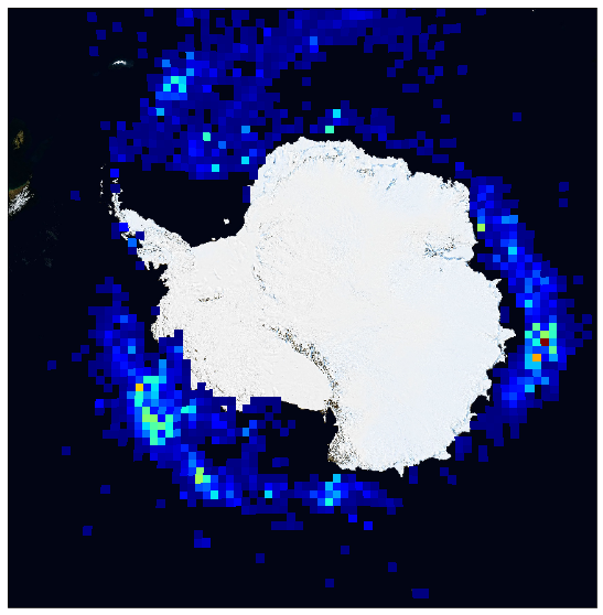
This dataset provides the version 3.1 of the database of small icebergs (lower than 3km in length) detected in Austral and Arctic Ocean, using the high resolution waveforms from spaceborne altimeters from 1992 to 2021.
This database is organized by pole (arctic, antarctic) and provides several product levels for each one:
* Level 2 products are the individual detections of icebergs along the altimeter tracks.
* Level 3 products contains both antarctic polar stereographic 100 km resolution grids of monthly volume of ice and geographic equirectangular (1° in lat x 2° in lon) resolution grids of monthly volume of ice, probability of presence of icebergs and mean iceberg area.
Each product organised by altimeter mission (ERS-1, ERS-2, Jason-1, Jason-2, Jason-3, CryoSat-2, Topex, ENVISAT, SARAL, HY2A, HY2B, Sentinel-3A, Sentinel-3B). A merged product combining all the available altimeters is also provided.
This database was developed in the frame of Altiberg project, funded by CNES.
Simple
- Date (Publication)
- 2021-04-16
- Identifier
- CER_PSI_ALTIBERG / 3.1
- Status
- completed Completed
- Access constraints
- OtherRestrictions
- Use constraints
- The CERSAT data are freely distributed. However, when using these data in a publication, we request that the following acknowledgement be given : <br> <br> <b><i>"These data were obtained from the Centre de Recherche et d'Exploitation Satellitaire (CERSAT), at IFREMER, Plouzané (France)"</i></b> <br> <br> We also request a reprint of any papers or reports published using these data (send to <a href="cersat@ifremer.fr">cersat@ifremer.fr</a>), in order tu update our reference archive and to improve our knowledge of the oceanographic community's needs. Open
- Other constraints
- CC-BY (Creative Commons - Attribution)
- Other constraints
- Tournadre J, Ifremer / LOPS. 2022. Database of Small Icebergs from Satellite Altimetry for Altiberg project. Ver. 3.1. Ifremer, Plouzane, France. Dataset accessed [YYYY-MM-DD]
- Spatial representation type
- grid Grid
- Distance
- 1 degree (latitude)
- Distance
- 2 degree (longitude)
- Distance
- 100 Km
))
- Geographic identifier
- Antarctic
- Begin date
- 1992-01-01
- End date
- 2021-12-31 Now
- Reference system identifier
- http://www.opengis.net/def/crs/EPSG/0/4326
- Unique resource identifier
- EPSG:3412
- Distribution format
-
-
NetCDF
(
3
)
-
NetCDF
(
3
)
- OnLine resource
- Ifremer FTP server ( WWW:FTP )
- OnLine resource
- Local path on Datarmor ( NETWORK:LINK )
- OnLine resource
- Ifremer HTTPS server ( WWW:LINK )
- OnLine resource
-
User guide
(
WWW:LINK
)
Altiberg Product User Guide, version 3
- OnLine resource
- Digital Object Identifier (DOI) ( DOI )
- Hierarchy level
- Series
- Attribute description
- composite
- Processing level code
- L3 /
- File identifier
- 06770b5a-b8aa-4a59-b66d-304c2bf9b548 XML
- Metadata language
- English
- Character set
- UTF8
- Hierarchy level
- Series
- Date stamp
- 2025-11-16T15:44:44.098176Z
- Metadata standard name
- ISO 19115-3:2018 - Remote Sensing
Overviews
Spatial extent
Provided by
