 Catalogue PIGMA
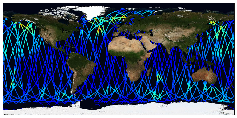
Global Remote Sensing Daily Merged Multi-Mission Along-Track Significant Wave Height from Altimetry, L3 Product, Version 3, from ESA Sea State CCI
The ESA Sea State Climate Change Initiative (CCI) project has produced global daily merged multi-sensor time-series of along-track satellite altimeter significant wave height data (referred to as Level 3 (L3) data) with a particular focus for use in climate studies.
This dataset contains the Version 3 Remote Sensing Significant Wave Height product, which provides along-track data at approximately 6 km spatial resolution. It has been generated from upstream Sea State CCI L2P products, edited and merged into daily products, retaining only valid and good quality measurements from all altimeters over one day, with simplified content (only a few key parameters). This is close to what is delivered in Near-Real Time by the CMEMS (Copernicus - Marine Environment Monitoring Service) project. It covers the date range from 2002-2021.
The altimeter data used in the Sea State CCI dataset v3 come from multiple satellite missions (Envisat, CryoSat-2, Jason-1, Jason-2, Jason-3, SARAL, Sentinel-3A), therefore spanning over a shorter time range than version 1.1. Unlike version 1.1, this version 3 involved a complete and consistent retracking of all the included altimeters. Many altimeters are bi-frequency (Ku-C or Ku-S) and only measurements in Ku band were used, for consistency reasons, being available on each altimeter but SARAL (Ka band).
Simple
- Date (Creation)
- 2022-10-10
- Date (Publication)
- 2022-10-10
- Identifier
- ESACCI-SEASTATE-L3-SWH / 3.0
- Status
- final final
- GEMET - INSPIRE themes, version 1.0
-
- Oceanographic geographical features
- Cersat - Parameter
-
- Ocean Waves
- Cersat - Latency
-
- Historical
- Cersat - GCMD parameter
-
- /Ocean Waves/Significant Wave Height
- Centre de données ODATIS
-
- CDS-CERSAT
- Type de jeux de donnée ODATIS
-
- /Observational data/satellite
- Use limitation
- None
- Access constraints
- unrestricted
- Use constraints
- Other restrictions
- Other constraints
- Open Licence
- Other constraints
- Piollé, J.-F.; Dodet, G.; Quilfen, Y. (2022): ESA Sea State Climate Change Initiative (Sea_State_cci) : Global remote sensing daily merged multi-mission along-track significant wave height from altimetry, L3 product, version 3. NERC EDS Centre for Environmental Data Analysis, 11 October 2022. doi:10.5285/e6af67fca81c40b7bb3eddaadde06909. http://dx.doi.org/10.5285/e6af67fca81c40b7bb3eddaadde06909
- Spatial representation type
- grid Grid
- Distance
- 6 km
- Topic category
-
- Oceans
))
- Geographic identifier
- Global
- Begin date
- 2002-01-15
- End date
- 2021-06-30
- Reference system identifier
- http://www.opengis.net/def/crs/EPSG/0/4326
- Distribution format
-
-
NetCDF
(
4
)
-
NetCDF
(
4
)
- OnLine resource
- Digital Object Identifier (DOI) ( DOI )
- OnLine resource
-
ESA CCI Archive
(
WWW:LINK
)
HTTPS
- OnLine resource
-
User guide
(
WWW:LINK
)
Product User Guide
- OnLine resource
-
Local path on Datarmor
(
NETWORK:LINK
)
Local path
- Hierarchy level
- Dataset
- Attribute description
- composite
- Processing level code
- L3 /
- File identifier
- 178244bd-a281-4ae1-af75-5882acdbcfef XML
- Metadata language
- English
- Character set
- UTF8
- Hierarchy level
- Dataset
- Date stamp
- 2025-11-30T20:31:12.925974Z
- Metadata standard name
- ISO 19115-3:2018 - Remote Sensing
Overviews
Spatial extent
Provided by
