 Catalogue PIGMA
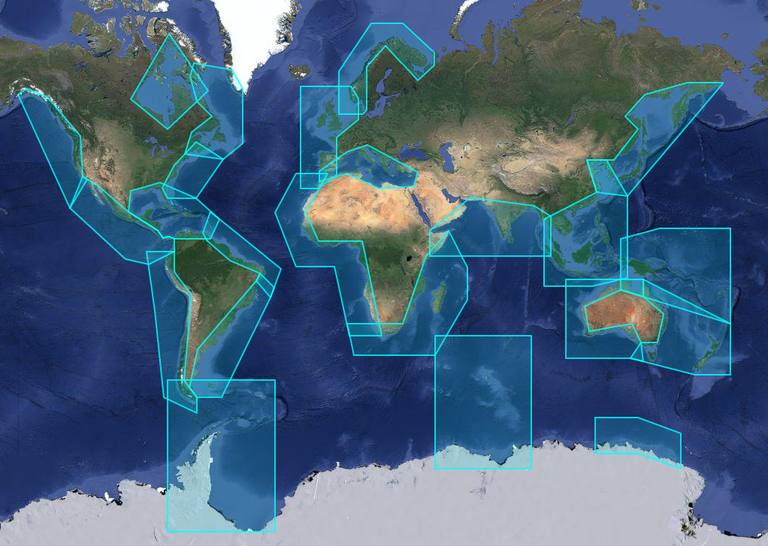
X-TRACK, Along track Sea Level Anomalies (2017_02)
X-TRACK, is a regional altimeter products for coastal applications. It has been developed in order to optimize the completeness and the accuracy of the sea surface height information derived from satellite altimetry in coastal ocean areas. 1hz alongtrack SLA are available in 23 regions for different altimetric missions (Topex, Jason-1&2, Geosat, Ers2, Envisat). SLA is computed on a reference track. X-TRACK SLA files hold alongtrack SLA data together with MSSH, FES2012 tide, Dynamic Atmospheric Corrections and distance to coast parameters. Users can both retrieve filtered and non-filtered data.
X-TRACK areas :
| short name | long name |
|:------------|:---------------------------------|
| adelie | Adelie-Mertz |
| amazon | Amazon |
| asa | Atlantic South America |
| chinasea | China Sea |
| drake | Drake passage |
| eaustralia | East Australia |
| gom | Gulf of Mexico - Caribbean Sea |
| gulfstream | Gulf Stream |
| hudson | Hudson Bay |
| humboldt | Humboldt current |
| kerguelen | Kerguelen Islands |
| labrador | Labrador Sea |
| medsea | Mediterranean Sea |
| nea | North East Atlantic |
| nindian | North Indian Ocean |
| norway | Norway |
| nwa | North West America |
| nwp | North West Pacific |
| sea | South and East Africa |
| wafrica | West Africa |
| waustralia | West Australia |
| wla | West Latin America - California |
| wtp | West Tropical Pacific |
Simple
- Date (Publication)
- 2017-10-01
- Identifier
- http://dx.doi.org/ / 10.6096/CTOH_X-TRACK_2017_02
- Credit
- SNO CTOH
- Status
- On going On going
- Maintenance and update frequency
- Annually Annually
- GEMET - INSPIRE themes, version 1.0
-
- Oceanographic geographical features
- Centre de données ODATIS
-
- CDS-OMP
- Type de jeux de donnée ODATIS
-
- /Observational data/in-situ
- Services Nationaux d'Observation
-
- SNO-CTOH
- Use limitation
- CTOH data policy, https://www.legos.omp.eu/ctoh/licence-dutilisation-des-produits-ctoh/
- Use limitation
- The data are provided without any warranty for any non-profit educational and research purposes.
- Other constraints
- No access conditions apply
- Metadata language
- EnglishEnglish
- Topic category
-
- Oceans
))
- Begin date
- 1995-05-17
- End date
- 2003-11-24
- Reference system identifier
-
WGS84
/
EPSG:4326
- Distribution format
-
-
GDR
()
-
GDR
()
- OnLine resource
- http://dx.doi.org/10.6096/CTOH_X-TRACK_2017_02 ( DOI )
- Hierarchy level
- Dataset Dataset
Conformance result
- Date (Publication)
- 2017-10-01
- Explanation
- NA
- Pass
- Yes
- Statement
- Data produced by the SNO CTOH.
- File identifier
- 51196bb7-c051-40cc-9fd4-e417acd245a2 XML
- Metadata language
- EnglishEnglish
- Character set
- UTF-8 UTF8
- Date stamp
- 2026-07-05T12:00:02.575+02:00
Overviews
Spatial extent
Provided by
