 Catalogue PIGMA
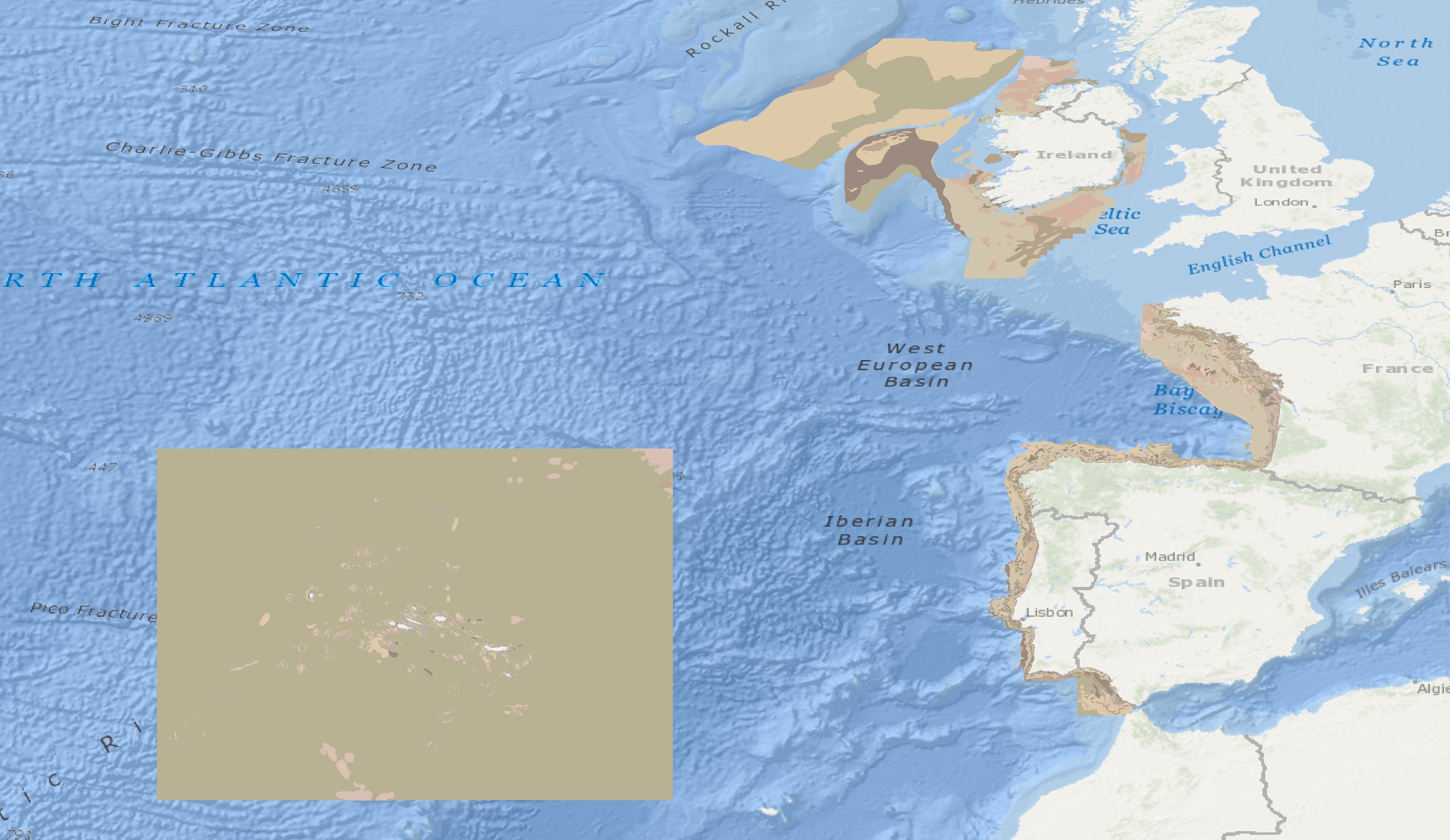
Habitat characterisation | Predictive Broadscale EUNIS Habitat Map | EMODnet Secretariat | Predicted broad-scale EUNIS habitats - Atlantic area (updated 9 December 2013)
Simple
- Alternate title
- Predicted broad-scale EUNIS habitats - Atlantic area (updated 9 December 2013)
- Date
- Identifier
- Habitat characterisation | Predictive Broadscale EUNIS Habitat Map | EMODnet Secretariat | Predicted broad-scale EUNIS habitats - Atlantic area (updated 9 December 2013)
- Other citation details
- Predicted broad-scale EUNIS habitats - Atlantic area (updated 9 December 2013)
- Purpose
- To show the distribution of predicted broad scale EUNIS habitats in the Northeast Atlantic
- Status
- onGoing On going
- Maintenance and update frequency
- Not planned
- Used by challenges
-
- Atlantic - CH07 - Fisheries Impact
- Environmental matrix
-
- Biota - Biology
- Production mode
-
- Delayed
- Visibility
-
- Search via reference catalogue (e.g. MyOcean, GEOSS Geoportal…)
- Policy visibility
-
- There is detailed information provided to understand data policy
- Readyness
-
- Format not proprietary and content clearly specified (e.g. autodescriptive like ODV, NetCDF CF) or at least with appropriate document describing the content
- Parameter Discovery Vocabulary (P02)
-
- Habitat characterisation
- GEMET - INSPIRE themes, version 1.0
-
- Habitats and biotopes
- Processing level of characteristics
-
- High level analyzed
- Data delivery mechanisms
-
- Online discovery + downloading + viewing services (Advanced services)
- Parameter Usage Vocabulary (other)
-
- Predictive Broadscale EUNIS Habitat Map
- Agreed Parameter Groups (P03)
-
- Habitat
- Service extent
-
- The datasets are provided through an EU Inspire catalogue service (OGC)
- Validation
-
- Submitted
- Access constraints
- Other restrictions
- Other constraints
- Unrestricted
- Use limitation
- Open and Free. No charge
- Spatial representation type
- vector Vector
- Distance
- 250 meter
- Metadata language
- Français
- Character set
- utf8 UTF8
- Topic category
-
- Oceans
- Environment description
- To spatially resolve seabed habitats in relation to fished areas in European waters to quantify the impact on vulnerable habitats.
N
S
E
W
))
- Begin date
- 2010-04-01
- End date
- 2013-09-01
Vertical extent
- Minimum value
- 0
- Maximum value
- 4000
- Dimension name
- Time
- Transformation parameter availability
- Yes
- Checkpoint Availability
- Yes
- Distribution format
-
-
ESRI Shapefile
()
-
ESRI Shapefile
()
- OnLine resource
- Spatial data downloads ( WWW:LINK )
- OnLine resource
- Predicted broad-scale EUNIS habitats - Atlantic area (updated 9 December 2013) ( WWW:LINK )
- Hierarchy level
- Dataset
Domain consistency
- Name of measure
- Responsiveness
Quantitative result
- Value
- Online downloading (i.e. a few hours or less) for release
Domain consistency
- Name of measure
- Reliability
Quantitative result
- Attribute description
- observation
- Content type
- Physical measurement
- File identifier
- 678cb740-e28f-400d-83e8-49762a68c217 XML
- Metadata language
- English
- Character set
- UTF8
- Hierarchy level
- Dataset
- Hierarchy level name
- Atlantic - CH07 - Fisheries Impact
- Date stamp
- 2017-05-02T15:29:22Z
- Metadata standard name
- ISO 19115-3 - Emodnet Checkpoint - Upstream Data
- Metadata standard version
- 1.0
Overviews
Spatial extent
N
S
E
W
Provided by

Associated resources
Not available