 Catalogue PIGMA
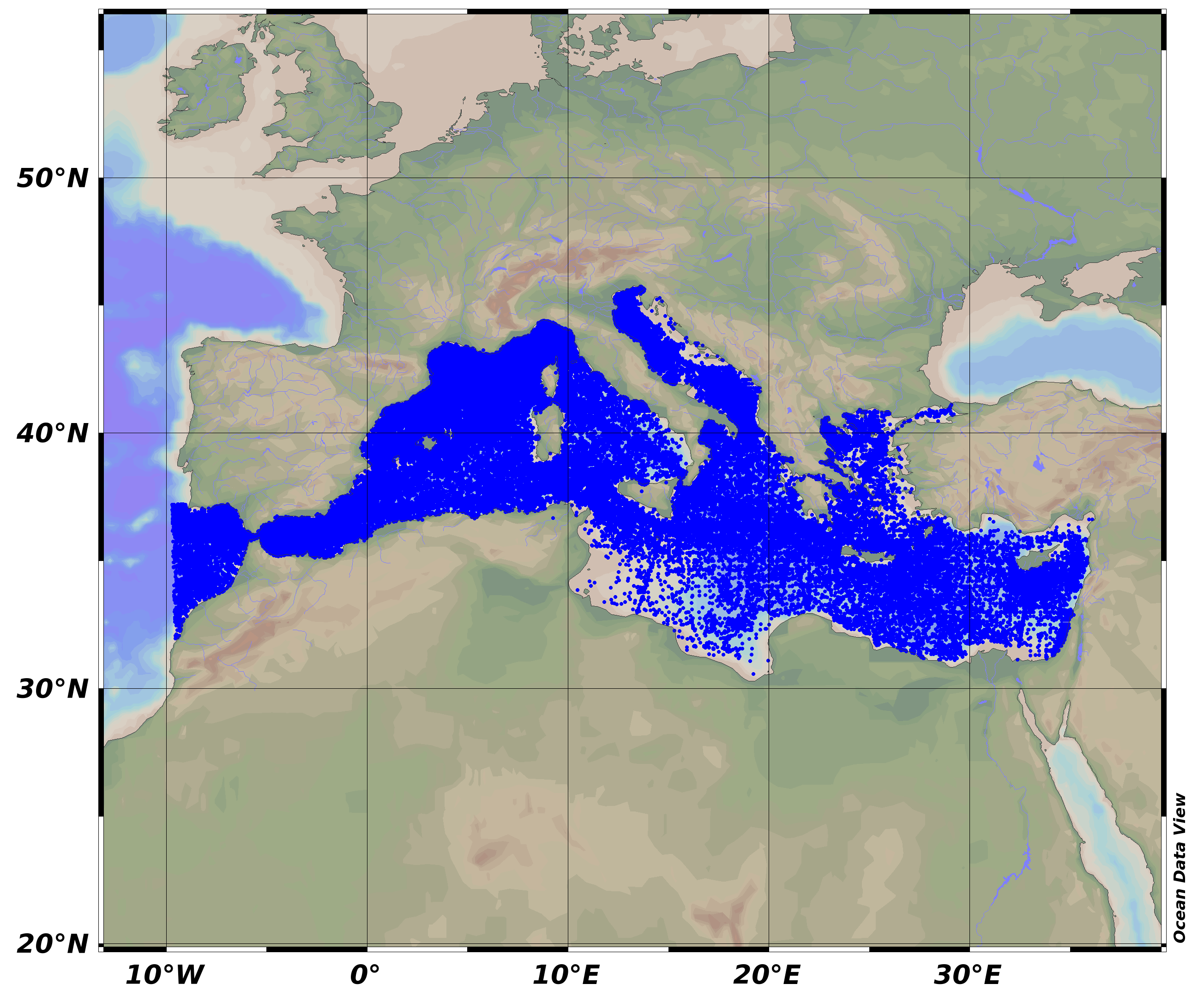
Mediterranean Sea - Temperature and salinity observation collection V2
SeaDataNet Temperature and Salinity historical data collection for the Mediterranean Sea contains all open access temperature and salinity in situ data retrieved from SeaDataNet infrastructure. The data span between -9.25 and 37 degrees of longitude, thus including an Atlantic box and Marmara Sea. It covers the time period 1900-2015. Data have been quality checked using ODV software. Quality Flags of anomalous data have been revised using basic QC procedures.
For data access please register at http://www.marine-id.org
The dataset format is ODV binary collections. You can read, analyse and export from the ODV application provided by Alfred Wegener institute at http://odv.awi.de/
Simple
- Alternate title
- seadatanet-med_sea-temperature_salinity_aggregated_public-v2
- Date (Creation)
- 2015-07-31
- Edition
- 2
- Edition date
- 2015-07-31
- Identifier
- 8c3bd19b-9687-429c-a232-48b10478581c
- Credit
- SeaDataNet
+39 0514151499
http://www.ingv.it
+33 (0)2 98.22.46.44
http://www.ifremer.fr/sismer/
- Use limitation
- SeaDataNet licence
- Use limitation
- SeaDataNet Usage Agreement: If you use SeaDataNet data in your publications please include the following in the Acknowledgements: Data were provided through SeaDataNet Pan-European infrastructure for ocean and marine data management (https://www.seadatanet.org)
- Access constraints
- Other restrictions
- Other constraints
- No limitations on public access. For data access please register at http://www.marine-id.org
- Spatial representation type
- Grid
- Distance
- 1 km
- Metadata language
- English
- Topic category
-
- Oceans
- Description
- bounding box
))
- Begin date
- 1900-01-01
- End date
- 2015-03-31
Vertical extent
- Reference system identifier
- EPSG / WGS 84 (EPSG:4326)
- Number of dimensions
- 2
- Dimension name
- Vertical
- Dimension size
- 12
- Dimension name
- Time
- Resolution
- 1 month
- Cell geometry
- Point
- Transformation parameter availability
- No
- OnLine resource
-
DOI of the product
(
DOI
)
DOI of the product
- OnLine resource
-
full collection dataset
(
WWW:DOWNLOAD
)
zipped ODV binary collection
- Hierarchy level
- Series
Conformance result
- Date (Publication)
- 2010-12-08
- Explanation
- See the referenced specification
- Statement
- The data used as input for this product have been extracted from the SeaDataNet Data Access Service: https://www.seadatanet.org/Data-Access
- File identifier
- 8c3bd19b-9687-429c-a232-48b10478581c XML
- Metadata language
- English
- Character set
- UTF8
- Parent identifier
- Mediterranean Sea - Temperature and salinity Historical Data Collection SeaDataCloud V2 2a2aa0c5-4054-4a62-a18b-3835b304fe64
- Hierarchy level
- Series
- Date stamp
- 2025-01-28T09:17:14.036815Z
- Metadata standard name
- ISO 19115:2003/19139 - EMODNET - SDN
- Metadata standard version
- 0.1
Overviews
Spatial extent
Provided by
