 Catalogue PIGMA
SAREDA MODIS-derived daily gridded Sargassum area coverage over the Atlantic
Simple
- Date (Publication)
- 2021-09-15
- Date
- Identifier
- DOI:10.12770/8fe1cdcb-f4ea-4c81-8543-50f0b39b4eca
- Credit
- AERIS/ICARE - CNES/TOSCA
- Variables ODATIS
-
- /Marine Biology/Macroalgae and seagrass
- Keywords
-
- Sargassum, seaweed, macroalgae
- Type de jeux de donnée ODATIS
-
- /Observational data
- /Processed data/Composite products
- Processing level
-
- Level 3
- Cersat - Sensor
-
- MODIS
- Cersat - Platform
-
- Terra
- AQUA
- Keywords
-
- Use limitation
- No conditions apply
- Access constraints
- Other restrictions
- Use constraints
- Other restrictions
- Other constraints
-
The conditions of use are specified on the following page, Access to the SAREDA dataset on the period [2002-2020] is available upon registration:
https://www.icare.univ-lille.fr/data-policy/?policy=sareda
Any publication using the SAREDA data set must acknowledge the data provenance as follows:
« The SAREDA data set was provided by the AERIS/ICARE Data and Services Center. DOI : https://doi.org/10.12770/8fe1cdcb-f4ea-4c81-8543-50f0b39b4eca » and refer to the following articles:
- Descloitres, J., Minghelli, A., Steinmetz, F., Chevalier, C., Chami, M., and Berline, L. (2021). Revisited Estimation of Moderate Resolution Sargassum Fractional Coverage Using Decametric Satellite Data (S2-MSI). Remote Sens. 2021, 13, 5106. https://doi.org/10.3390/rs13245106
- Podlejski, W., Descloitres, J., Chevalier, C., Minghelli, A., Lett, C., and Berline, L. (2022). Filtering out false Sargassum detections using context features. Front. Mar. Sci. 9:960939. https://doi.org/10.3389/fmars.2022.960939
- Unique resource identifier
- 10.3390/rs13245106
- Association Type
- Cross reference
- Initiative Type
- Study
- Unique resource identifier
- 10.3389/fmars.2022.960939
- Association Type
- Cross reference
- Initiative Type
- Study
- Spatial representation type
- grid Grid
- Metadata language
- Français
- Character set
- utf8 UTF8
- Topic category
-
- Oceans
))
- Begin date
- 2002-01-01
- End date
- 2020-12-31
- Geometric object type
- Complex
- Distribution format
-
-
NetCDF
(
CF
)
-
NetCDF
(
CF
)
- OnLine resource
-
DOI du jeu de données Sargasses
(
DOI
)
DOI of the dataset Sargassum
- OnLine resource
-
SAREDA products - MODIS Terra via https
(
WWW:DOWNLOAD
)
SAREDA products - MODIS Terra via https
- OnLine resource
-
SAREDA products - MODIS Aqua via https
(
WWW:DOWNLOAD
)
SAREDA products - MODIS Aqua via https
- OnLine resource
-
SAREDA products - MODIS Aqua + Terra via https
(
WWW:DOWNLOAD
)
SAREDA products - MODIS Aqua + Terra via https
- Hierarchy level
- Dataset
- Statement
-
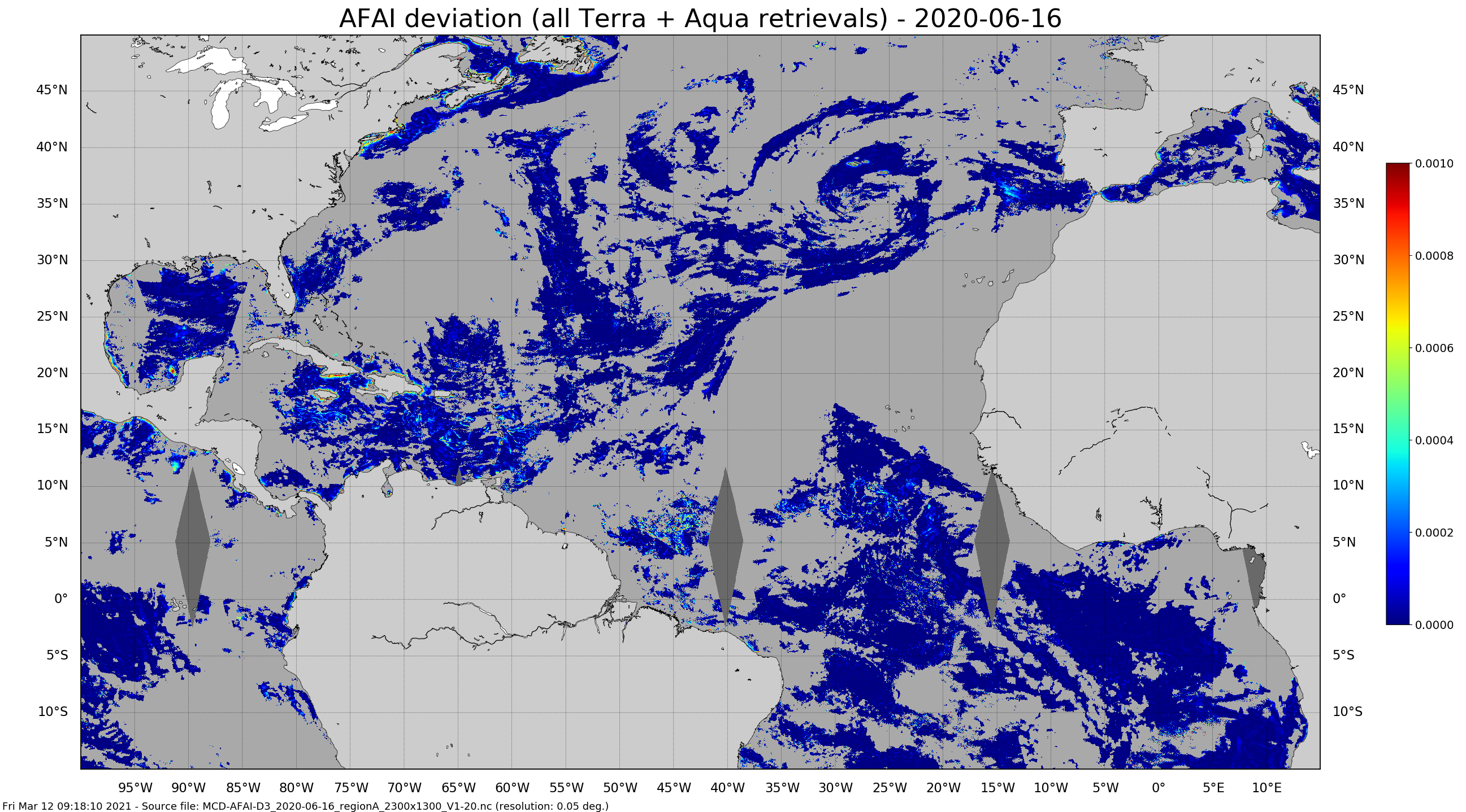
The SAREDA (SArgassum Evolving Distribution in the Atlantic) algorithm performs a contextual detection of Sargassum using the Alternative Floating Algae Index (AFAI) (Wang and Hu, 2016). The AFAI deviation with respect to the local background is used to retrieve the Sargassum area coverage, i.e. the fraction of MODIS pixels covered with Sargassum. Daily gridded 1km and 5km composites are derived from MODIS-Terra and MODIS-Aqua instantaneous retrievals.
Within the framework of the SAREDA project, supported by TOSCA-CNES and IRD, the MIO has partnered with the AERIS cluster and its ICARE data and services centre specialised in the massive exploitation of Earth observation spatial data, for the processing of data. GeoID-OCEAN contributed to the implementation of the prototype processing chain.
References :
- Descloitres, J.; Minghelli, A.; Steinmetz, F.; Chevalier, C.; Chami, M.; Berline, L. Revisited Estimation of Moderate Resolution Sargassum Fractional Coverage Using Decametric Satellite Data (S2-MSI). Remote Sens. 2021, 13, 5106. https://doi.org/10.3390/rs13245106
- Podlejski, W. et al. (2022) Filtering out false Sargassum detections using context features. Frontiers in Marine Science. 9:960939. https://doi.org/10.3389/fmars.2022.960939
- File identifier
- 8fe1cdcb-f4ea-4c81-8543-50f0b39b4eca XML
- Metadata language
- Français
- Character set
- UTF8
- Hierarchy level
- Dataset
- Date stamp
- 2026-10-22T10:20:14.120917Z
- Metadata standard name
- ISO 19115-3:2018 - Remote Sensing ISO 19115-3:2018 - Remote Sensing
- Metadata standard version
- 1.0
Overviews
Spatial extent
Provided by
