 Catalogue PIGMA
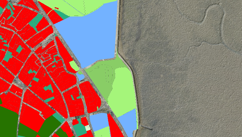
Occupation du sol en 2013 de 4 communes de l'île d'Oléron
Description à la parcelle de l’occupation du sol en 2013, pour les 4 communes d'étude de l'île d'Oléron du programme de recherche RISKS : Saint-Pierre-d'Oléron, Le Château-d'Oléron, Saint-Georges-d'Oléron et Saint-Trojan-les-Bains.
Simple
- Date (Creation)
- 2014-03-18
- Date (Creation)
- 2014-04-16
- Identifier
- FRA-LIENSs-V2015-5
- Credit
- LIttoral ENvironnement et Sociétés - La Rochelle Université / CNRS
Owner
Littoral ENvironnement et Sociétés (LIENSs) - UMR 7266 - CNRS
2 rue Olympe de Gouges
,
La Rochelle
,
17000
,
France
Point of contact
Littoral ENvironnement et Sociétés (LIENSs)
-
Service d'Aide à la Gestion de la Donnée
- Theme
-
- occupation du sol; RISKS; île d'Oléron;
- GEMET - INSPIRE themes, version 1.0
-
- Land cover
- Cadastral parcels
- Use limitation
- Mentions obligatoires sur tout document de diffusion ex: "Copyright : DGFIP - LIENSs - Nom de la donnée - Année".
- Classification
- Unclassified
- Spatial representation type
- vector Vector
- Denominator
- 1000
- Metadata language
- Français
- Character set
- utf8 UTF8
- Topic category
-
- Imagery base maps earth cover
- Location
- Imagery base maps earth cover
N
S
E
W
))
- Reference system identifier
- EPSG / RGF93 / Lambert-93 (EPSG:2154) / 7.4
- Distribution format
-
-
ESRI Shapefile
(
10.2
)
-
ESRI Shapefile
(
10.2
)
- OnLine resource
- https://sextant.ifremer.fr/fr/web/lienss/ ( WWW:LINK )
- Hierarchy level
- Dataset
- Statement
- L'occupation des sol est issue du croisement des données du PCI-vecteur 2013 et MAJIC 2013, s'appuyant sur l'information relative aux subdivisions fiscales.
- File identifier
- 9f88473d-b07f-4609-b19b-67676ae119e1 XML
- Metadata language
- Français
- Character set
- UTF8
- Hierarchy level
- Dataset
- Hierarchy level name
- Série de données
- Date stamp
- 2025-05-15T23:31:24.212688Z
- Metadata standard name
- ISO 19115-3 - SEXTANT
- Metadata standard version
- 1.0
Point of contact
Littoral ENvironnement et Sociétés (LIENSs) - UMR 7266 - CNRS
2 rue Olympe de Gouges
,
La Rochelle
,
17000
,
France
Overviews
Spatial extent
N
S
E
W
Provided by

Associated resources
Not available