 Catalogue PIGMA
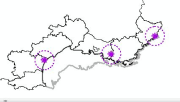
Localisation des radars aviation civile
Cette couche représente la localisation des radars de l'aviation civile.
Simple
- Date (Creation)
- 2011-03-01T14:22:00
- Identifier
- FR-177-606-654-0098-R_aviation_civile
- Status
- onGoing On going
- Maintenance and update frequency
- As needed
- Discipline
-
- aviation civile
- radar
- Access constraints
- Copyright
- Spatial representation type
- vector Vector
- Denominator
- 10000
- Metadata language
- Français
- Character set
- utf8 UTF8
- Topic category
-
- Intelligence military
N
S
E
W
))
- Reference system identifier
- EPSG / RGF93 / Lambert-93 (EPSG:2154) / 7.4
- Topology level
- Geometry only
- Geometric object type
- Point
- Distribution format
-
-
ESRI Shapefile
(
1.0
)
-
ESRI Shapefile
(
1.0
)
- OnLine resource
- www.geolittoral.developpement-durable.gouv.fr ( WWW:LINK )
- Hierarchy level
- Dataset
Absolute external positional accuracy
Conformance result
- Date (Creation)
- 2012-01-16
- Explanation
- Non évalué
- Pass
- No
- Statement
-
La DGAC a mis à disposition les coordonnées géographiques des radars de l'aviation civile. Ces coordonnées ont été transformées en polygones pour constituer la couche finale.
Donnée disponible sur la façade de la Méditerranée.
- File identifier
- cb01f29d-4e78-4ebe-b603-4d106a62ce7f XML
- Metadata language
- Français
- Character set
- UTF8
- Hierarchy level
- Dataset
- Date stamp
- 2025-05-16T00:09:11.251839Z
- Metadata standard name
- ISO 19115-3 - SEXTANT
- Metadata standard version
- 1.0
Overviews
Spatial extent
N
S
E
W
Provided by

Associated resources
Not available