 Catalogue PIGMA
Wind strength and direction | Wind speed and Wind direction | COCONET | Wind strength and direction
Simple
- Alternate title
- Wind strength and direction
- Date
- Identifier
- Wind strength and direction | Wind speed and Wind direction | COCONET | Wind strength and direction
- Other citation details
- Offshore Wind Farms
- Status
- onGoing On going
edmerp
Towards COast to COast NETworks of marine protected areas, Coupled with Sea-based Wind Energy Potential
-
COCONET
Italy
edmo
COCONET
Borgo Grotta Gigante 42/c
,
Sgonico (Trieste)
,
34010
,
Italy
http://coconetgis.ismar.cnr.it/
- Maintenance and update frequency
- Unknown
- Used by challenges
-
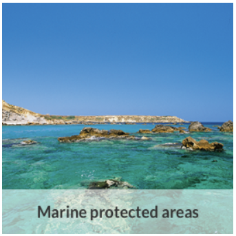
- MedSea - CH02 - Marine Protected Areas
- Environmental matrix
-
- Air
- Production mode
-
- Delayed
- Parameter Discovery Vocabulary (P02)
-
- Wind strength and direction
- GEMET - INSPIRE themes, version 1.0
-
- Oceanographic geographical features
- Processing level of characteristics
-
- High level analyzed
- Data delivery mechanisms
-
- Manual process: Order form/invoice is requested
- Parameter Usage Vocabulary (other)
-
- Wind speed and Wind direction
- Agreed Parameter Groups (P03)
-
- Meteorology
- Service extent
-
- The datasets are provided through an EU Inspire catalogue service (OGC)
- Visibility
-
- Search via reference catalogue (e.g. MyOcean, GEOSS Geoportal…)
- Policy visibility
-
- There is detailed information provided to understand data policy
- Readyness
-
- Format not proprietary and content clearly specified (e.g. autodescriptive like ODV, NetCDF CF) or at least with appropriate document describing the content
- Access constraints
- Other restrictions
- Other constraints
- Restricted
- Use limitation
- Open and Free. No charge
- Spatial representation type
- vector Vector
- Distance
- 0.25 degrees
- Metadata language
- Français
- Character set
- utf8 UTF8
- Topic category
-
- Oceans
N
S
E
W
))
Vertical extent
- Minimum value
- 0
- Dimension name
- Time
- Transformation parameter availability
- Yes
- Checkpoint Availability
- Yes
- Distribution format
-
-
raster
()
-
ESRI Shapefile
()
-
raster
()
- OnLine resource
- CoConet WEBGIS ( WWW:LINK )
- OnLine resource
- http://coconetgis.ismar.cnr.it/ ( WWW:LINK )
- Hierarchy level
- Dataset
Domain consistency
- Name of measure
- Responsiveness
Quantitative result
- Value
- No information is found on response time
- Attribute description
- observation
- Content type
- Physical measurement
- Description
- 0
- File identifier
- 4ec74993-ec49-43b7-b468-58b6aa9ac8bf XML
- Metadata language
- English
- Character set
- UTF8
- Hierarchy level
- Dataset
- Hierarchy level name
- MedSea - CH02 - Marine Protected Areas
- Date stamp
- 2017-08-24T12:29:13Z
- Metadata standard name
- ISO 19115-3 - Emodnet Checkpoint - Upstream Data
- Metadata standard version
- 1.0
Point of contact
Hellenic Centre for Marine Research
http://www.hcmr.gr
46,7 km Athens Sounio ave.
,
Anavyssos Attiki
,
19013
,
Greece
+302291076462
http://www.hcmr.gr
Overviews

thumbnail
large_thumbnail
Spatial extent
N
S
E
W
Provided by

Associated resources
Not available