 Catalogue PIGMA
Aerial images collected by an Unmanned Aerial Vehicle in Hermitage, Réunion - 2023-12-01
This dataset was collected by an Unmanned Aerial Vehicle in Hermitage, Réunion - 2023-12-01. Underwater or aerial images collected by scientists or citizens can have a wide variety of use for science, management, or conservation. These images can be annotated and shared to train IA models which can in turn predict the objects on the images. We provide a set of tools (hardware and software) to collect marine data, predict species or habitat, and provide maps.
Survey information
- Camera: Hasselblad L1D-20c
- Number of images: 119
- Total size : 1.04 Gb
- Flight start: 2023:12:01 15:07:31
- Flight end: 2023:12:01 15:13:31
- Flight duration: 0h 6min 0sec
- Median height: 79.9 m
- Area covered: 3.93 ha
Generic folder structure
YYYYMMDD_COUNTRYCODE-optionalplace_device_session-number ├── DCIM : folder to store videos and photos depending on the media collected. ├── GPS : folder to store any positioning related file. If any kind of correction is possible on files (e.g. Post-Processed Kinematic thanks to rinex data) then the distinction between device data and base data is made. If, on the other hand, only device position data are present and the files cannot be corrected by post-processing techniques (e.g. gpx files), then the distinction between base and device is not made and the files are placed directly at the root of the GPS folder. │ ├── BASE : files coming from rtk station or any static positioning instrument. │ └── DEVICE : files coming from the device. ├── METADATA : folder with general information files about the session. ├── PROCESSED_DATA : contain all the folders needed to store the results of the data processing of the current session. │ ├── BATHY : output folder for bathymetry raw data extracted from mission logs. │ ├── FRAMES : output folder for georeferenced frames extracted from DCIM videos. │ ├── IA : destination folder for image recognition predictions. │ └── PHOTOGRAMMETRY : destination folder for reconstructed models in photogrammetry. └── SENSORS : folder to store files coming from other sources (bathymetry data from the echosounder, log file from the autopilot, mission plan etc.).
Software All the raw data was processed using our worflow. All predictions were generated by our inference pipeline. You can find all the necessary scripts to download this data in this repository. Enjoy your data with SeatizenDOI!
Simple
- Date (Publication)
- 2023-12-01
- Date (Revision)
- 2025-01-15
- Other citation details
- Contini Matteo, Bonhommeau Sylvain, Barde Julien, Bernard Serge (2023). Aerial images collected by an Unmanned Aerial Vehicle in Hermitage, Réunion - 2023-12-01. SEANOE. https://doi.org/10.17882/104347
- Theme
-
- Coral Reef
- Coral Reef Habitat
- Citizen Sciences
- Deep Learning
- Machine Learning
- Computer Vision
- Ecology
- Mapping
- Remote Sensing
- GeoAI
- Indian Ocean
- Global Coral Reef Monitoring Network
- Artificial Intelligence
- Reef Ecosystem
- Cross-discipline
- Use limitation
- CC-BY (Creative Commons - Attribution)
- Use constraints
- Other restrictions
- Metadata language
- English
- Topic category
-
- Oceans
))
- Distribution format
-
-
IMAGE
(
)
-
ZIP
(
)
-
IMAGE
(
)
- OnLine resource
-
Raw data
(
WWW:DOWNLOAD-1.0-link--download
)
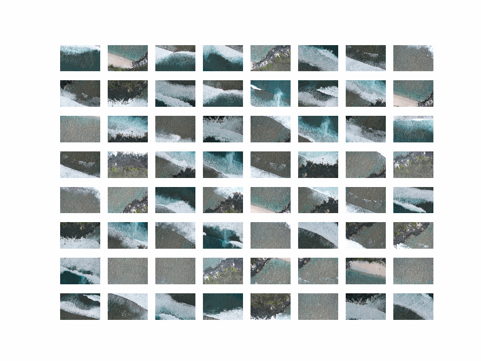
00_sample_rawdata_overview.png - 704 KB

- OnLine resource
-
Raw data
(
WWW:DOWNLOAD-1.0-link--download
)
RAW DCIM - 993 MB
- OnLine resource
-
Raw data
(
WWW:DOWNLOAD-1.0-link--download
)
RAW GPS - 2 MB
- OnLine resource
-
Raw data
(
WWW:DOWNLOAD-1.0-link--download
)
RAW METADATA - 5 MB
- OnLine resource
- DOI of the product ( DOI )
- OnLine resource
- Seanoe ( rel-canonical )
- Hierarchy level
- Dataset
- File identifier
- seanoe:104347 XML
- Metadata language
- English
- Character set
- UTF8
- Hierarchy level
- Dataset
- Date stamp
- 2025-01-15
- Metadata standard name
- ISO 19115:2003/19139
- Metadata standard version
- 1.0
Overviews
Spatial extent
Provided by
