 Catalogue PIGMA
Sea level | Height above sea level | Physical Oceanography Distributed Active Archive Centre | PODAAC - Reconstructed Sea Level Version 1
Simple
- Alternate title
- PODAAC - Reconstructed Sea Level Version 1
- Date
- Identifier
- Sea level | Height above sea level | Physical Oceanography Distributed Active Archive Centre | PODAAC - Reconstructed Sea Level Version 1
- Other citation details
- PODAAC - Reconstructed Sea Level Version 1
- Purpose
- PODAAC - Reconstructed Sea Level Version 1
- Status
- onGoing On going
- Maintenance and update frequency
- As needed
- Used by challenges
-
- Atlantic - CH10 - Bathymetry
- Environmental matrix
-
- Marine water
- Production mode
-
- Delayed
- Visibility
-
- Use of open search engines, searching by name either the data provider or the characteristics
- Policy visibility
-
- There is information, but details are available only on request
- Readyness
-
- Format not proprietary but content not clearly specified
- Parameter Discovery Vocabulary (P02)
-
- Sea level
- GEMET - INSPIRE themes, version 1.0
-
- Elevation
- Processing level of characteristics
-
- Observation (raw, QC)
- Data delivery mechanisms
-
- Online downloading services
- Parameter Usage Vocabulary (P01)
-
- Height above sea level
- Parameter Usage Vocabulary (other)
-
- BATHDPTH
- Agreed Parameter Groups (P03)
-
- Sea level
- Service extent
-
- The datasets are referenced in a public national catalogue, in an international catalogue service
- Validation
-
- Draft
- Access constraints
- Other restrictions
- Other constraints
- Unrestricted
- Use limitation
- Open and Free. No charge
- Spatial representation type
- vector Vector
- Metadata language
- Français
- Character set
- utf8 UTF8
- Topic category
-
- Oceans
- Environment description
- Sea Level- Analysis of water depth.
N
S
E
W
))
Vertical extent
- Dimension name
- Time
- Resolution
- 1
- Transformation parameter availability
- Yes
- Checkpoint Availability
- Yes
- Distribution format
-
-
NetCDF
()
-
NetCDF
()
- OnLine resource
- PODAAC - Reconstructed Sea Level Version 1 ( WWW:LINK )
- OnLine resource
- RECON_SEA_LEVEL_OST_L4_V1 ( WWW:LINK )
- Hierarchy level
- Dataset
Domain consistency
- Name of measure
- Responsiveness
Quantitative result
- Value
- Online downloading (i.e. a few hours or less) for release
Domain consistency
- Name of measure
- Reliability
Quantitative result
- Statement
- podaac.jpl.nasa.gov/dataset/RECON_SEA_LEVEL_OST_L4_V1
- Attribute description
- observation
- Content type
- Physical measurement
- File identifier
- 30e9c4a9-7216-4d27-90bf-8d0dd973b888 XML
- Metadata language
- English
- Character set
- UTF8
- Hierarchy level
- Dataset
- Hierarchy level name
- Atlantic - CH10 - Bathymetry
- Date stamp
- 2016-11-17T12:38:31Z
- Metadata standard name
- ISO 19115-3 - Emodnet Checkpoint - Upstream Data
- Metadata standard version
- 1.0
Overviews
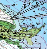
Spatial extent
N
S
E
W
Provided by

Associated resources
Not available