 Catalogue PIGMA
Wind strength and direction | Wind velocity in the atmosphere (E and N components) | Hellenic Centre for Marine Research | POSEIDON meteorological model - Mediterranean
Simple
- Alternate title
- POSEIDON meteorological model - Mediterranean
- Date
- Identifier
- Wind strength and direction | Wind velocity in the atmosphere (E and N components) | Hellenic Centre for Marine Research | POSEIDON meteorological model - Mediterranean
- Purpose
- Meteo forecasting system
- Status
- onGoing On going
http://www.hcmr.gr
http://www.hcmr.gr
- Maintenance and update frequency
- Daily
- Used by challenges
-
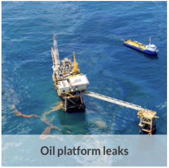
- MedSea - CH03 - Oil Platform Leaks
- Environmental matrix
-
- Air
- Production mode
-
- Real-time
- Parameter Discovery Vocabulary (P02)
-
- Wind strength and direction
- GEMET - INSPIRE themes, version 1.0
-
- Meteorological geographical features
- Processing level of characteristics
-
- Forecast/Hindcast
- Data delivery mechanisms
-
- Online discovery + downloading + viewing services (Advanced services)
- Parameter Usage Vocabulary (other)
-
- Wind velocity in the atmosphere (E and N components)
- Agreed Parameter Groups (P03)
-
- Meteorology
- Service extent
-
- Data sets are not referenced in a catalogue or are referenced in a non public catalogue
- Visibility
-
- Use of open search engines, searching by name either the data provider or the characteristics
- Policy visibility
-
- There is information, but details are available only on request
- Readyness
-
- Format not or not well documented
- Access constraints
- Other restrictions
- Other constraints
- Accessible under moratorium
- Use limitation
- Not or not well documented
- Spatial representation type
- vector Vector
- Distance
- 5000 meter
- Metadata language
- Français
- Character set
- utf8 UTF8
- Topic category
-
- Oceans
- Environment description
-
Oil spill predictions
forecast of the oil spill transport and transformation using the oil spill model (MEDSLIK-II, MEDSLIK); output oil concentration evolution in space and time
))
Vertical extent
- Minimum value
- 10
- Maximum value
- 10
- Dimension name
- Time
- Resolution
- 1 hour
- Transformation parameter availability
- Yes
- Checkpoint Availability
- Yes
- Distribution format
-
-
NetCDF
()
-
NetCDF
()
- OnLine resource
- http://poseidon.hcmr.gr/listview.php?id=17 ( WWW:LINK )
- Protocol
- WWW:LINK
- Hierarchy level
- Dataset
Domain consistency
- Name of measure
- Responsiveness
Quantitative result
- Value
- Online downloading (i.e. a few hours or less) for release
- Hierarchy level
- datasetComponent
))
- Begin date
- 2014-07-27T05:05:00
- End date
- 2014-07-31T10:20:00
Vertical extent
- Minimum value
- 0
- Maximum value
- 5
- Other
- MEDSEA_CH03_Product_1_1
Completeness omission
- Name of measure
- Horizontal Spatial Coverage
- Measure identification
- AP.1.1
- Measure description
- Horizontal coverage extent of product (eg : surface of the Mediterranean Sea)
Quantitative result
- Value type
- Real
- Value
- 2500000
Completeness omission
- Name of measure
- Vertical Spatial Coverage
- Measure identification
- AP.1.2
- Measure description
- Vertical coverage extent of product
Quantitative result
- Value type
- Real
- Value
- 0
Completeness omission
- Name of measure
- Temporal Coverage
- Measure identification
- AP.1.3
- Measure description
- Temporal coverage extent of product
Quantitative result
- Value type
- Integer
- Value
- 5
Conceptual consistency
- Name of measure
- Number of Characteristics
- Measure identification
- AP.2.1
- Measure description
- Number of characteristics in product
Quantitative result
- Value type
- Integer
Thematic classification correctness
- Name of measure
- Horizontal resolution
- Measure identification
- AP.3.1
- Measure description
- Horizontal mesh size or equivalent value for the given scale of product (eg 50m for 1/50 000)
Quantitative result
- Value type
- Integer
- Value
- 5000
Thematic classification correctness
- Name of measure
- Vertical resolution
- Measure identification
- AP.3.2
- Measure description
- Average vertical sampling
Quantitative result
- Value type
- Real
- Value
- 1
gmd:DQ_DescriptiveResult
- Date / Time
- 2016-09-20T00:00:00
- Statement
- vertical resolution of POSEIDON WIND forcing, I do not know actually. I put one to have a 0 error
Thematic classification correctness
- Name of measure
- Temporal resolution
- Measure identification
- AP.3.3
- Measure description
- Temporal sampling interval of product
Quantitative result
- Value type
- Real
- Value
- 1
Quantitative attribute accuracy
- Name of measure
- Thematic accuracy
- Measure identification
- AP.3.4
- Measure description
- Percentage error of the product and description of error concept for the product (100 words max) provided by expert
Quantitative result
- Value type
- Percentage
- Value
- 10
Temporal validity
- Name of measure
- Temporal validity
- Measure identification
- AP.4.1
- Measure description
- Max elapsed time between last input data records update and product creation date
Quantitative result
- Value type
- Integer
- Value
- 1
Completeness omission
- Name of measure
- Horizontal spatial coverage compliance
- Measure identification
- UD.APE.1.1
- Measure description
-
Percentage to which the extent of the horizontal spatial
coverage of the selected input data is not compliant with the DPS extent in km**2
(UD_AP_1_1 - DPS_AP_1_1)*100/DPS_AP_1_1
Quantitative result
- Value type
- Percentage
- Value
- 2.4999E6
Completeness omission
- Name of measure
- Horizontal spatial coverage fitness for use error
- Measure identification
- UD.FU.1.1
- Measure description
-
Combination of the errors of the product
component Cn with the error of the selected input data set Ud Cn used for this component
- Value
- 100
Completeness omission
- Name of measure
- Vertical spatial coverage compliance
- Measure identification
- UD.APE.1.2
- Measure description
-
Percentage to which the vertical coverage of the selected
input data is not compliant with the DPS coverage extent in metres
(UD_AP_1_2 - DPS_AP_1_2)*100/DPS_AP_1_2
Quantitative result
- Value type
- Percentage
- Value
- -100
Completeness omission
- Name of measure
- Vertical spatial coverage fitness for use error
- Measure identification
- UD.FU.1.2
- Measure description
-
Combination of the errors of the product
component Cn with the error of the selected input data set Ud Cn used for this component
- Value
- -100
Completeness omission
- Name of measure
- Temporal coverage compliance
- Measure identification
- UD.APE.1.3
- Measure description
-
Percentage to which the time coverage of the selected input data is compliant with the DPS coverage extent in days
(UD_AP_1_3 - DPS_AP_1_3)*100/DPS_AP_1_3
Quantitative result
- Value type
- Percentage
- Value
- 25
Completeness omission
- Name of measure
- Temporal coverage fitness for use error
- Measure identification
- UD.FU.1.3
- Measure description
-
Combination of the errors of the product
component Cn with the error of the selected input data set Ud Cn used for this component
- Value
- 25
Thematic classification correctness
- Name of measure
- Horizontal resolution compliance
- Measure identification
- UD.APE.3.1
- Measure description
-
Percentage to which the horizontal resolution or equivalent scale value (eg 50 m for map scale of 1/50 000) data
or mean horizontal sampling interval of the selected input data is compliant not with the DPS horizontal
resolution
(DPS_AP_3_1 - UD_AP_3_1)*100/DPS_AP_3_1
Quantitative result
- Value type
- Percentage
- Value
- -900
Thematic classification correctness
- Name of measure
- Horizontal resolution fitness for use error
- Measure identification
- UD.FU.3.1
- Measure description
-
Combination of the errors of the product
component Cn with the error of the selected input data set Ud Cn used for this component
- Value
- -100
Thematic classification correctness
- Name of measure
- Vertical resolution compliance
- Measure identification
- UD.APE.3.2
- Measure description
-
Percentage to which the vertical sampling interval of the selected input data is not compliant with the DPS
vertical resolution
(DPS_AP_3_2 - UD_AP_3_2)*100/DPS_AP_3_2
Quantitative result
- Value type
- Percentage
- Value
- 0
Thematic classification correctness
- Name of measure
- Vertical resolution fitness for use error
- Measure identification
- UD.FU.3.2
- Measure description
-
Combination of the errors of the product
component Cn with the error of the selected input data set Ud Cn used for this component
- Value
- 0
Thematic classification correctness
- Name of measure
- Temporal resolution compliance
- Measure identification
- UD.APE.3.3
- Measure description
-
Percentage to which the temporal sampling interval
is not compliant with the DPS temporal sampling interval
(DPS_AP_3_3-UD_AP_3_3)*100/DPS_AP_3_3
Quantitative result
- Value type
- Percentage
- Value
- -2299.9808001535985
Thematic classification correctness
- Name of measure
- Temporal resolution fitness for use error
- Measure identification
- UD.FU.3.3
- Measure description
-
Combination of the error of the product
component Cn with the error of the selected input data set Ud Cn used for this component
- Value
- -100
Quantitative attribute accuracy
- Name of measure
- Thematic accuracy compliance
- Measure identification
- UD.APE.3.4
- Measure description
-
Compliance of the value domain of
the accuracy of the selected input data with the value domain of the accuracy defined in DPS (% extracted from
thematic accuracy description)
UD_AP_3_4
Quantitative result
- Value type
- Percentage
- Value
- 10
Quantitative attribute accuracy
- Name of measure
- Thematic accuracy fitness for use error
- Measure identification
- UD.FU.3.4
- Measure description
-
Combination of the error of the product
component Cn with the error of the selected input data set Ud Cn used for this component
- Value
- 10
Temporal validity
- Name of measure
- Temporal validity compliance
- Measure identification
- UD.APE.4.1
- Measure description
-
Percentage to which the elapsed time between last selected input data record update is not compliant with the max
elapsed time specified in DPS
(DPS_AP_4_1 - UD_AP_4_1)*100/DPS_AP_4_1
Quantitative result
- Value type
- Percentage
- Value
- 0
Temporal validity
- Name of measure
- Temporal validity fitness for use error
- Measure identification
- UD.FU.4.1
- Measure description
-
Combination od errors of extent to which
the elapsed time between last selected input data record update and the product creation date is compliant with
the max elapsed time specified in DPS
- Value
- 0
- Attribute description
- observation
- Content type
- Physical measurement
- Description
- 10
- File identifier
- 36f106c7-1db8-4b1c-83a1-519db65ad6ac XML
- Metadata language
- English
- Character set
- UTF8
- Hierarchy level
- Series
- Hierarchy level name
- MedSea - CH03 - Oil Platform Leaks
- Date stamp
- 2017-08-24T12:28:00Z
- Metadata standard name
- ISO 19115-3 - Emodnet Checkpoint - Upstream Data
- Metadata standard version
- 1.0
Overviews

Spatial extent
Provided by
