 Catalogue PIGMA
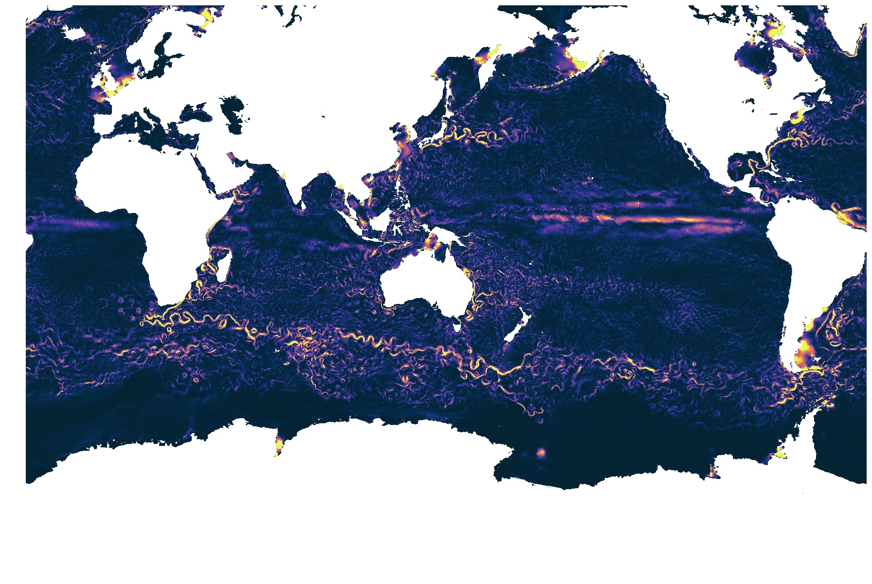
Champs de surface LLC4320
La simulation numérique LLC4320 est une simulation de l'écoulement océanique globale avec une résolution horizontale de 1-2 km. Cette simulation résout les phénomènes rapides de marée. Seuls les champs de surface sont disponibles
Simple
- Date (Creation)
- 2013-01-01
- Date (Publication)
- 2020-06-09
- Identifier
- FR-330-715-368-00032-IFR-LOPS-OC-CHAMPS-SURF_LLC4320
- Credit
- Jet Propulsion Laboratory - NASA - USA
Publisher
Ifremer, Scientific Information Systems for the sea
+33 (0)2 98.22.49.16
+33 (0)2 98.22.46.44
http://data.ifremer.fr/SISMER
IFREMER Centre de Bretagne
ZI Pointe du diable
CS 10070
, PLOUZANE , 29280 , France+33 (0)2 98.22.46.44
http://data.ifremer.fr/SISMER
Author
IFREMER
-
Ponte Aurelien
02 98 22 44 96
Centre Bretagne - ZI de la Pointe du Diable - CS 10070 - 29280 Plouzané
,
Brest
,
France
02 98 22 40 73
02 98 22 44 96
- GEMET - INSPIRE themes, version 1.0
-
- Caractéristiques géographiques océanographiques
- Thèmes Sextant
-
- /Milieu physique/Hydrodynamique océanique
- Type de jeux de donnée ODATIS
-
- Données de simulation
- Use limitation
- CC-BY (Creative Commons - Attribution)
- Access constraints
- Other restrictions
- Use constraints
- Other restrictions
- Spatial representation type
- grid Grid
- Metadata language
- Français
- Character set
- utf8 UTF8
- Topic category
-
- Oceans
N
S
E
W
))
- Begin date
- 2011-09-13
- End date
- 2022-11-15
- Reference system identifier
- EPSG / WGS 84 (EPSG:4326) / 8.6
- Distribution format
-
-
(
)
-
(
)
- OnLine resource
- /home/ref-ocean-analysis/LLC4320_surface ( NETWORK:LINK )
- Hierarchy level
- Dataset
- Statement
-
La grille horizontale de LLC4320 est au 1/48 deg, ce qui résulte en une résolution comprise entre 1 et 2km. La grille verticale comprends 90 niveaux avec une résolution à la surface de 1m approximativement et 100m à 2000m de profondeur.
Le forçage de surface est ECMWF à 0.14deg à 6h.
Le forçage de marée comprend 16 constituents.
1 an de sortie sont disponibles.
- File identifier
- b2bcb9af-f335-45b6-a2a9-e460e4132879 XML
- Metadata language
- Français
- Character set
- UTF8
- Hierarchy level
- Dataset
- Date stamp
- 2025-12-13T10:30:18.250006Z
- Metadata standard name
- ISO 19115-3 - SEXTANT
- Metadata standard version
- 1.0
Point of contact
IFREMER
-
Ponte Aurelien
02 98 22 44 96
Centre Bretagne - ZI de la Pointe du Diable - CS 10070 - 29280 Plouzané
,
Brest
,
France
02 98 22 40 73
02 98 22 44 96
Overviews
KE_surf.jpg
Spatial extent
N
S
E
W
Provided by

Associated resources
Not available