 Catalogue PIGMA
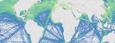
Cumulative human impacts: raw stressor data (2008 and 2013)
This is a portion of the data used to calculate 2008 and 2013 cumulative human impacts in: Halpern et al. 2015. Spatial and temporal changes in cumulative human impacts on the world's ocean.
Seven data packages are available for this project:
(1) supplementary data (habitat data and other files);
(2) raw stressor data (2008 and 2013);
(3) stressor data rescaled by one time period (2008 and 2013, scaled from 0-1);
(4) stressor data rescaled by two time periods (2008 and 2013, scaled from 0-1);
(5) pressure and cumulative impacts data (2013, all pressures);
(6) pressure and cumulative impacts data (2008 and 2013, subset of pressures updated for both time periods);
(7) change in pressures and cumulative impact (2008 to 2013).
All raster files are .tif format and coordinate reference system is mollweide wgs84.
Here is an overview of the calculations:
Raw stressor data -> rescaled stressor data (values between 0-1) -> pressure data (stressor data after adjusting for habitat/pressure vulnerability) -> cumulative impact (sum of pressure data) -> difference between 2008 and 2013 pressure and cumulative impact data.
This data package includes 2008 and 2013 raw stressor data.
The 2008 data includes 18 raster files (preceeded by raw_2008_).
The 2013 data includes 19 raster files (preceeded by raw_2013_).
There is no sea level rise data for 2008.
Simple
- Date (Publication)
- 2015-07-14
- Identifier
- dd076783-e6f3-4168-8fe4-ff789e8707b5
- Credit
- University of California (USA)
- GEMET - INSPIRE themes, version 1.0
-
- Oceanographic geographical features
- Mission Atlantic - Case Studies
-
- Canary Current system
- Atlantic Ocean
- Mission Atlantic - BODC Parameters
-
- /Human activities/Pollution
- /Human activities/Fisheries
- Mission Atlantic - Data type (DMP)
-
- Spatial data products
- Mission Atlantic - Work Package
-
- WP1 Atlantic Ocean IEA
- WP4 Benthic Mapping
- WP3 Pelagic Mapping
- Mission Atlantic - Resources
-
- Data
- Use limitation
- CC0 (Creative Commons - Transfer into public domain)
- Spatial representation type
- grid Grid
- Metadata language
- English
- Character set
- utf8 UTF8
- Topic category
-
- Oceans
))
- Begin date
- 2008-01-01
- End date
- 2013-01-01
- Unique resource identifier
- EPSG:4326
- OnLine resource
- KNB data access ( WWW:DOWNLOAD )
- OnLine resource
- https://knb.ecoinformatics.org/view/doi:10.5063/F1S180FS ( DOI )
- File identifier
- dd076783-e6f3-4168-8fe4-ff789e8707b5 XML
- Metadata language
- English
- Character set
- UTF8
- Hierarchy level
- Dataset
- Date stamp
- 2025-05-16T09:12:38.997165Z
- Metadata standard name
- ISO 19115-3 - SEXTANT
- Metadata standard version
- 1.0
Overviews
Spatial extent
Provided by
