 Catalogue PIGMA
Administrative units | Biodiversity monitoring stations | Integrated Regional monitoring Implementation Strategy in the South European Seas | Biodiversity monitoring stations
Simple
- Alternate title
- Biodiversity monitoring stations
- Date
- Identifier
- Administrative units | Biodiversity monitoring stations | Integrated Regional monitoring Implementation Strategy in the South European Seas | Biodiversity monitoring stations
- Other citation details
- Biodiversity monitoring stations
- Status
- onGoing On going
http://iris-ses.eu/
http://iris-ses.eu/
- Maintenance and update frequency
- As needed
- Used by challenges
-
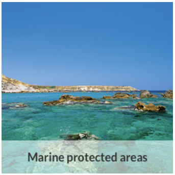
- MedSea - CH02 - Marine Protected Areas
- Environmental matrix
-
- Marine water
- Production mode
-
- Delayed
- Visibility
-
- Use of open search engines, searching by name either the data provider or the characteristics
- Policy visibility
-
- There is detailed information provided to understand data policy
- Readyness
-
- Format not proprietary and content clearly specified (e.g. autodescriptive like ODV, NetCDF CF) or at least with appropriate document describing the content
- Parameter Discovery Vocabulary (P02)
-
- Administrative units
- GEMET - INSPIRE themes, version 1.0
-
- Bio-geographical regions
- Processing level of characteristics
-
- Observation (raw, QC)
- Data delivery mechanisms
-
- Manual process: Order form/invoice is requested
- Parameter Usage Vocabulary (other)
-
- Biodiversity monitoring stations
- Agreed Parameter Groups (P03)
-
- Habitat
- Service extent
-
- The datasets are provided through an EU Inspire catalogue service (OGC)
- Access constraints
- Other restrictions
- Other constraints
- Restricted
- Use limitation
- Open and Free. No charge
- Spatial representation type
- vector Vector
- Metadata language
- Français
- Character set
- utf8 UTF8
- Topic category
-
- Oceans
))
- Begin date
- 1959-01-01T00:00:00
- End date
- 2012-01-01T00:00:00 After
Vertical extent
- Minimum value
- 0
- Maximum value
- 0
- Dimension name
- Time
- Transformation parameter availability
- Yes
- Checkpoint Availability
- Yes
- Distribution format
-
-
XLS
()
-
XLS
()
- OnLine resource
- Final Metadatabase for IRIS-SES ( WWW:LINK )
- OnLine resource
- http://iris-ses.eu/final-metadatabase-for-iris-ses/ ( WWW:LINK )
- Hierarchy level
- Dataset
Domain consistency
- Name of measure
- Responsiveness
Quantitative result
- Value
- No information is found on response time
- Hierarchy level
- datasetComponent
- Other
- MEDSEA_CH2_Product_6
))
- Begin date
- 1987-01-01T00:00:00
- End date
- 2014-12-31T00:00:00 After
Vertical extent
- Minimum value
- 0
- Maximum value
- 100
Completeness omission
- Name of measure
- Horizontal Spatial Coverage
- Measure identification
- AP.1.1
- Measure description
- Horizontal coverage extent of product (eg : surface of the Mediterranean Sea)
Quantitative result
- Value type
- Real
- Value
- 1
Completeness omission
- Name of measure
- Vertical Spatial Coverage
- Measure identification
- AP.1.2
- Measure description
- Vertical coverage extent of product
Quantitative result
- Value type
- Real
- Value
- 100
Completeness omission
- Name of measure
- Temporal Coverage
- Measure identification
- AP.1.3
- Measure description
- Temporal coverage extent of product
Quantitative result
- Value type
- Integer
- Value
- 9855
Conceptual consistency
- Name of measure
- Number of Characteristics
- Measure identification
- AP.2.1
- Measure description
- Number of characteristics in product
Quantitative result
- Value type
- Integer
Thematic classification correctness
- Name of measure
- Horizontal resolution
- Measure identification
- AP.3.1
- Measure description
- Horizontal mesh size or equivalent value for the given scale of product (eg 50m for 1/50 000)
Quantitative result
- Value type
- Integer
- Value
- 2
Thematic classification correctness
- Name of measure
- Vertical resolution
- Measure identification
- AP.3.2
- Measure description
- Average vertical sampling
Quantitative result
- Value type
- Real
gmd:DQ_DescriptiveResult
- Date / Time
- 2016-12-01T00:00:00
- Statement
- unknown
Thematic classification correctness
- Name of measure
- Temporal resolution
- Measure identification
- AP.3.3
- Measure description
- Temporal sampling interval of product
Quantitative result
- Value type
- Real
- Value
- 30
Quantitative attribute accuracy
- Name of measure
- Thematic accuracy
- Measure identification
- AP.3.4
- Measure description
- Percentage error of the product and description of error concept for the product (100 words max) provided by expert
Quantitative result
- Value type
- Percentage
- Value
- 5
Temporal validity
- Name of measure
- Temporal validity
- Measure identification
- AP.4.1
- Measure description
- Max elapsed time between last input data records update and product creation date
Quantitative result
- Value type
- Integer
- Value
- 365
Completeness omission
- Name of measure
- Horizontal spatial coverage compliance
- Measure identification
- UD.APE.1.1
- Measure description
-
Percentage to which the extent of the horizontal spatial
coverage of the selected input data is not compliant with the DPS extent in km**2
(UD_AP_1_1 - DPS_AP_1_1)*100/DPS_AP_1_1
Quantitative result
- Value type
- Percentage
- Value
- -99.99996
Completeness omission
- Name of measure
- Horizontal spatial coverage fitness for use error
- Measure identification
- UD.FU.1.1
- Measure description
-
Combination of the errors of the product
component Cn with the error of the selected input data set Ud Cn used for this component
- Value
- -99.99996
Completeness omission
- Name of measure
- Vertical spatial coverage compliance
- Measure identification
- UD.APE.1.2
- Measure description
-
Percentage to which the vertical coverage of the selected
input data is not compliant with the DPS coverage extent in metres
(UD_AP_1_2 - DPS_AP_1_2)*100/DPS_AP_1_2
Quantitative result
- Value type
- Percentage
- Value
- -98.07692307692308
Completeness omission
- Name of measure
- Vertical spatial coverage fitness for use error
- Measure identification
- UD.FU.1.2
- Measure description
-
Combination of the errors of the product
component Cn with the error of the selected input data set Ud Cn used for this component
- Value
- -98.07692307692308
Completeness omission
- Name of measure
- Temporal coverage compliance
- Measure identification
- UD.APE.1.3
- Measure description
-
Percentage to which the time coverage of the selected input data is compliant with the DPS coverage extent in days
(UD_AP_1_3 - DPS_AP_1_3)*100/DPS_AP_1_3
Quantitative result
- Value type
- Percentage
- Value
- -6.896551724137931
Completeness omission
- Name of measure
- Temporal coverage fitness for use error
- Measure identification
- UD.FU.1.3
- Measure description
-
Combination of the errors of the product
component Cn with the error of the selected input data set Ud Cn used for this component
- Value
- -6.896551724137931
Thematic classification correctness
- Name of measure
- Horizontal resolution compliance
- Measure identification
- UD.APE.3.1
- Measure description
-
Percentage to which the horizontal resolution or equivalent scale value (eg 50 m for map scale of 1/50 000) data
or mean horizontal sampling interval of the selected input data is compliant not with the DPS horizontal
resolution
(DPS_AP_3_1 - UD_AP_3_1)*100/DPS_AP_3_1
Quantitative result
- Value type
- Percentage
- Value
- 60
Thematic classification correctness
- Name of measure
- Horizontal resolution fitness for use error
- Measure identification
- UD.FU.3.1
- Measure description
-
Combination of the errors of the product
component Cn with the error of the selected input data set Ud Cn used for this component
- Value
- 60
Thematic classification correctness
- Name of measure
- Vertical resolution compliance
- Measure identification
- UD.APE.3.2
- Measure description
-
Percentage to which the vertical sampling interval of the selected input data is not compliant with the DPS
vertical resolution
(DPS_AP_3_2 - UD_AP_3_2)*100/DPS_AP_3_2
Quantitative result
- Value type
- Percentage
Thematic classification correctness
- Name of measure
- Vertical resolution fitness for use error
- Measure identification
- UD.FU.3.2
- Measure description
-
Combination of the errors of the product
component Cn with the error of the selected input data set Ud Cn used for this component
Thematic classification correctness
- Name of measure
- Temporal resolution compliance
- Measure identification
- UD.APE.3.3
- Measure description
-
Percentage to which the temporal sampling interval
is not compliant with the DPS temporal sampling interval
(DPS_AP_3_3-UD_AP_3_3)*100/DPS_AP_3_3
Quantitative result
- Value type
- Percentage
- Value
- 0
Thematic classification correctness
- Name of measure
- Temporal resolution fitness for use error
- Measure identification
- UD.FU.3.3
- Measure description
-
Combination of the error of the product
component Cn with the error of the selected input data set Ud Cn used for this component
- Value
- 0
Quantitative attribute accuracy
- Name of measure
- Thematic accuracy compliance
- Measure identification
- UD.APE.3.4
- Measure description
-
Compliance of the value domain of
the accuracy of the selected input data with the value domain of the accuracy defined in DPS (% extracted from
thematic accuracy description)
UD_AP_3_4
Quantitative result
- Value type
- Percentage
- Value
- 5
Quantitative attribute accuracy
- Name of measure
- Thematic accuracy fitness for use error
- Measure identification
- UD.FU.3.4
- Measure description
-
Combination of the error of the product
component Cn with the error of the selected input data set Ud Cn used for this component
- Value
- 5
Temporal validity
- Name of measure
- Temporal validity compliance
- Measure identification
- UD.APE.4.1
- Measure description
-
Percentage to which the elapsed time between last selected input data record update is not compliant with the max
elapsed time specified in DPS
(DPS_AP_4_1 - UD_AP_4_1)*100/DPS_AP_4_1
Quantitative result
- Value type
- Percentage
- Value
- 0
Temporal validity
- Name of measure
- Temporal validity fitness for use error
- Measure identification
- UD.FU.4.1
- Measure description
-
Combination od errors of extent to which
the elapsed time between last selected input data record update and the product creation date is compliant with
the max elapsed time specified in DPS
- Value
- 0
- Attribute description
- observation
- Content type
- Physical measurement
- Description
- 0
- File identifier
- ed5d16a3-57e7-45ca-9ade-f7cca2bc47d8 XML
- Metadata language
- English
- Character set
- UTF8
- Hierarchy level
- Dataset
- Hierarchy level name
- MedSea - CH02 - Marine Protected Areas
- Date stamp
- 2017-08-24T12:30:10Z
- Metadata standard name
- ISO 19115-3 - Emodnet Checkpoint - Upstream Data
- Metadata standard version
- 1.0
Overviews
Spatial extent
Provided by
