 Catalogue PIGMA
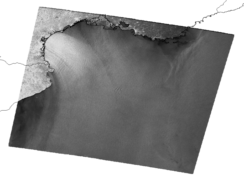
InterRisk - satellite image - MERSEA experimentation
Satellite image (Golfe du Lion).
Satellite Synthetic Aperture Radar (SAR) imagery used for Oil Spill Detection.
Simple
- Alternate title
- INTERRISK_IMG_SAT_GLION
- Date (Publication)
- Presentation form
- Digital map
- Status
- onGoing On going
- Maintenance and update frequency
- As needed
- Thèmes Sextant
-
- /Imagerie/Imagerie aérienne/Imagerie numérique
- Theme
-
- Place
-
- Méditerranée
- Golfe du lion
- Access constraints
- Copyright
- Use constraints
- otherRestictions
- Spatial representation type
- grid Grid
- Metadata language
- Français
- Character set
- utf8 UTF8
- Topic category
-
- Oceans
N
S
E
W
))
- Reference system identifier
- 4326
- Number of dimensions
- 3
- Dimension name
- Row
- Dimension name
- Column
- Dimension name
- Vertical
- Cell geometry
- Area
- Transformation parameter availability
- No
Distributor
- OnLine resource
- ASA_WSM ( OGC:WMS )
- Hierarchy level
- Dataset
- File identifier
- 056eba70-e458-11dc-879a-000086f6a603 XML
- Metadata language
- Français
- Character set
- UTF8
- Hierarchy level
- Dataset
- Date stamp
- 2025-05-15T21:14:40.491009Z
- Metadata standard name
- ISO 19115-3 - SEXTANT
- Metadata standard version
- 1.0
Overviews

thumbnail
large_thumbnail
Spatial extent
N
S
E
W
Provided by

Associated resources
Not available