 Catalogue PIGMA
Bathymetry and Elevation | Sea-floor depth (below mean sea level) {bathymetric depth} in the water body by derivation from GEBCO_08 30 arc-second global grid | GEBCO | GEBCO_2014 Grid — a global 30 arc-second interval grid
Simple
- Alternate title
- GEBCO_2014 Grid — a global 30 arc-second interval grid
- Date
- Identifier
- Bathymetry and Elevation | Sea-floor depth (below mean sea level) {bathymetric depth} in the water body by derivation from GEBCO_08 30 arc-second global grid | GEBCO | GEBCO_2014 Grid — a global 30 arc-second interval grid
- Other citation details
- GEBCO’s gridded bathymetric data sets
- Purpose
- Gridded bathymetry across All the atlantic-Complete Atlantic coverage (30´resolution)
- Status
- onGoing On going
Originator
Intergovernmental Oceanographic Commission - IODE
http://www.iode.org/projectoffice/
Wandelaarkaai 7
,
Oostende
,
B-8400
,
Belgium
+32(0)59 34 21 30
http://www.iode.org/projectoffice/
- Maintenance and update frequency
- As needed
- Used by challenges
-
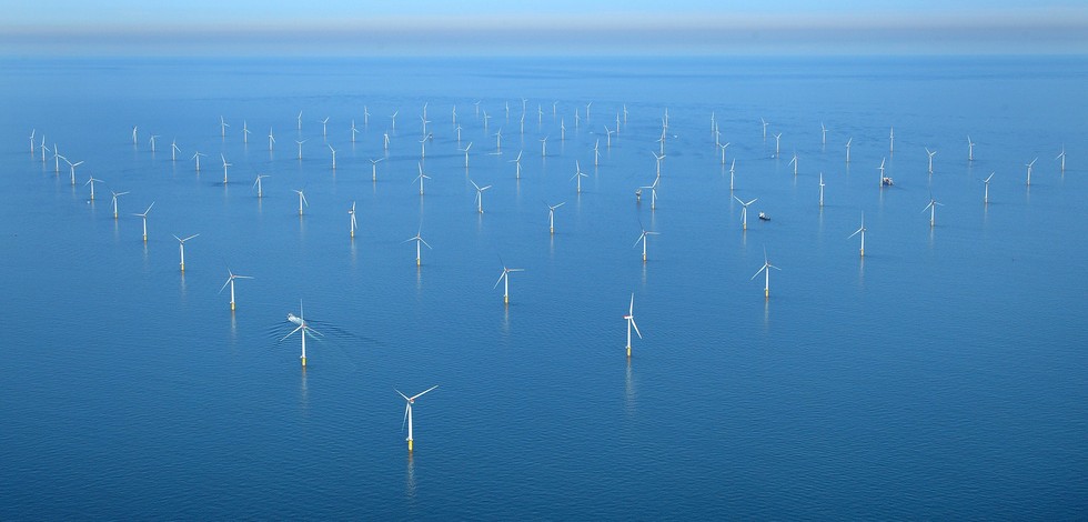
- Atlantic - CH01 - Windfarm Siting
- Environmental matrix
-
- Seabed - Riverbed
- Production mode
-
- Delayed
- Visibility
-
- Search via reference catalogue (e.g. MyOcean, GEOSS Geoportal…)
- Policy visibility
-
- There is detailed information provided to understand data policy
- Readyness
-
- Format not proprietary and content clearly specified (e.g. autodescriptive like ODV, NetCDF CF) or at least with appropriate document describing the content
- Parameter Discovery Vocabulary (P02)
-
- Bathymetry and Elevation
- GEMET - INSPIRE themes, version 1.0
-
- Hydrography
- Processing level of characteristics
-
- High level analyzed
- Data delivery mechanisms
-
- Online discovery + downloading + viewing services (Advanced services)
- Parameter Usage Vocabulary (P01)
-
- Sea-floor depth (below mean sea level) {bathymetric depth} in the water body by derivation from GEBCO_08 30 arc-second global grid
- Agreed Parameter Groups (P03)
-
- Gravity, magnetics and bathymetry
- Service extent
-
- The datasets are referenced in a public national catalogue, in an international catalogue service
- Validation
-
- Submitted
- Access constraints
- Other restrictions
- Other constraints
- Unrestricted
- Use limitation
- Open and Free. No charge
- Spatial representation type
- vector Vector
- Metadata language
- Français
- Character set
- utf8 UTF8
- Topic category
-
- Oceans
- Environment description
- Seabed depth will used as major indicator in fitness for use OWF siting assessment-Complete Atlantic coverage (30´resolution)
N
S
E
W
))
- Begin date
- 2014-12-01T00:00:00
Vertical extent
- Minimum value
- 0
- Maximum value
- 11000
- Number of dimensions
- 1
- Dimension name
- Time
- Transformation parameter availability
- Yes
- Checkpoint Availability
- Yes
- Distribution format
-
-
Ascii
()
-
GeoTIFF
()
-
NetCDF
()
-
Ascii
()
- OnLine resource
- GEBCO_2014 grid ( WWW:LINK )
- OnLine resource
- GEBCO’s gridded bathymetric data sets ( WWW:LINK )
- Hierarchy level
- Dataset
Domain consistency
- Name of measure
- Responsiveness
Quantitative result
- Value
- Online downloading (i.e. a few hours or less) for release
Domain consistency
- Name of measure
- Reliability
Quantitative result
- Statement
- NA
- Attribute description
- observation
- Content type
- Physical measurement
- Description
- 0
- File identifier
- f1fa11b0-96a6-4d52-86b6-2252ce2cf5ce XML
- Metadata language
- English
- Character set
- UTF8
- Hierarchy level
- Dataset
- Hierarchy level name
- Atlantic - CH01 - Windfarm Siting
- Date stamp
- 2018-01-09T10:09:13Z
- Metadata standard name
- ISO 19115-3 - Emodnet Checkpoint - Upstream Data
- Metadata standard version
- 1.0
Overviews
Spatial extent
N
S
E
W
Provided by

Associated resources
Not available