 Catalogue PIGMA
Sediment water content, porosity and surface area
Type of resources
Available actions
Topics
Keywords
Contact for the resource
Provided by
Formats
Representation types
-
POSEIDON is an operational marine monitoring, forecasting and information system for the Greek Seas. The observing component is a distributed infrastructure made by three coastal buoys (Saronikos buoy-SB, Heraklion Coastal Buoy-HCB and Athos buoy-AB) and one Ferrybox (PFB). A calibration laboratory) is supporting the observing activities. The Ferrybox is installed on board H/S/F “Knossos Palace” and is equipped with sensors measuring T, C/S, DO, pH, fluorescence and turbidity. It is the only Ferry Box in the Mediterranean operating daily along the route Heraklion – Piraeus.
-
POSEIDON is an operational marine monitoring, forecasting and information system for the Greek Seas. The observing component is a distributed infrastructure made by three coastal buoys (Saronikos buoy-SB, Heraklion Coastal Buoy-HCB and Athos buoy-AB) and one FerryBox (PFB). A calibration laboratory (see Chapter 2) is supporting the observing activities. The Athos buoy is equipped with meteo sensors and T, C/S, DO, fluorescence and turbidity sensors up to 100m in depth, is located in the coastal area in the Northern Aegean, representative of mesotrophic to oligotrophic conditions affected by circulation. Although coastal the depth of the water column allows deeper observations.
-

The "Acqua Alta" research tower consists of a platform containing an instrument house, supported by a steel pipe structure, similar to that of an oil well derrick. The pipe structure is hammered 22 m into the bottom through each of its four hollow legs. Energy is supplied at 125, 220, 380 VAC (50 Hz –remote activation), along with continuous voltage 12 and 24 VDC. The tower can host two technicians and three scientists for several days and allows specific dedicated campaigns and long-term measurements. A broadband wireless communication system between the tower and the operating Institute allows 10 Mb/s data communication rate and real time data availability. The bridge allows the tower to be part of the Institute LAN so all the scientists on board can access internet and potentially the instruments could be controlled remotely. Measurements routinely acquired with periodic sampling concern biology, chemistry, physical oceanography. Autonomous instrumentations cover atmospheric and hydrological parameters with a series of meteorological stations and oceanographic instruments. A direct view of the sea condition around the tower is available continuously by the three high resolution webcams installed on the roof. Two underwater webcams are installed at -3 and -12 m to observe biological populations and to monitor potentially critical phenomena such as jellyfish swarms and mucilaginous macro aggregates. Given the high level of security and wide desk space, sophisticated instruments can be hosted on board reducing drastically the risk of loss (when not in service the tower is locked and a video surveillance is active). The good level of logistic support allows the setup of in situ experiments.
-
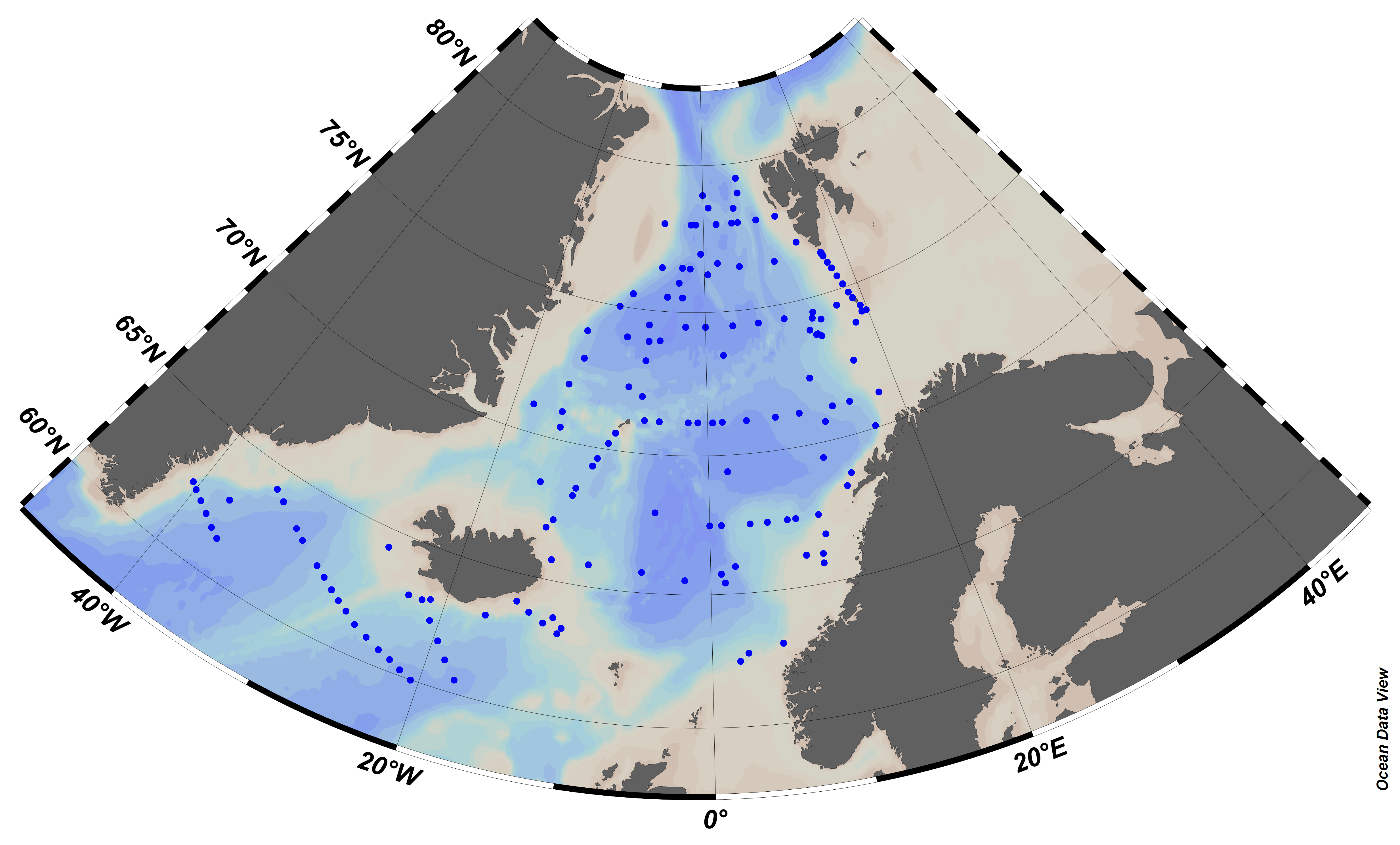
EMODnet Chemistry aims to provide access to marine chemistry data sets and derived data products concerning eutrophication, ocean acidification and contaminants. The chemicals chosen reflect importance to the Marine Strategy Framework Directive (MSFD). This regional aggregated dataset contains all unrestricted EMODnet Chemistry data on contaminants (20 parameters), and covers the Arctic Ocean with 548 CDI records divided per matrices: 235 water profiles, 313 sediment profiles. Vertical profiles temporal range is from 1974-03-25 to 2015-06-15. Data were aggregated and quality controlled by ‘Institute of Marine Research - Norwegian Marine Data Centre (NMD)’ from Norway. Regional datasets concerning contaminants are automatically harvested. Parameter names in these datasets are based on P01, BODC Parameter Usage Vocabulary, which is available at: http://seadatanet.maris2.nl/bandit/browse_step.php . Each measurement value has a quality flag indicator. The resulting data collections for each Sea Basin are harmonised, and the collections are quality controlled by EMODnet Chemistry Regional Leaders using ODV Software and following a common methodology for all Sea Regions. Harmonisation means that: (1) unit conversion is carried out to express contaminant concentrations with a limited set of measurement units (according to EU directives 2013/39/UE; Comm. Dec. EU 2017/848) and (2) merging of variables described by different “local names” ,but corresponding exactly to the same concepts in BODC P01 vocabulary. The harmonised dataset can be downloaded as ODV spreadsheet (TXT file), which is composed of metadata header followed by tab separated values. This worksheet can be imported to ODV Software for visualisation (More information can be found at: https://www.seadatanet.org/Software/ODV ). The same dataset is offered also as XLSX file in a long/vertical format, in which each P01 measurement is a record line. Additionally, there are a series of columns that split P01 terms in subcomponents (measure, substance, CAS number, matrix...).This transposed format is more adapted to worksheet applications users (e.g. LibreOffice Calc). The 20 parameter names in this metadata record are based on P02, SeaDataNet Parameter Discovery Vocabulary, which is available at: http://seadatanet.maris2.nl/v_bodc_vocab_v2/vocab_relations.asp?lib=P02 . Detailed documentation will be published soon. The original datasets can be searched and downloaded from EMODnet Chemistry Download Service: https://emodnet-chemistry.maris.nl/search
-
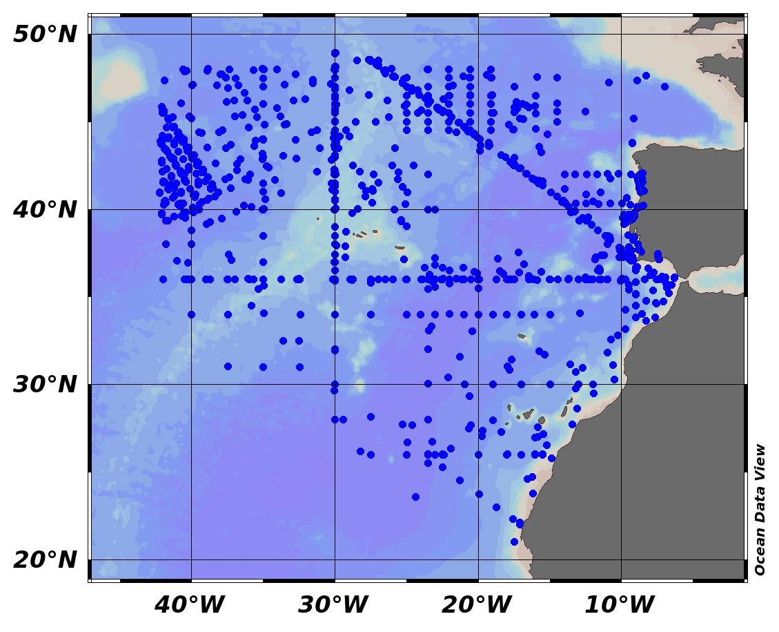
EMODnet Chemistry aims to provide access to marine chemistry data sets and derived data products concerning eutrophication, ocean acidification and contaminants. The chemicals chosen reflect importance to the Marine Strategy Framework Directive (MSFD). This regional aggregated dataset contains all unrestricted EMODnet Chemistry data on contaminants (20 parameters), and covers the North East Atlantic Ocean with 2400 CDI records divided per matrices: 122 in biota (as time series), 1689 in water (as vertical profiles), 589 in sediment (478 Vertical profiles and 111 Time series). Vertical profiles temporal range is from 1970-07-29 to 2017-02-28. Time series temporal range is from 1979-02-28 to 2014-10-21. Data were aggregated and quality controlled by ‘IFREMER / IDM / SISMER - Scientific Information Systems for the SEA’ from France. Regional datasets concerning contaminants are automatically harvested. Parameter names in these datasets are based on P01, BODC Parameter Usage Vocabulary, which is available at: http://seadatanet.maris2.nl/bandit/browse_step.php . Each measurement value has a quality flag indicator. The resulting data collections for each Sea Basin are harmonised, and the collections are quality controlled by EMODnet Chemistry Regional Leaders using ODV Software and following a common methodology for all Sea Regions. Harmonisation means that: (1) unit conversion is carried out to express contaminant concentrations with a limited set of measurement units (according to EU directives 2013/39/UE; Comm. Dec. EU 2017/848) and (2) merging of variables described by different “local names” ,but corresponding exactly to the same concepts in BODC P01 vocabulary. The harmonised dataset can be downloaded as ODV spreadsheet (TXT file), which is composed of metadata header followed by tab separated values. This worksheet can be imported to ODV Software for visualisation (More information can be found at: https://www.seadatanet.org/Software/ODV ). The same dataset is offered also as XLSX file in a long/vertical format, in which each P01 measurement is a record line. Additionally, there are a series of columns that split P01 terms in subcomponents (measure, substance, CAS number, matrix...).This transposed format is more adapted to worksheet applications users (e.g. LibreOffice Calc). The 20 parameter names in this metadata record are based on P02, SeaDataNet Parameter Discovery Vocabulary, which is available at: http://seadatanet.maris2.nl/v_bodc_vocab_v2/vocab_relations.asp?lib=P02 . Detailed documentation will be published soon. The original datasets can be searched and downloaded from EMODnet Chemistry Download Service: https://emodnet-chemistry.maris.nl/search