 Catalogue PIGMA
Keyword
sea bass
Type of resources
Available actions
Topics
Keywords
Contact for the resource
Provided by
Representation types
Scale
From
1
-
1
/
1
-
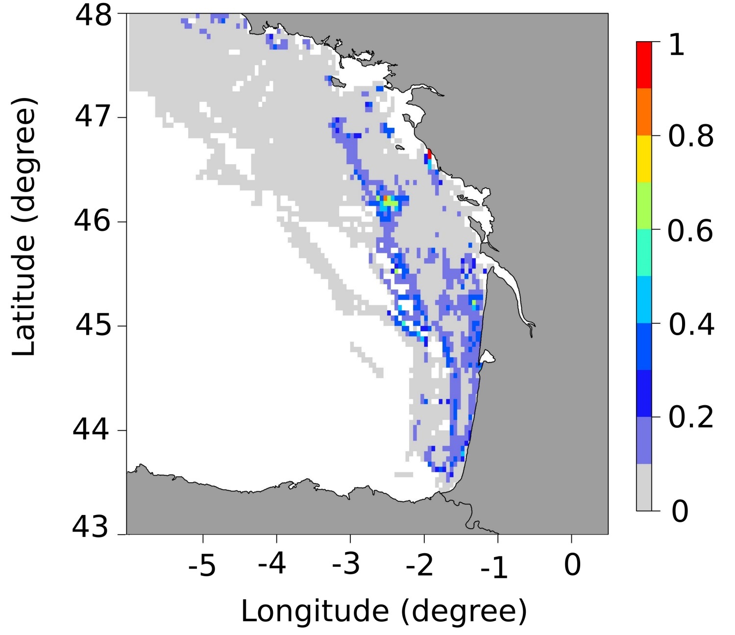
These maps represent the monthly probability of being a seabass spawning area for each month of the spawning season (January to March), and the mean probability of being a seabass spawning area over all spawning months in the Bay of Biscay. These probability maps were calculated by performing a geostatistical analysis of fishing data from geolocated vessels, and have a spatial resolution of 3 by 3 nautical miles.