Catalogue PIGMA
Search
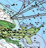
Map
Sign in
Search
Contact for the resource
US Government Open Data Source
1 record(s)
Type of resources
Dataset
(1)
Topics
Oceans
(1)
Keywords
The datasets are referenced in a public national catalogue, in an international catalogue service
(1)
Submitted
(1)
Delayed
(1)
Online downloading services
(1)
Use of open search engines, searching by name either the data provider or the characteristics
(1)
Elevation
(1)
Seabed - Riverbed
(1)
There is no information at all on data policy adopted by data providers
(1)
High level analyzed
(1)
Terrestrial
(1)
Format not or not well documented
(1)
Bathymetry and Elevation
(1)
Atlantic - CH10 - Bathymetry
(1)
Sea-floor depth (below mean sea level) {bathymetric depth}
(1)
Depth Uncertainty
(1)
Contact for the resource
HR Wallingford
(1)
NOAA
(1)
US Government Open Data Source
(1)
Provided by
IFREMER
(1)
Formats
ZIP
(1)
Representation types
Vector
(1)
Update frequencies
Biannually
(1)
status
On going
(1)
From
1
-
1
/
1
Bathymetry and Elevation | Sea-floor depth (below mean sea level) {bathymetric depth} | US Government Open Data Source | NOAA ESRI Grid - depth uncertainty predictions in New York offshore planning area from Biogeography Branch bathymetry model
About
Github
 Catalogue PIGMA