 Catalogue PIGMA
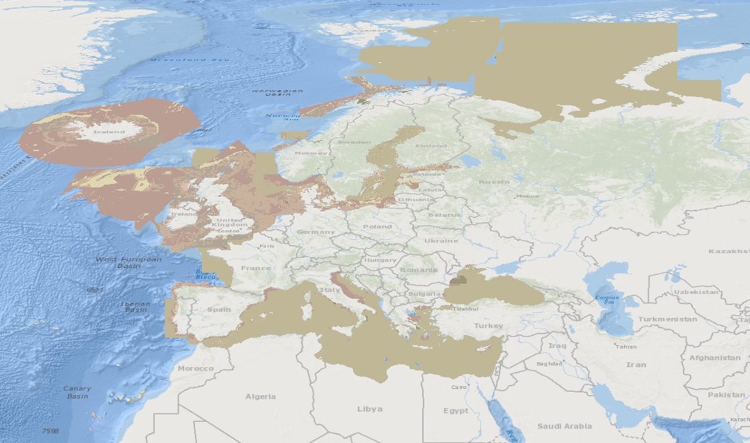
Habitat characterisation | Seabed substrate map | EMODnet Secretariat | EMODnet Seabed substrate (250k)
Simple
- Alternate title
- EMODnet Seabed substrate (250k)
- Date
- Identifier
- Habitat characterisation | Seabed substrate map | EMODnet Secretariat | EMODnet Seabed substrate (250k)
- Other citation details
- EMODnet Seabed substrate (250k)
- Purpose
- EMODnet Bathymetry aims to provide a single access point to bathymetric products, Digital Terrain Models (DTM) and data (survey data sets and composite DTM) collected and managed by an increasing number of organisation from government and research scattered over Europe
- Status
- onGoing On going
- Maintenance and update frequency
- As needed
- Used by challenges
-
- Atlantic - CH07 - Fisheries Impact
- Environmental matrix
-
- Seabed - Riverbed
- Production mode
-
- Delayed
- Visibility
-
- Search via reference catalogue (e.g. MyOcean, GEOSS Geoportal…)
- Policy visibility
-
- There is detailed information provided to understand data policy
- Readyness
-
- Format not proprietary and content clearly specified (e.g. autodescriptive like ODV, NetCDF CF) or at least with appropriate document describing the content
- Parameter Discovery Vocabulary (P02)
-
- Habitat characterisation
- GEMET - INSPIRE themes, version 1.0
-
- Habitats and biotopes
- Processing level of characteristics
-
- High level analyzed
- Data delivery mechanisms
-
- Online discovery + downloading + viewing services (Advanced services)
- Parameter Usage Vocabulary (other)
-
- Seabed substrate map
- Agreed Parameter Groups (P03)
-
- Habitat
- Service extent
-
- The datasets are provided through an EU Inspire catalogue service (OGC)
- Validation
-
- Submitted
- Access constraints
- Other restrictions
- Other constraints
- Unrestricted
- Use limitation
- Open and Free. No charge
- Spatial representation type
- vector Vector
- Distance
- 250 meter
- Metadata language
- Français
- Character set
- utf8 UTF8
- Topic category
-
- Oceans
- Environment description
- To spatially resolve seabed habitats in relation to fished areas in European waters to quantify the impact on vulnerable habitats.
N
S
E
W
))
- Begin date
- 2010-04-01
- End date
- 2013-09-01
Vertical extent
- Minimum value
- 0
- Maximum value
- 4800
- Dimension name
- Time
- Transformation parameter availability
- Yes
- Checkpoint Availability
- Yes
- Distribution format
-
-
ESRI Shapefile
()
-
ESRI Shapefile
()
- OnLine resource
- Download and links ( WWW:LINK )
- OnLine resource
- EMODnet Seabed substrate (250k) ( WWW:LINK )
- Hierarchy level
- Dataset
Domain consistency
- Name of measure
- Responsiveness
Quantitative result
- Value
- Online downloading (i.e. a few hours or less) for release
Domain consistency
- Name of measure
- Reliability
Quantitative result
- Attribute description
- observation
- Content type
- Physical measurement
- File identifier
- 49ec66e5-6090-4a62-a7b2-bf377b83b84d XML
- Metadata language
- English
- Character set
- UTF8
- Hierarchy level
- Dataset
- Hierarchy level name
- Atlantic - CH07 - Fisheries Impact
- Date stamp
- 2018-01-04T15:26:54Z
- Metadata standard name
- ISO 19115-3 - Emodnet Checkpoint - Upstream Data
- Metadata standard version
- 1.0
Overviews
Spatial extent
N
S
E
W
Provided by

Associated resources
Not available