 Catalogue PIGMA
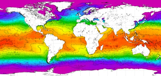
World Ocean Atlas 2018. NOAA National Centers for Environmental Information
Simple
- Date (Publication)
- 2018-10-15
- Identifier
- 6675938c-c643-4015-9897-2c0b1d1aad60
- Purpose
- Oceanographic objective analyses have proven to be of great utility to the oceanographic, climate research, geophysical, and operational environmental forecasting communities. Such analyses are used as boundary and/or initial conditions in numerical ocean circulation models and atmosphere-ocean models, for verification of numerical simulations of the ocean, as a form of "sea truth" for satellite measurements such as altimetric observations of sea surface height, for computation of nutrient fluxes by Ekman transport, and for planning oceanographic expeditions among others.
- Credit
- National Oceanic and Atmospheric Administration (USA)
- Status
- completed Completed
- Thèmes Sextant
-
- /Physical Environment
- GEMET - INSPIRE themes, version 1.0
-
- Oceanographic geographical features
- Mission Atlantic - Case Studies
-
- South Mid-Atlantic Ridge
- South Brazilian Shelf
- Atlantic Ocean
- Mission Atlantic - BODC Parameters
-
- /Chemical oceanography/Dissolved gases
- /Chemical oceanography/Nutrients
- /Physical oceanography/Water column temperature and salinity
- Mission Atlantic - Data type (DMP)
-
- Environmental data
- Mission Atlantic - Work Package
-
- WP5 Assessing state, drivers and tipping points
- WP6 Dynamics of ecosystem state and resources
- Ocean Hackathon - Ville
-
- International and global data portals
- Mission Atlantic - Resources
-
- Data
- Use limitation
- CC0 (Creative Commons - Transfer into public domain)
- Other constraints
-
When using temperature, please also cite: Locarnini, R. A., A. V. Mishonov, O. K. Baranova, T. P. Boyer, M. M. Zweng, H. E. García, J. R. Reagan, D. Seidov, K. Weathers, C. R. Paver, and I. Smolyar, 2019. World Ocean Atlas 2018, Volume 1: Temperature. A. Mishonov Technical Ed.; NOAA Atlas NESDIS 81, 52 pp.
When using salinity, please also cite: Zweng, M. M., J. R. Reagan, D. Seidov, T. P. Boyer, R. A. Locarnini, H. E. García, A. V. Mishonov, O. K. Baranova, K. Weathers, C. R. Paver, and I. Smolyar, 2019. World Ocean Atlas 2018, Volume 2: Salinity. A. Mishonov Technical Ed.; NOAA Atlas NESDIS 82, 50 pp.
When using oxygen, please also cite: García, H. E., K. Weathers, C. R. Paver, I. Smolyar, T. P. Boyer, R. A. Locarnini, M. M. Zweng, A. V. Mishonov, O. K. Baranova, D. Seidov, and J. R. Reagan, 2019. World Ocean Atlas 2018, Volume 3: Dissolved Oxygen, Apparent Oxygen Utilization, and Oxygen Saturation. A. Mishonov Technical Ed.; NOAA Atlas NESDIS 83, 38 pp.
When using nutrients, please also cite: García, H. E., K. Weathers, C. R. Paver, I. Smolyar, T. P. Boyer, R. A. Locarnini, M. M. Zweng, A. V. Mishonov, O. K. Baranova, D. Seidov, and J. R. Reagan, 2019. World Ocean Atlas 2018, Volume 4: Dissolved Inorganic Nutrients (phosphate, nitrate and nitrate+nitrite, silicate). A. Mishonov Technical Ed.; NOAA Atlas NESDIS 84, 35 pp.
- Spatial representation type
- grid Grid
- Metadata language
- English
- Character set
- utf8 UTF8
- Topic category
-
- Oceans
))
- Begin date
- 1955-01-01
- End date
- 2017-12-31
- Unique resource identifier
- EPSG:4326
- Geometric object type
- Composite
- Distribution format
-
-
NetCDF
(
)
-
NetCDF
(
)
- OnLine resource
- WOA website ( WWW:LINK )
- OnLine resource
- WOA18 Data Access ( DOI )
- OnLine resource
- WOA 2018 - Data Access: Statistical mean of Mixed Layer Depth on 1° grid for all decades ( WWW:LINK )
- OnLine resource
- WOA 2018 - Data Access: Statistical mean of salinity on 1° grid for all decades ( WWW:LINK )
- Hierarchy level
- Dataset
- Description
-
2018-10-15T23:47:37Z - NCEI Accession 0176314 v1.1 was published.
2019-03-19T02:52:58Z - NCEI Accession 0176314 was revised and v2.2 was published.
2021-03-22T13:54:45Z - NCEI Accession 0192181 v1.1 was published.
- File identifier
- 6675938c-c643-4015-9897-2c0b1d1aad60 XML
- Metadata language
- English
- Character set
- UTF8
- Hierarchy level
- Dataset
- Date stamp
- 2025-05-15T22:41:45.071106Z
- Metadata standard name
- ISO 19115-3 - SEXTANT
- Metadata standard version
- 1.0
Overviews
Spatial extent
Provided by
