Catalogue PIGMA
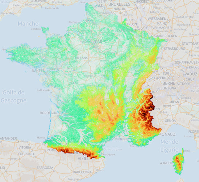
France : Courbes de niveau
Le produit « Courbes de niveau » est un modèle numérique de terrain sous forme de courbes de même altitude, appelées aussi « isoplèthes d’altitude », ou plus techniquement « isohypses ». Ces courbes permettent la description du relief français.
Simple
- Date (Creation)
- 2022-07-20
- Identifier
- 0f162230-02f5-49dc-9a48-0eabd0fd874b
- GEMET - INSPIRE themes, version 1.0
-
- Région
- Theme
-
- altimétrie
- niveau
- courbes
- Access constraints
- otherRestrictions Other restrictions
- Spatial representation type
- vector Vector
- Metadata language
- freFrançais
- Topic category
-
- imagerie-et-occupation-du-sol
- OnLine resource
- https://wxs.ign.fr/altimetrie/geoportail/r/wms?SERVICE=WMS&VERSION=1.3.0&REQUEST=GetCapabilities ( WWW:LINK-1.0-http--link )
- Hierarchy level
- dataset Dataset
- File identifier
- 0f162230-02f5-49dc-9a48-0eabd0fd874b XML
- Metadata language
- freFrançais
- Hierarchy level
- dataset Dataset
- Date stamp
- 2022-07-20
- Metadata standard name
- INSPIRE Metadata Implementing Rules
- Metadata standard version
- Technical Guidelines based on EN ISO 19115 and EN ISO 19119 (Version 1.2)