 Catalogue PIGMA
Sea level | Surface elevation annual mean (unspecified datum) of the water body | Permanent Service for Mean Sea Level | Permanent Service for Mean Sea Level
Simple
- Alternate title
- Permanent Service for Mean Sea Level
- Date
- Identifier
- Sea level | Surface elevation annual mean (unspecified datum) of the water body | Permanent Service for Mean Sea Level | Permanent Service for Mean Sea Level
- Purpose
- The Permanent Service for Mean Seal Level Rise
- Status
- onGoing On going
edmerp
Permanent Service for Mean Sea Level (PSMSL)
-
PSMSL
United Kingdom
www.psmsl.org/data/obtaining/complete.php
edmo
Permanent Service for Mean Sea Level
www.psmsl.org/data/obtaining/complete.php
Joseph Proudman Building
6 Brownlow Street
, Liverpool , L3 5DA , United Kingdom- Maintenance and update frequency
- Unknown
- Used by challenges
-
- Atlantic - CH10 - Bathymetry
- Environmental matrix
-
- Marine water
- Production mode
-
- Delayed
- Visibility
-
- Use of open search engines, searching by name either the data provider or the characteristics
- Policy visibility
-
- There is detailed information provided to understand data policy
- Readyness
-
- Format not proprietary and content clearly specified (e.g. autodescriptive like ODV, NetCDF CF) or at least with appropriate document describing the content
- Parameter Discovery Vocabulary (P02)
-
- Sea level
- GEMET - INSPIRE themes, version 1.0
-
- Elevation
- Processing level of characteristics
-
- High level analyzed
- Data delivery mechanisms
-
- Online downloading services
- Parameter Usage Vocabulary (P01)
-
- Surface elevation annual mean (unspecified datum) of the water body
- Agreed Parameter Groups (P03)
-
- Sea level
- Service extent
-
- The datasets are referenced in a public national catalogue, in an international catalogue service
- Validation
-
- Draft
- Access constraints
- Other restrictions
- Other constraints
- Unrestricted
- Use limitation
- Open and Free. No charge
- Spatial representation type
- vector Vector
- Metadata language
- Français
- Character set
- utf8 UTF8
- Topic category
-
- Oceans
- Environment description
- Mean sea level - analysis of water depth
N
S
E
W
))
- Begin date
- na
Vertical extent
- Minimum value
- na
- Maximum value
- na
- Dimension name
- Time
- Transformation parameter availability
- Yes
- Checkpoint Availability
- Yes
- Distribution format
-
-
PNG
()
-
Unclear
()
-
PNG
()
- OnLine resource
- www.psmsl.org/data/obtaining/complete.php ( WWW:LINK )
- OnLine resource
- www.psmsl.org/data/obtaining/complete.php ( WWW:LINK )
- Hierarchy level
- Dataset
Domain consistency
- Name of measure
- Responsiveness
Quantitative result
- Value
- Online downloading (i.e. a few hours or less) for release
Domain consistency
- Name of measure
- Reliability
Quantitative result
- Statement
- www.psmsl.org/data/obtaining/complete.php
- Attribute description
- observation
- Content type
- Physical measurement
- File identifier
- 27e41349-84da-43fe-bc24-34b2106d1612 XML
- Metadata language
- English
- Character set
- UTF8
- Hierarchy level
- Series
- Hierarchy level name
- Atlantic - CH10 - Bathymetry
- Date stamp
- 2018-03-23T14:08:15Z
- Metadata standard name
- ISO 19115-3 - Emodnet Checkpoint - Upstream Data
- Metadata standard version
- 1.0
Overviews
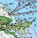
Spatial extent
N
S
E
W
Provided by

Associated resources
Not available