 Catalogue PIGMA
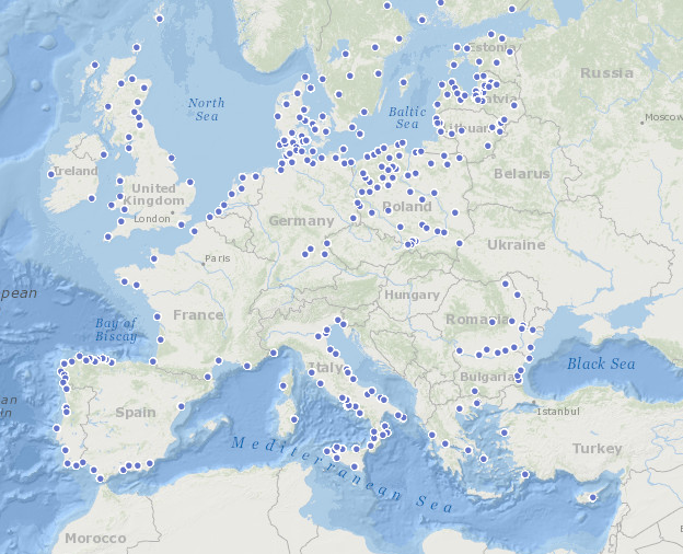
Fisheries Local Action Groups (FLAGs)
This map shows the different Fisheries Local Action Groups (FLAGs) mobilised by the implementation of Axis 4 of the European Fisheries Fund (EFF) to design and implement integrated local development strategies for the sustainable development of fisheries areas. The FARNET Support Unit acts as a platform for networking between fisheries areas and as support for the FLAGs.
Links to related websites are displayed when a FLAG is clicked.
Simple
- Date (Creation)
- 2011-01-01T00:00:00
- Identifier
- EUROSHELL_FLAGS_¨T
- Credit
- FARNET
- Status
- onGoing On going
Point of contact
European Commission - JRC - Institute for Environment and Sustainability - DERD Unit
- Maintenance and update frequency
- As needed
- Theme
-
- conchyliculture
- Installations agricoles et aquacoles
- clams
- mussels
- oysters
- shellfish production area
- GEMET - INSPIRE themes, version 1.0
-
- Agricultural and aquaculture facilities
- Thèmes Sextant
-
- /Human Activities/Marine cultures
- Access constraints
- Other restrictions
- Use constraints
- Copyright
- Other constraints
- Farnet copyright
- Spatial representation type
- vector Vector
- Metadata language
- English
- Character set
- utf8 UTF8
- Topic category
-
- Oceans
N
S
E
W
))
- Reference system identifier
- EPSG / WGS 84 (EPSG:4326) / 7.9
- Topology level
- Geometry only
- Geometric object type
- Point
- Distribution format
-
-
(
)
-
(
)
- OnLine resource
- EUROSHELL_FLAGS_PT ( OGC:WMS )
- OnLine resource
- European Atlas of the Sea website ( WWW:LINK )
- OnLine resource
- FARNET website ( WWW:LINK )
- Hierarchy level
- Dataset
Absolute external positional accuracy
Conformance result
- Date (Creation)
- 2012-01-16
- Explanation
- Non évalué
- Pass
- No
- Statement
- Data has been collected from the European Atlas of the Sea (MARATLAS : http://ec.europa.eu/maritimeaffairs/atlas/maritime_atlas )
Overviews
Spatial extent
N
S
E
W
Provided by

Associated resources
Not available