 Catalogue PIGMA
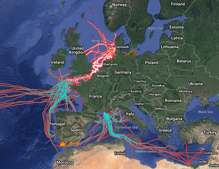
EMODnet Human Activities, Telecommunication and power cables, Actual Routes
Simple
- Date (Publication)
- 2015-01-15
- Date (Revision)
- 2021-01-26
- Date (Creation)
- 2014-12-22
- Identifier
- EMODnet_HA_Cables_20210126
- Credit
- European Marine Observation and Data Network
- GEMET - INSPIRE themes, version 1.0
-
- utilitiesCommunication
- Utility and governmental services
- Mission Atlantic - Resources
-
- Data
- Mission Atlantic - Case Studies
-
- Celtic Seas
- North Mid-Atlantic Ridge
- Mission Atlantic - Work Package
-
- WP3 Pelagic Mapping
- WP4 Benthic Mapping
- Mission Atlantic - BODC Parameters
-
- /Human activities/Cables
- Mission Atlantic - Data type (DMP)
-
- Spatial data products
- Use limitation
- Re-use of content for commercial or non-commercial purposes is permitted free of charge, provided that the sources (both EMODnet - Human Activities, and primary sources) are acknowledged. EMODnet - Human Activities accepts no responsibility or liability whatsoever for the re-use of content accessible on its website.
- Access constraints
- Other restrictions
- Other constraints
- no limitation
- Spatial representation type
- Vector
- Denominator
- 100000
- Metadata language
- EnglishEnglish
- Topic category
-
- Planning cadastre
- Utilities communication
))
- Reference system identifier
- EPSG:4326
- Reference system identifier
- ISO 19108 calendar
- Distribution format
-
-
ESRI Shapefile
(
1.0
)
-
ESRI Shapefile
(
1.0
)
- Transfer size
- 0
- OnLine resource
-
EMODnet Human Activities
(
WWW:LINK
)
EMODnet Human Activities aims to facilitate access to existing marine data on activities carried out in EU waters, by building a single entry point for geographic information on human uses of the ocean. The portal makes available information such as geographical position, spatial extent of a series of activities related to the sea, their temporal variation, time when data was provided, and attributes to indicate the intensity of each activity. The data are aggregated and presented so as to preserve personal privacy and commercially-sensitive information. The data also include a time interval so that historic as well as current activities can be included.
- Hierarchy level
- Dataset
Conformance result
- Date (Publication)
- 2008-12-04
- Explanation
- See the referenced specification
- Pass
- Yes
Conformance result
- Date (Publication)
- 2010-12-08
- Explanation
- See the referenced specification
Conformance result
- Date (Publication)
- 2009-12-15
- Explanation
- See the referenced specification
- Pass
- Yes
- Statement
- Data were retrived from 8 different sources. Validation and quality assurance remain up to the primary sources. Cogea simply retrieved the information available online, except for Maltese cables that have been edited ina shapefile using tabular data of coordinates submitted via EMODnet Data Ingestion portal by the International Ocean Institute-Malta Operational Centre (University Of Malta)/Physical Oceanography Unit.
Overviews
Spatial extent
Provided by
