 Catalogue PIGMA
Modélisations hydrodynamiques (MARS3D) pour la façade Méditerranée Nord-Ouest (F2 1200, 1200sn, 1200 v10)
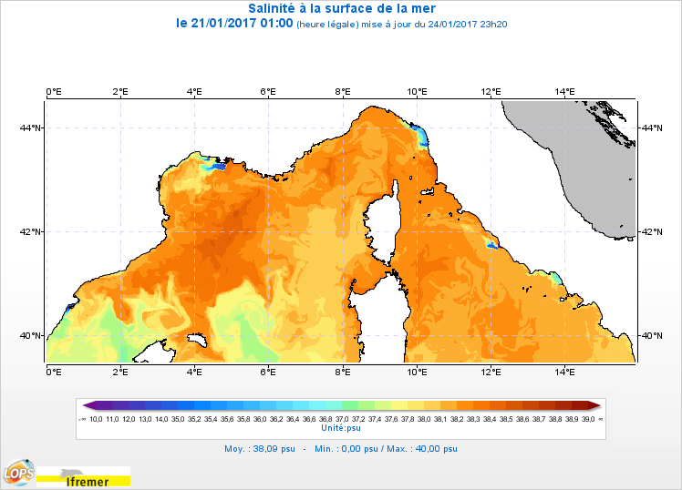
Le modèle hydrodynamique MARS3D sur la façade Méditerranée Nord-Ouest (MARC_F2-MARS3D-MENOR1200) est un modèle 3D de résolution spatiale 1,2 km sur 60 niveaux qui fournit les courants, niveaux de la mer, température et salinité toutes les 3 heures.
Chaque semaine, un mécanisme d'ajustement spectral (spectral nudging) de la température et de la salinité vers la solution à plus grande échelle est effectué sur la semaine passée. Cette technique permet d'éviter des écarts importants et irréalistes entre les champs de forçage du modèle de circulation générale et les champs du modèle régional aux échelles spatiales du GCM.
Simple
- Date (Creation)
- 2010-01-01
- Date (Publication)
- 2010-01-01
- Identifier
- FR-330-715-368-00032-IFR-F2-1200-ECOMARS3D-MANGA4000
- Credit
- MARC
02 98 22 48 64
- Maintenance and update frequency
- Weekly
- GEMET - INSPIRE themes, version 1.0
-
- Caractéristiques géographiques océanographiques
- Thèmes Sextant
-
- /Milieu physique/Hydrodynamique/Colonne d'eau
- Sous-regions marines
-
- /Métropole/Méditerranée occidentale
- Thématiques - SIMM
-
- /Etat du Milieu/Hydrodynamique
- Recherche
- ODATIS aggregation parameters and Essential Variable names
-
- Salinité
- Hauteur de la surface de la mer
- Température de la mer
- Courants
- Type de jeux de donnée ODATIS
-
- Données de simulation
- Use limitation
- Données sous Licence ouverte / Open licence : http://www.etalab.gouv.fr/pages/licence-ouverte-open-licence-5899923.html
- Access constraints
- Other restrictions
- Use constraints
- Copyright
- Spatial representation type
- grid Grid
- Metadata language
- Français
- Character set
- utf8 UTF8
- Topic category
-
- Oceans
))
- Begin date
- 2010-01-01
- Reference system identifier
- EPSG / WGS 84 (EPSG:4326) / 8.6
- Number of dimensions
- 2
- Dimension name
- Column
- Dimension size
- 1101
- Resolution
- 1.2 km
- Dimension name
- Row
- Dimension size
- 463
- Resolution
- 1.2 km
- Dimension name
- Vertical
- Dimension size
- 60
- Distribution format
-
-
(
)
-
(
)
- OnLine resource
-
SAL
(
OGC:WMS
)
MARC F2 1200sn - Sea water salinity
- OnLine resource
- /home/ref-marc/f2_1200_sn ( NETWORK:LINK )
- OnLine resource
- /home/ref-marc/f2_1200 ( NETWORK:LINK )
- OnLine resource
- /home/ref-marc/f2_1200_v10 ( NETWORK:LINK )
- OnLine resource
-
Lien vers une publication principale
(
WWW:LINK-1.0-http--publication-URL
)
MENOR: a high-resolution (1.2 km) modeling of the North-Western Mediterranean Sea routinely run by the PREVIMER operational forecast system
- OnLine resource
-
Lien vers une publication principale
(
WWW:LINK-1.0-http--publication-URL
)
DOWNSCALING FROM OCEANIC GLOBAL CIRCULATION MODEL TOWARDS REGIONAL AND COASTAL MODEL USING SPECTRAL NUDGING TECHNIQUES: APPLICATION TO THE MEDITERRANEAN SEA AND IBI AREA MODELS.
- OnLine resource
- Accès site MARC ( WWW:LINK )
- OnLine resource
- Formulaire d'accès à la donnée ( null )
- OnLine resource
- Téléchargement direct https ( WWW:DOWNLOAD )
- OnLine resource
-
TEMP
(
OGC:WMS
)
MARC F2 1200sn - Sea water temperature
- OnLine resource
-
XE
(
OGC:WMS
)
MARC F2 1200sn - Sea surface height
- OnLine resource
-
UZ
(
OGC:WMS
)
MARC F2 1200sn - Sea water velocity (x)
- OnLine resource
-
VZ
(
OGC:WMS
)
MARC F2 1200sn - Sea water velocity (y)
- OnLine resource
-
Opendap
(
WWW:DOWNLOAD
)
MARC F2 1200sn
- OnLine resource
-
SAL
(
OGC:WMS
)
MARC F2 1200 - Sea water salinity
- OnLine resource
-
TEMP
(
OGC:WMS
)
MARC F2 1200 - Sea water temperature
- OnLine resource
-
XE
(
OGC:WMS
)
MARC F2 1200 - Sea surface height
- OnLine resource
-
UZ
(
OGC:WMS
)
MARC F2 1200 - Sea water velocity (x)
- OnLine resource
-
VZ
(
OGC:WMS
)
MARC F2 1200 - Sea water velocity (y)
- OnLine resource
-
Opendap
(
WWW:DOWNLOAD
)
MARC F2 1200
- OnLine resource
- Digital Object Identifier (DOI) ( DOI )
- Hierarchy level
- Dataset
- Statement
-
Paramètres calculés :
Les paramètres calculés sont les suivants :
* XE : sea_surface_height_above_geoid (m)
* UZ : sea_water_x_velocity_at_u_location (m.s-1)
* VZ : sea_water_y_velocity_at_v_location (m.s-1)
* SAL : sea_water_salinity (PSU)
* TEMP : sea_water_potential_temperature (degree_celsius)
* TAUX : surface_downward_x_stress_at_u_location (N.m-2)
* TAUY : surface_downward_y_stress_at_v_location (N.m-2)
- File identifier
- aca0fac4-5104-43f3-9d0d-dbb892098e9b XML
- Metadata language
- Français
- Character set
- UTF8
- Hierarchy level
- Dataset
- Date stamp
- 2026-06-05T07:47:02.301837Z
- Metadata standard name
- ISO 19115-3 - SEXTANT
- Metadata standard version
- 1.0
02 98 22 46 44
02 98 22 48 64
Overviews
Spatial extent
Provided by
