 Catalogue PIGMA
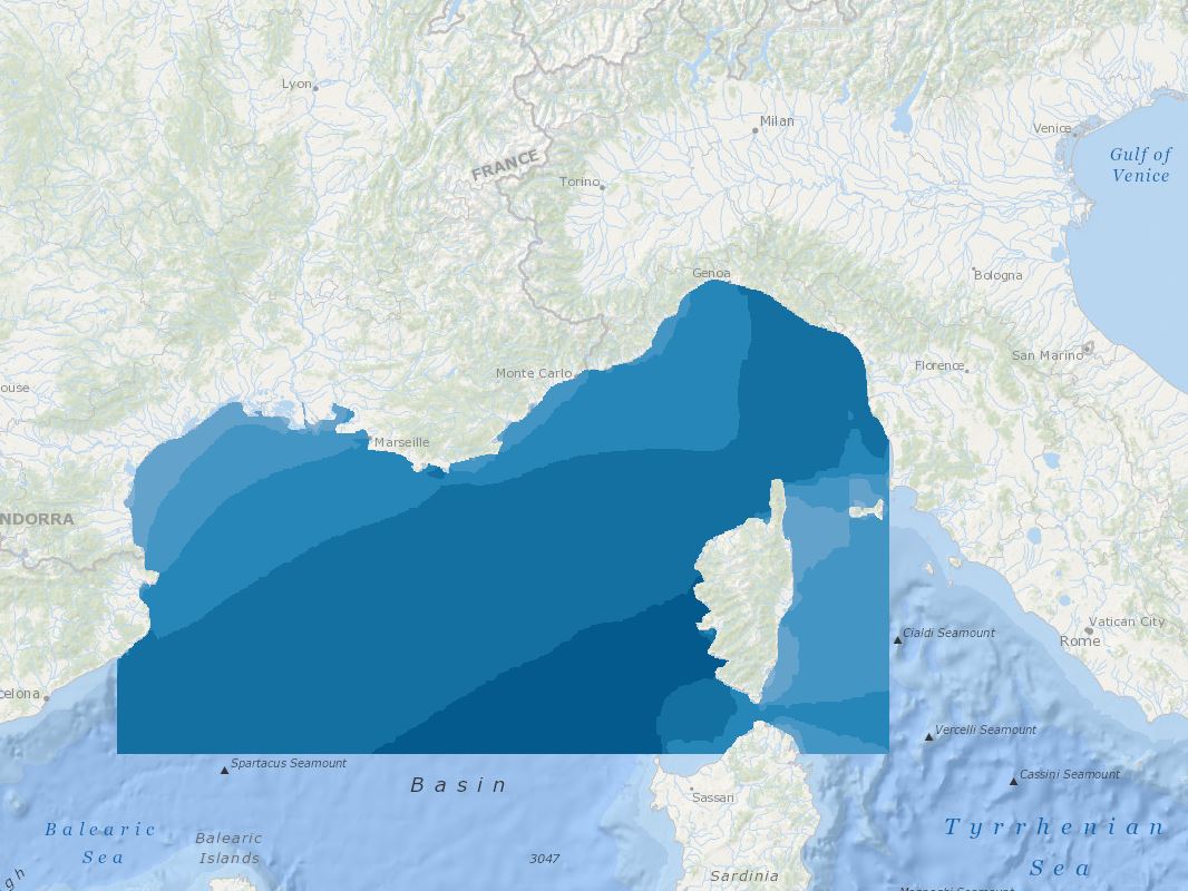
MEDSEA_CH1_Product_1 / Wind and wave data set from MARINA project
Today's normative and regulatory requirements to assess the producible energy from wind rely on in situ measurements (mast with anemometric sensors), which are extremely costly to Implement offshore. However, proof should be provided that hindcast model results are highly reliable, in order to provide an equivalent assessment. Very high resolution models is also the key issue in decision
making for a proper siting that is relaying on the consistency of all datasets provided in the assessment.
In this tender the products of the FP7 MARINA project will be used. 10-year (2001-2010) highresolution atmospheric, wave, tidal and ocean current simulations will be used. The model outputs are at high resolution (0.05x0.05 degree horizontal resolution, 1-hour time resolution, 5-vertical levels at 10,40,80,120,180 m). The wave parameters are co-located with the meteorological output fields.
Satellite altimetry data from ENVISAT and JASON satellites have been assimilated in the system. Other wind and wave satellite data sets will be also analyzed (Synthetic Aperture Radars-SAR for example). At the same co-located points the tidal and ocean current data together with bathymetry are available. For preselected points in the North Western Mediterranean (Spain-France-ltaly areas)
directional wave spectra data have been saved and are available. From SKIRON meteorological model available parameters are: WIND SPEED (m/s), WIND DIRECTION (deg), AIR PRESSURE (hPa), AIR DENSITY (Kgr/m3), TEMPERATURE (K), MODEL SEAMASK
From the wave model available parameters: SIGNIFICANT WAVE HEIGHT (m), MEAN WAVE DIRECTION (deg), WAVE MEAN PERIOD (s), PEAK WAVE PRERIOD (s), SWELL WAVE HEIGHT (m), MEAN SWELL PERIOD (s), MEAN DIRECTIONAL SPREAD, WINDSEA MEAN DIRECTIONAL SPREAD, SWELL MEAN DIRECTIONAL SPREAD, MAXIMUM WAVE HEIGHT (m)
Simple
- Date (Creation)
- 2016-11-21
- Identifier
- DOI:10.12770/c669abf9-31a3-40d0-9954-3e8a31f2bf73
- Issue identification
- MEDSEA D2.3.5
- Purpose
- Support the evaluation of the suitability of sites for wind farm development in particular: o on border between Spanish and French waters o on border between French and Italian waters
- Credit
- EMODnet Medsea Checkpoint
- Used by challenges
-
- MedSea - CH01 - Windfarm Siting
- Processing level of characteristics
-
- Forecast/Hindcast
- Production mode
-
- Delayed
- GEMET - INSPIRE themes, version 1.0
-
- Atmospheric conditions
- Theme
-
- Offshore wind energy
- Wind energy site assessment
- Numerical Atmospheric Modeling
- Use limitation
-
This EMODnet MedSea Checkpoint data product is the result of a stress test so called “challenge” specified by the call for tenders No MARE/2012/11 to determine how well the input data from the observing and monitoring systems existing at the sea basin scale fit the user requirements stated by the “challenge” partners to develop it (Data Product Specifications).
The information contained in the data products and in the descriptions (metadata) of the input data and of the data products making use of them is believed to be trustworthy. However its completeness, consistency, accuracy and usability cannot be guaranteed.
Whilst every effort has been made to ensure its reliability within the limits of present knowledge, no responsibility can be accepted by those involved in its compilation or publication for any consequential loss or damage arising from its use.
For further information, refer to the Second Data Adequacy Report available on the EMODnet Medsea Checkpoint portal at http://www.emodnet-mediterranean.eu/reports_news/
- Access constraints
- Copyright
- Use constraints
- Intellectual property rights
- Aggregate Datasetindentifier
- db4dcd80-1169-450a-a4e8-eae2b839b5ee
- Association Type
- Cross reference
- Initiative Type
- specification
- Aggregate Datasetindentifier
- e97a2074-0902-4e5d-a0d9-57458df80671
- Association Type
- Cross reference
- Initiative Type
- upstreamData
- Aggregate Datasetindentifier
- 4e04ad5e-219e-4c54-90a5-7698057c43b2
- Association Type
- Cross reference
- Initiative Type
- upstreamData
- Aggregate Datasetindentifier
- 83f2d145-669c-4713-af98-c1f3e78e079a
- Association Type
- Cross reference
- Initiative Type
- upstreamData
- Aggregate Datasetindentifier
- 3a8d490b-883e-45ca-a0bf-a7ef542b31e9
- Association Type
- Cross reference
- Initiative Type
- upstreamData
- Spatial representation type
- grid Grid
- Metadata language
- English
- Character set
- utf8 UTF8
- Topic category
-
- Oceans
))
- Begin date
- 2001-01-01T00:00:00
- End date
- 2010-12-31T23:00:00 After
Vertical extent
- Minimum value
- -186
- Maximum value
- 0
Reference System Information
- Distribution format
-
-
Ascii
()
-
Ascii
()
- OnLine resource
-
DOI of the product
(
DOI
)
DOI of the product
- OnLine resource
-
CH1_product_1
(
OGC:OWS-C
)
Product visualization
- OnLine resource
- Access to the website ( WWW:LINK )
- Hierarchy level
- datasetComponent
- Begin date
- 2001-01-01T00:00:00
- End date
- 2010-12-31 Now
Vertical extent
- Minimum value
- -180
- Maximum value
- 0
- Other
- MEDSEA_CH1_Product_1
- Other
- 10 year high spatial and temporal resolution wind wave hindcast data
- Other
- Air|Wind speed and direction|Eastward wind velocity in the atmosphere|Forecast/Hindcast|Delayed
- Other
- Air|Wind strength and direction|Northward wind velocity in the atmosphere|Forecast/Hindcast|Delayed
- Other
- Air|Air pressure|Pressure (measured variable) exerted by the atmosphere|Forecast/Hindcast|Delayed
- Other
- Marine water|Wave height and period statistics||Forecast/Hindcast|Delayed
Completeness omission
- Name of measure
- Horizontal Spatial Coverage
- Measure identification
- AP.1.1
- Measure description
- Horizontal coverage extent of product (eg : surface of the Mediterranean Sea)
Quantitative result
- Value type
- Real
- Value
- 257526.36
Completeness omission
- Name of measure
- Vertical Spatial Coverage
- Measure identification
- AP.1.2
- Measure description
- Vertical coverage extent of product
Quantitative result
- Value type
- Real
- Value
- 180
Completeness omission
- Name of measure
- Temporal Coverage
- Measure identification
- AP.1.3
- Measure description
- Temporal coverage extent of product
Quantitative result
- Value type
- Integer
- Value
- 3652
Conceptual consistency
- Name of measure
- Number of Characteristics
- Measure identification
- AP.2.1
- Measure description
- Number of characteristics in product
Quantitative result
- Value type
- Integer
- Value
- 4
Thematic classification correctness
- Name of measure
- Horizontal resolution
- Measure identification
- AP.3.1
- Measure description
- Horizontal mesh size or equivalent value for the given scale of product (eg 50m for 1/50 000)
Quantitative result
- Value type
- Integer
- Value
- 5000
Thematic classification correctness
- Name of measure
- Vertical resolution
- Measure identification
- AP.3.2
- Measure description
- Average vertical sampling
Quantitative result
- Value type
- Real
- Value
- 40
gmd:DQ_DescriptiveResult
- Date / Time
- 2016-11-21T00:00:00
- Statement
- 0, 10, 40, 80, 120, 180
Thematic classification correctness
- Name of measure
- Temporal resolution
- Measure identification
- AP.3.3
- Measure description
- Temporal sampling interval of product
Quantitative result
- Value type
- Real
- Value
- 0.042
Quantitative attribute accuracy
- Name of measure
- Thematic accuracy
- Measure identification
- AP.3.4
- Measure description
- Percentage error of the product and description of error concept for the product (100 words max) provided by expert
Quantitative result
- Value type
- Percentage
- Value
- 10
Temporal validity
- Name of measure
- Temporal validity
- Measure identification
- AP.4.1
- Measure description
- Max elapsed time between last input data records update and product creation date
Quantitative result
- Value type
- Integer
- Value
- 1095
Completeness omission
- Name of measure
- Horizontal spatial coverage error
- Measure identification
- P.APE.1.1
- Measure description
-
Percentage to which the extent of the horizontal
spatial coverage of TPD is not compliant with the DPS extent in km**2(TDP_AP_1_1 - DPS_AP_1_1)*100/DPS_AP_1_1
Quantitative result
- Value type
- Percentage
- Value
- 0
Completeness omission
- Name of measure
- Vertical spatial coverage error
- Measure identification
- P.APE.1.2
- Measure description
-
Percentage to which the extent of the vertical spatial coverage of TPD is not compliant with the DPS extent in
metres.(TDP_AP_1_2 - DPS_AP_1_2)*100/DPS_AP_1_2
Quantitative result
- Value type
- Percentage
- Value
- 0
Completeness omission
- Name of measure
- Temporal coverage error
- Measure identification
- P.APE.1.3
- Measure description
-
Percentage to which the extent of the temporal coverage of TPD is not compliant with the DPS extent in
days.(TDP_AP_1_3 - DPS_AP_1_3)*100/DPS_AP_1_3
Quantitative result
- Value type
- Percentage
- Value
- 0
Conceptual consistency
- Name of measure
- Thematic content error
- Measure identification
- P.APE.2.1
- Measure description
-
Percentage
of completeness/Incompleteness of the number of characteristcs with respect to the list in DPS(TDP_AP_2_1 - DPS_AP_2_1)*100/DPS_AP_2_1
Quantitative result
- Value type
- Percentage
- Value
- 0
Thematic classification correctness
- Name of measure
- Horizontal resolution error
- Measure identification
- P.APE.3.1
- Measure description
-
Percentage to which the product averaged horizontal mesh size or horizontal scale is not compliant with the DPS
averaged mesh size or horizontal scale(DPS_AP_3_1 - TDP_AP_3_1)*100/DPS_AP_3_1
Quantitative result
- Value type
- Percentage
- Value
- 0
Thematic classification correctness
- Name of measure
- Vertical resolution error
- Measure identification
- P.APE.3.2
- Measure description
-
Percentage to which the product averaged vertical mesh size or vertical scale is not compliant with the DPS
averaged mesh size or vertical scale(DPS_AP_3_2 - TDP_AP_3_2)*100/DPS_AP_3_2
Quantitative result
- Value type
- Percentage
- Value
- 0
Thematic classification correctness
- Name of measure
- Temporal sampling interval error
- Measure identification
- P.APE.3.3
- Measure description
-
Percentage to which the product temporal sampling interval is not compliant with the one defined in DPS
(percentage to be extracted from text of AP.3.3 measure)(DPS_AP_3_3 - TDP_AP_3_3)*100/DPS_AP_3_3
Quantitative result
- Value type
- Percentage
- Value
- 0
Quantitative attribute accuracy
- Name of measure
- Thematic accuracy errror
- Measure identification
- P.APE.3.4
- Measure description
-
Compliance with the value domain of
the accuracy defined in DPS (% extracted from thematic accuracy description)TDP_AP_3_4
Quantitative result
- Value type
- Percentage
- Value
- 10
Temporal validity
- Name of measure
- Temporal validity error
- Measure identification
- P.APE.4.1
- Measure description
-
Percentage to which the elapsed time of the product is not compliant with the max elapsed time specified in
DPS.(DPS_AP_4_1 - TDP_AP_4_1)*100/DPS_AP_4_1
Quantitative result
- Value type
- Percentage
- Value
- 0
- File identifier
- c669abf9-31a3-40d0-9954-3e8a31f2bf73 XML
- Metadata language
- English
- Character set
- UTF8
- Hierarchy level
- Dataset
- Date stamp
- 2025-01-28T09:10:39.469082Z
- Metadata standard name
- ISO 19115-3 - Emodnet Checkpoint - Targeted Data Product
Overviews
Spatial extent
Provided by
