 Catalogue PIGMA
France Energies Marines
Type of resources
Available actions
Topics
Keywords
Contact for the resource
Provided by
Formats
status
-
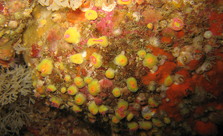
The main objective of this atlas is to summarise the knowledge acquired on biofouling, and more generally on communities of living organisms on hard substrates, available today in mainland France and the French overseas territories, in order to anticipate the issues that this phenomenon will pose in an ORE context. The atlas is based on the most exhaustive bibliographical analysis possible, including A-level scientific articles, reports (training courses, monitoring, studies), and works presenting the results of studies conducted in French waters
-

Current measurements on the water column (11 ADCP) and punctual near the bottom (5 ADV) at Raz Blanchard.
-

As part of the FEM THYMOTE and PHYSIC projects, which combined measurements and numerical development to obtain high-resolution information on the turbulent flows of tidal stream sites, current measurement campaigns were carried out at the end of 2017 in the Raz Blanchard.