 Catalogue PIGMA
Type of resources
Available actions
Topics
Keywords
Contact for the resource
Provided by
Years
Formats
Representation types
status
Scale
-
Auteur(s): Darteyron Bernard , Projet d'un centre de thermalisme en milieu rural dans le département des Landes sur quatre communes voisines de Dax
-
Auteur(s): Faux Michel , Projet pour un nouveau jardin et centre d'informations botaniques à Bordeaux-Lac
-
Auteur(s): Bonneau Lila , Projet d'un ensemble de bâtiments sur une exploitation viticole, comprenant des locaux techniques liés au travail du vin et des éléments dédiés à la mise en valeur de vestiges archéologiques présents sur le site. L'auteur s'appuie sur une analyse sensible de l'esprit du lieu, avec la double empreinte d'un patrimoine et d'un terroir. Photogr., images de synthèse, cartes, plans, coupes, élévations
-
Auteur(s): Botella Nadine , Historique des bains dans le monde grec, romain, oriental. Projet d'un ensemble balnéo-culturel à l'intérieur d'une carrière souterraine, à Saint-Genès-de-Castillon : problèmes de sécurité et programme.
-
Auteur(s): Aubert Amaya , Comment envisager à Anglet (Pyrénées-Atlantiques) la réalisation d'un concept universitaire et technologique respectueux du donné naturel (les Landes de Juzan) et vecteur de qualité pour l'agglomération aussi bien que pour les quartiers avoisinants ? Le projet proposé par l'auteur, en réponse à cette problématique, fait suite à une double réflexion : sur les caractéristiques du territoire concerné et les contraintes locales d'une part, et sur la question de l'aménagement universitaire et de son rapport à l'urbanisme et à l'environnement, d'autre part.
-
Auteur(s): Perrin Martine , Installation d'un parcours éphémère d'animation artistique.
-
Auteur(s): Grossin Eric - Piquet Patricia, Historique du développement urbain de Bayonne. Projet d'un nouveau pont et de l'aménagement des berges de l'Adour en vue d'exploiter le potentiel fluvial.
-
Auteur(s): Morel Hélène , Projet de reconversion de la grande halle en béton des anciens abattoirs de Bordeaux (quai de Paludate) en espace à dédié à la culture et aux loisirs
-
Auteur(s): Faure Dominique , Projet de logements semi-communautaires à Périgueux.
-
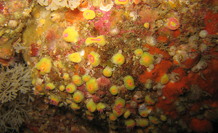
The main objective of this atlas is to summarise the knowledge acquired on biofouling, and more generally on communities of living organisms on hard substrates, available today in mainland France and the French overseas territories, in order to anticipate the issues that this phenomenon will pose in an ORE context. The atlas is based on the most exhaustive bibliographical analysis possible, including A-level scientific articles, reports (training courses, monitoring, studies), and works presenting the results of studies conducted in French waters