 Catalogue PIGMA
Yermak Plateau
Type of resources
Available actions
Topics
Keywords
Contact for the resource
Provided by
Years
Formats
-
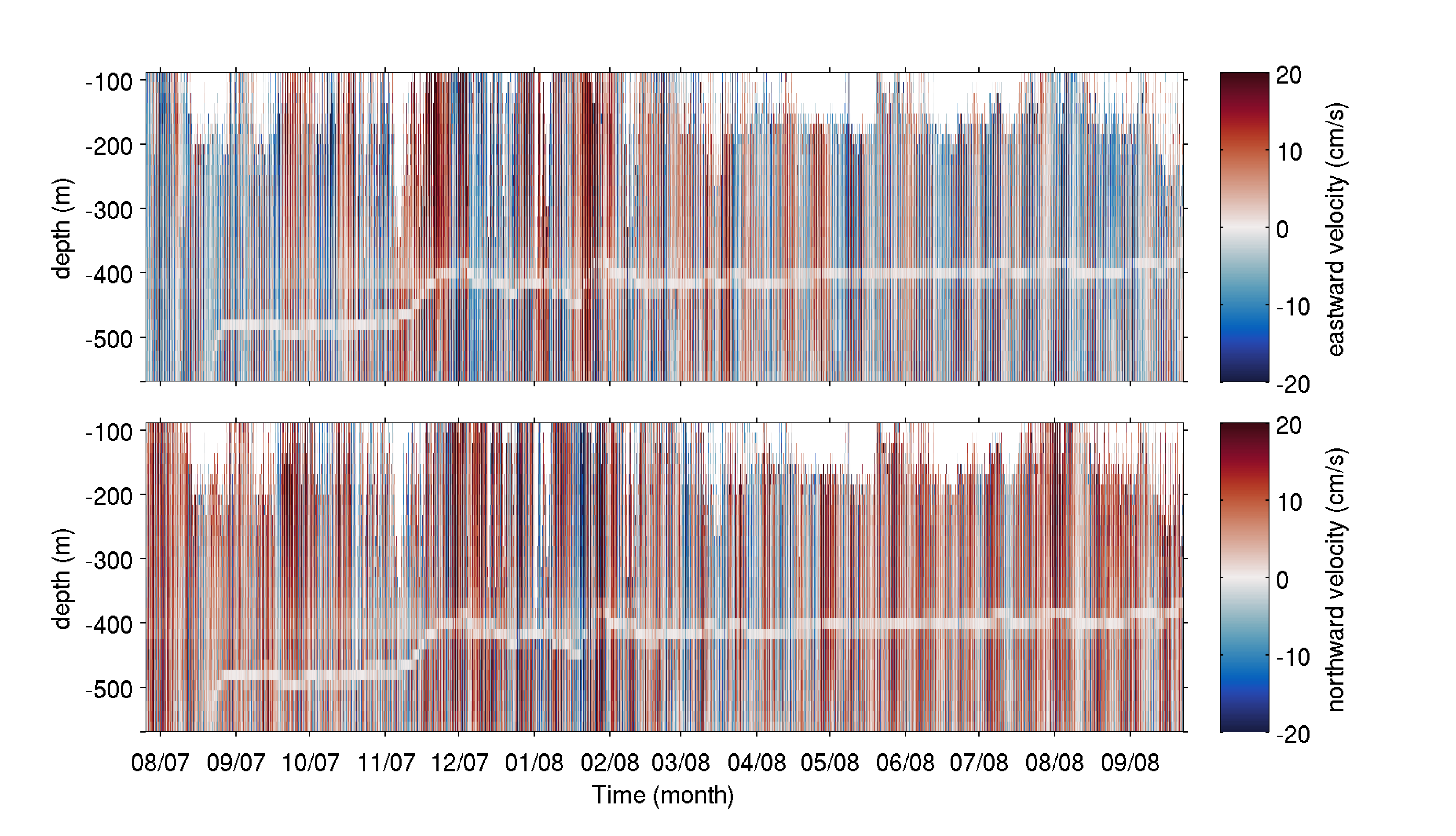
The mooring was deployed on 25 July 2007 from the R/V Haakon Mosby at 80.601°N, 7.119°E (depth of 745 m) in the Yermak Pass over the Yermak Plateau north of Svalbard. It comprised an upward-looking RDI 75kHz Long Ranger Acoustic Doppler Current Profiler (ADCP) at 585 m with 16 m vertical resolution and a 1hour sampling time, and an ocean profiler on a taut cable between 130 and 530 m. The mooring was recovered on 23 September 2008 by the K/V Svalbard. The dataset is composed of the raw data from the ADCP, after declination correction. A white shaded zone is visible in the data between 380 and 500 m depth throughout the time series. It corresponds to the reflection of the acoustic bins on the profiler stuck on the cable.
-
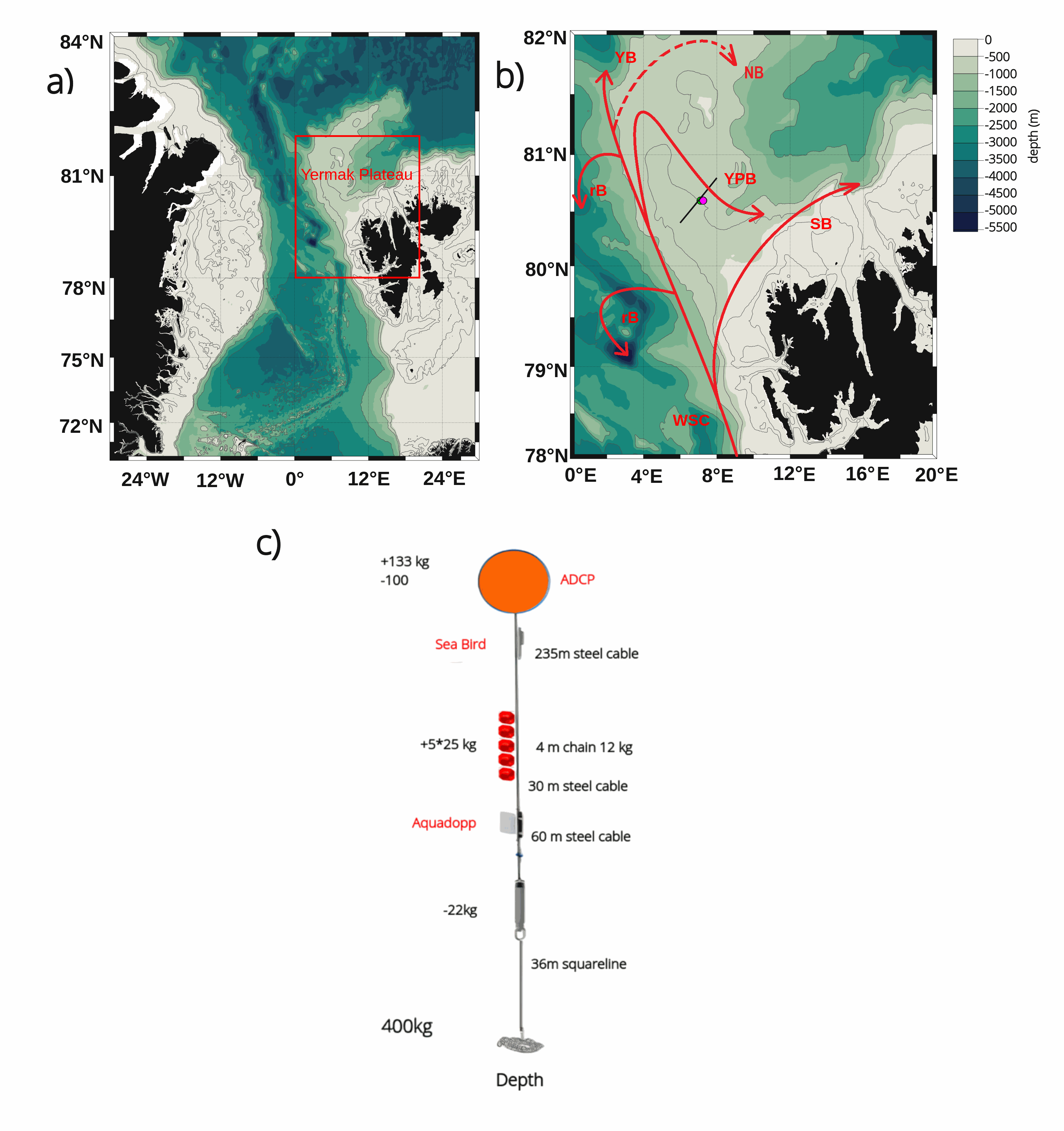
The mooring was deployed on 15 September 2017 from Norwegian Research Vessel Lance at 80.6°N and 7.26°E (depth of 730 m) in the Yermak Pass over the Yermak Plateau north of Svalbard. It comprised 3 instruments: an upward-looking RDI 75kHz, a Long Ranger Acoustic Doppler Current Profiler (ADCP) at 340 m with 16 m vertical resolution (25 bins of 16 m each) and a 2-hour sampling time; a Seabird SBE37 measuring temperature, salinity and pressure at 348 m with 10-minute sampling time; and an Aquadopp current meter at 645 m with a 2-hour sampling time. The mooring was retrieved on the 19 July 2020 by Norwegian Icebreaker K.V. Svalbard. The present dataset features: (i) the ADCP 50-hour smoothed daily velocities, conservative temperature and pressure time series interpolated every 10 meters within the 20-330m layer, (ii) the Aquadopp 50-hour smoothed daily velocities and pressure time series at 645 m; and (iii) the SBE37 50-hour smoothed daily conservative temperature, absolute salinity and pressure time series at 348 m.