 Catalogue PIGMA
denominator
2400000
Type of resources
Available actions
Topics
Provided by
Years
Representation types
Update frequencies
status
Scale
From
1
-
1
/
1
-
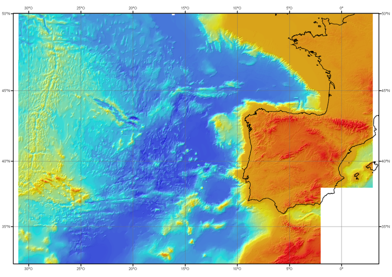
Pour ce produit consulter les données plus récentes du projet EMODnet Bathymetry : https://emodnet.ec.europa.eu/en/bathymetry. Modèle bathymétrique régional (MNT) de l'Atlantique Nord-Est, générée à partir de données conventionnelles de bathymétrie multifaisceaux, antérieures à l'année 2000. Le pas de la grille est de 1000 mètres. Référence bibliographique : Sibuet J.C. & al., (2004) - Carte bathymétrique de l'Atlantique nord-est et du golfe de Gascogne : implications cinématiques. Bull. Soc. géol. Fr.T. 175, n°5, pp. 429-442