 Catalogue PIGMA
Netcdf
Type of resources
Available actions
Topics
Provided by
Years
Formats
Representation types
-
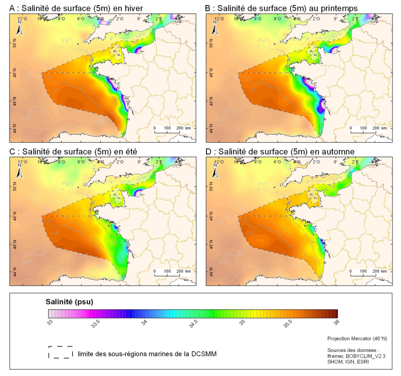
Champ de salinité (en Psu) saisonnié 3D obtenu par analyse objective (interpolation) de la donnée brute in situ à 5 m de profondeur. Dans le cadre du Défi Golfe de Gascogne et du programme d'Océanographie Côtière Operationnelle Prévimer, les services SISMER et DYNECO-PHYSED de l'IFREMER ont constitué une base de données hydrologiques unique du Golfe de Gascogne, à partir de mesures CTD, Bouteilles, XBT/ MBT et Profileurs provenant de plusieurs centres de données mondiaux, afin de réaliser un atlas climatologique de la région en température et salinité.
-
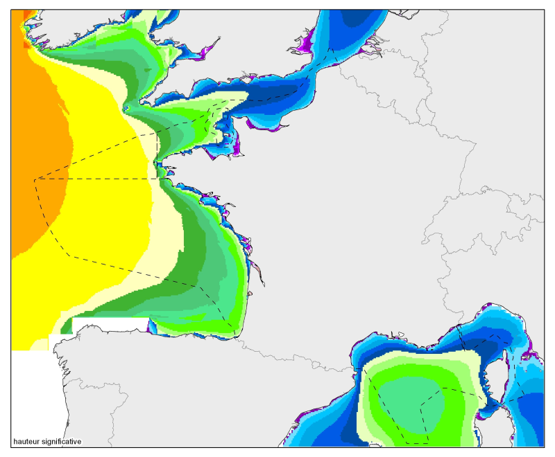
Moyennes, percentile 90 et percentile 99 des hauteurs significatives et des agitations significatives. De la Mer du Nord à la mer Méditerranée, à une résolution de 2 minutes.
-
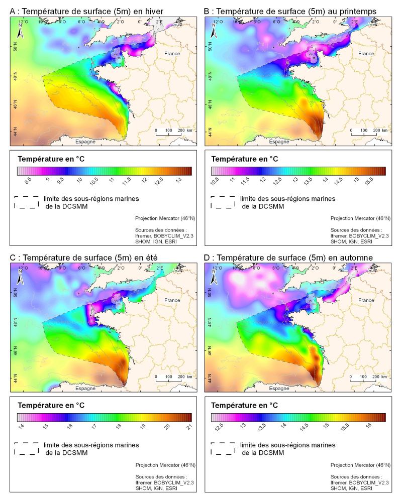
Champ de température de surface (en °C) saisonnié 3D obtenu par analyse objective (interpolation) de la donnée brute in situ, à 5 m de profondeur. Dans le cadre du Défi Golfe de Gascogne et du programme d'Océanographie Côtière Operationnelle Prévimer, les services SISMER et DYNECO-PHYSED de l'IFREMER ont constitué une base de données hydrologiques unique du Golfe de Gascogne, à partir de mesures CTD, Bouteilles, XBT/ MBT et Profileurs provenant de plusieurs centres de données mondiaux, afin de réaliser un atlas climatologique de la région en température et salinité.
-
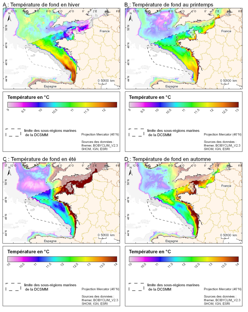
Champ de température (en °C) saisonnié 3D obtenu par analyse objective (interpolation) de la donnée brute in situ, à proximité du fond. Dans le cadre du Défi Golfe de Gascogne et du programme d'Océanographie Côtière Operationnelle Prévimer, les services SISMER et DYNECO-PHYSED de l'IFREMER ont constitué une base de données hydrologiques unique du Golfe de Gascogne, à partir de mesures CTD, Bouteilles, XBT/ MBT et Profileurs provenant de plusieurs centres de données mondiaux, afin de réaliser un atlas climatologique de la région en température et salinité.
-
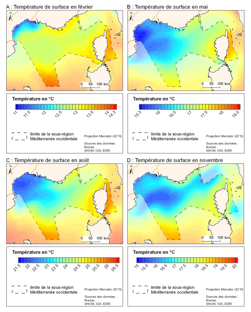
La résolution spatiale de la climatologie satellitale permet une description plus fine des variations spatio-temporelles de la température de surface dans cette partie nord du bassin occidental. Il existe pour la température de surface des climatologies basées sur la mesure infrarouge par satellites qui proposent une résolution spatiale de l'ordre du kilomètre.
-
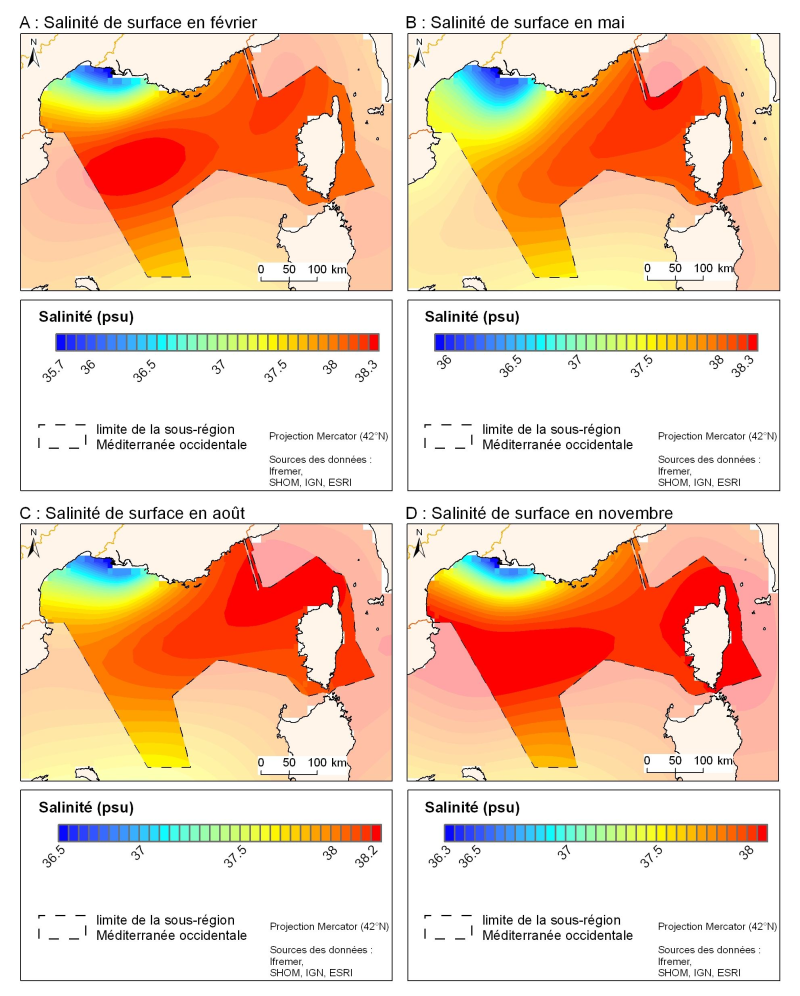
Construite à partir de données historiques, la climatologie MEDAR/MEDATLAS propose pour la Méditerranée des champs de salinité d'une résolution horizontale de l'ordre de 20 kilomètres, avec toutefois des zooms mieux résolus comme pour le Golfe du Lion et la Mer Ligure.