 Catalogue PIGMA
INGV
Type of resources
Available actions
Topics
Keywords
Contact for the resource
Provided by
Years
Formats
Representation types
-
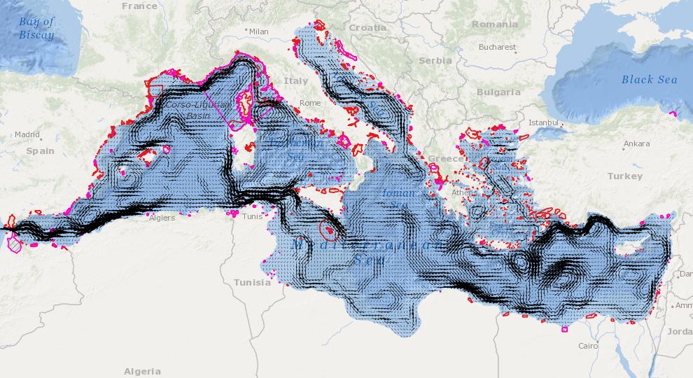
In order to assess the connectivity oceanographic data will be used. A shape map will be created combining data on MPAs adequacy and distribution of MPAs and temperature, currents seasonal GIS layers (The temperature and currents are INGV climatological products made available to CH2.
-
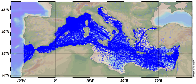
SDC_MED_DATA_TS_V1 SeaDataCloud Temperature and Salinity data collection for the Mediterranean Sea contains all open access temperature and salinity in situ data retrieved from SeaDataNet infrastructure at the end of October 2017. The data span between -9.25 and 37 degrees of longitude, thus including an Atlantic box and the Marmara Sea. It covers the time period 1900-2017. Data have been quality checked using ODV 5.0 software. Quality Flags of anomalous data have been revised using basic QC procedures. The dataset format is ODV binary collections. You can read, analyse and export from the ODV application provided by Alfred Wegener institute at http://odv.awi.de/. For data access please register at http://www.marine-id.org/.
-
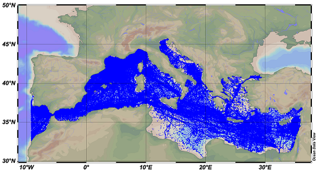
SDC_MED_DATA_TS_V2 SeaDataCloud Temperature and Salinity data collection for the Mediterranean Sea contains all open access temperature and salinity in situ data retrieved from SeaDataNet infrastructure at the end of July 2019. The data span between -9.25 and 37 degrees of longitude, thus including an Atlantic box and the Marmara Sea. It covers the time period 1900-2019. Data have been quality checked using ODV 5.3.2 software. Quality Flags of anomalous data have been revised using basic QC procedures. The dataset format is ODV binary collections. You can read, analyse and export from the ODV application provided by Alfred Wegener institute at http://odv.awi.de/. For data access please register at http://www.marine-id.org/.