 Catalogue PIGMA
Ocean currents
Type of resources
Topics
Keywords
Contact for the resource
Provided by
Years
Formats
Representation types
status
Resolution
-
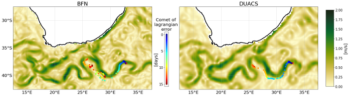
This dataset provides Level 4 total current including geostrophy and a data-driven approach for Ekman and near-inertial current, based on a convolution between drifter observation and wind history, to fit empirically a complex and time-lag dependant transfert function between ERA5 wind stress and current The data are available through HTTP and FTP; access to the data is free and open. In order to be informed about changes and to help us keep track of data usage, we encourage users to register at: https://forms.ifremer.fr/lops-siam/access-to-esa-world-ocean-circulation-project-data/ This dataset was generated by Datlas and is distributed by Ifremer / CERSAT in the frame of the World Ocean Circulation (WOC) project funded by the European Space Agency (ESA).
-
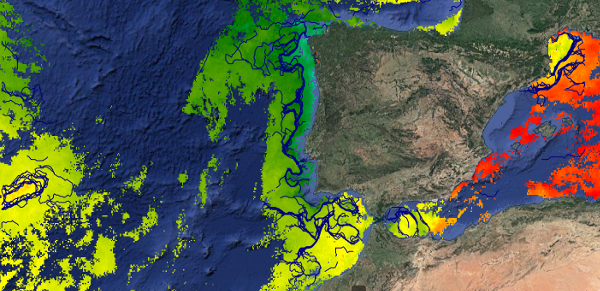
This dataset provides detections of fronts derived from high resolution remote sensing SST observations by SEVIRI L3C from OSISAF over Western Europe region. The data are available through HTTP and FTP; access to the data is free and open. In order to be informed about changes and to help us keep track of data usage, we encourage users to register at: https://forms.ifremer.fr/lops-siam/access-to-esa-world-ocean-circulation-project-data/ This dataset was generated by OceanDataLab and is distributed by Ifremer / CERSAT in the frame of the World Ocean Circulation (WOC) project funded by the European Space Agency (ESA).
-
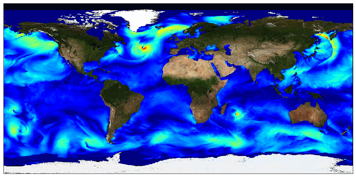
This dataset provides surface Stokes drift as retrieved from the wave energy spectrum computed by the spectral wave model WAVEWATCH-III (r), under NOAA license, discretized in wave numbers and directions and the water depth at each location. It is estimated at the sea surface and expressed in m.s-1. WAVEWATCH-III (r) model solves the random phase spectral action density balance equation for wavenumber-direction spectra. Please refer to the WAVEWATCH-III User Manual for fully detailed description of the wave model equations and numerical approaches. The data are available through HTTP and FTP; access to the data is free and open. In order to be informed about changes and to help us keep track of data usage, we encourage users to register at: https://forms.ifremer.fr/lops-siam/access-to-esa-world-ocean-circulation-project-data/ This dataset was generated by Ifremer / LOPS and is distributed by Ifremer / CERSAT in the frame of the World Ocean Circulation (WOC) project funded by the European Space Agency (ESA).
-

This dataset contains the high-frequency total horizontal current at 15m depth on a global grid at 1/4° resolution. It is composed by the addition of two components, the first is the Geostrophic current derived by Altimetry, from the DT-2018 CMEMS database, and the second is the unsteady-Ekman ageostrophic component forced by the wind. All the details about the algorithm and the physical content of this ageostrophy component are given in the ATBD. The data are available through HTTP and FTP; access to the data is free and open. This dataset was generated by Datlas Ocean and is distributed by Ifremer / CERSAT in the frame of the World Ocean Circulation (WOC) project funded by the European Space Agency (ESA).
-
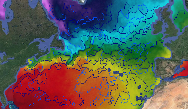
This dataset provides detections of fronts derived from low resolution optimally interpolated remote sensing microwave SST L4 from REMSS over North Atlantic region. The data are available through HTTP and FTP; access to the data is free and open. In order to be informed about changes and to help us keep track of data usage, we encourage users to register at: https://forms.ifremer.fr/lops-siam/access-to-esa-world-ocean-circulation-project-data/ This dataset was generated by OceanDataLab and is distributed by Ifremer / CERSAT in the frame of the World Ocean Circulation (WOC) project funded by the European Space Agency (ESA).
-

Operational altimetry processing traditionally relies on a “frozen sea” assumption, neglecting the influence of ocean dynamics on Doppler frequencies and introducing biases in estimated sea-state parameters. This dataset is based on an advanced SAR (Delay-Doppler) processing approach that overcomes this limitation by explicitly accounting for ocean surface dynamics. The methodology incorporates enhanced SAR models that jointly retrieve the standard deviation of vertical wave orbital velocities and the along-track component of the geophysical Doppler vector. These quantities are estimated through full two-dimensional retracking of unfocused SAR Delay-Doppler maps (stacks), rather than through the conventional summed Doppler beam approach used in operational processing. The processing has been implemented within the Sentinel Processing Prototype (SPP), leading to the generation of two six-month Sentinel-6A (S6A) data series covering January–June 2022 and January–June 2024. Validation results show that the dataset is fully consistent with conventional altimetry products in terms of sea surface height (SSH) and significant wave height (SWH), while providing reduced noise levels and improved along-track resolution. Key added-value parameters and improvements include: • Vertical wave velocity statistics: The dataset characterizes azimuth smearing induced by vertical wave motion, enabling the retrieval of the standard deviation of vertical wave velocity. This parameter is directly related to the mean zero up-crossing wave period and refines the estimation of sea-state conditions. Its inclusion reduces sea-state-dependent biases in SWH and shows strong agreement with ERA5 wave model outputs without requiring external corrections. • Geophysical Doppler contribution: The along-track component of the geophysical Doppler vector is estimated, providing information linked to wind direction and intensity, as well as surface currents (including contributions such as Stokes drift). Accounting for this term significantly reduces wind-dependent SSH biases, particularly between ascending and descending passes, while preserving large-scale spectral content. This dataset constitutes a demonstration product designed for the scientific community, showcasing the potential of advanced SAR retracking techniques. It delivers enhanced-resolution altimetry measurements together with improved SSH and SWH estimates, wave-period-related diagnostics derived from vertical velocity, and geophysical Doppler information. These features open new perspectives for coastal ocean applications, surface current studies, and swell characterization.