CDS-AVISO
Type of resources
Available actions
Topics
Keywords
Contact for the resource
Provided by
Years
Formats
Representation types
status
Scale
Resolution
-

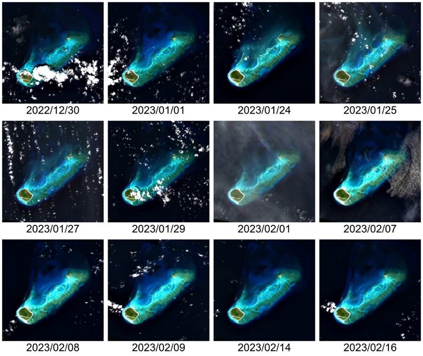
This Level 2 product provides marine reflectances from the VENµS mission, processed with the Polymer algorithm, on a subset of sites with coastal or inland areas. VENµS (Vegetation and Environment monitoring on a New Micro-Satellite) is a Franco-Israeli satellite launched in 2017, dedicated to the fine and regular monitoring of terrestrial vegetation, in particular cultivated areas, forests, protected natural areas, etc. The images acquired in 12 spectral bands by a camera provided by CNES, on a selection of about one hundred scientific sites spread over the planet, are of high spatial (5 m) and temporal resolution. The lifetime of the VENµS satellite has been divided into two phases: a first phase VM1 at an altitude of 720 km with a 2-day revisit, a native spatial resolution of 5.3 m and a swath of 27.6 km from August 2017 to November 2020, and a second phase VM5 at an altitude of 560 km with a daily revisit, a native spatial resolution of 4.1 m and a swath of 21.3 km from March 2022 to July 2024. VENµS is the first sensor on board an orbiting satellite to combine such revisit frequency and spatial finesse for vegetation monitoring. A subset of sites with coastal areas or inland waters have been identified to generate Level 2 data dedicated to marine reflectance. The geographical areas covered are given through a kmz file, see below to download it. This Level 2 data product has been processed using the Polymer algorithm developed by Hygeos (https://hygeos.com/en/polymer/) and provides marine reflectances for the VENµS bands from 420 to 865 nm. These reflectances, without units, include a bidirectional normalization for the Sun at nadir and the observer at nadir. VENµS data products (Level-1, Level-2 and Level-3) are primarily generated with the MAJA algorithm, further information can be found on THEIA website: https://www.theia-land.fr/en/product/venus/
-

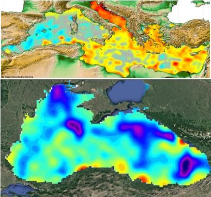
These gridded products are produced from the along-track (or Level-3) SEA LEVEL products (DOI: doi.org/10.48670/moi-00147) delivered by the Copernicus Marine Service (CMEMS, marine.copernicus.eu) for satellites SARAL/AltiKa, Cryosat-2, HaiYang-2B, Jason-3, Copernicus Sentinel-3A/B, Sentinel-6 MF, SWOT nadir, and SWOT Level-3 KaRIn sea level products (DOI: https://doi.org/10.24400/527896/A01-2023.018). Three mapping algorithms are proposed: MIOST, 4DvarNET, 4DvarQG: - the MIOST approach which give the global SSH solutions: the MIOST method is able of accounting for various modes of variability of the ocean surface topography (e.g., geostrophic, barotrope, equatorial waves dynamic …) by constructing several independent components within an assumed covariance model. - the 4DvarNET approach for the regional SSH solutions: the 4DvarNET mapping algorithm is a data-driven approach combining a data assimilation scheme associated with a deep learning framework. - the 4DvarQG approach for the regional SSH solutions: the 4DvarQG mapping technique integrates a 4-Dimensional variational (4DVAR) scheme with a Quasi-Geostrophic (QG) model.
-

These gridded products are produced from the following upstream data: - for satellites SARAL/AltiKa, Cryosat-2, HaiYang-2B, Jason-3, Copernicus Sentinel-3A&B, Sentinel 6A, SWOT Nadir => NRT (Near-Real-Time) Nadir along-track (or Level-3) SEA LEVEL products (DOI: https://doi.org/10.48670/moi-00147) delivered by the Copernicus Marine Service (CMEMS, http://marine.copernicus.eu/ ). The gridded product is based on NRT L3 Nadir datasets for the period from July 1, 2024, to December 31, 2024. => MY (Multi-Year) Nadir along-track (or Level-3) SEA LEVEL products (DOI: https://doi.org/10.48670/moi-00146 ) delivered by the Copernicus Marine Service (CMEMS, http://marine.copernicus.eu/ ). The gridded product is based on MY L3 Nadir datasets for the period from March 28, 2023, to June 30, 2024. - for SWOT KaRIn : the SEA LEVEL products L3_LR_SSH (V2.0.1) delivered by AVISO for Expert SWOT L3 SSH KaRin (DOI: https://doi.org/10.24400/527896/A01-2023.018) for the period from March 28, 2023 to December 31, 2024. One mapping algorithm is proposed: the MIOST approach which give the global SSH solutions: the MIOST method is able of accounting for various modes of variability of the ocean surface topography (e.g., geostrophic, barotrope, equatorial waves dynamic …) by constructing several independent components within an assumed covariance model.
-

The Sentinel-6 Level-2P skewness products was developed to estimate the skewness from Sentinel-6 LR (Low Resolution Mode) and HR (High Resolution Mode) acquisitions. That demonstration product is generated by different retracking processes, provides an initial estimation of such a phenomenon and allows a finer description of the sea state.
-

The SWOT KaRIn Level-3 Wind Wave product (L3_LR_WIND_WAVE) is an innovative product derived from the Unsmoothed L3_LR_SSH product (DOI: 10.24400/527896/A01-2024.003), which is based on the algorithm presented by Ardhuin et al. (2024). L3_LR_WIND_WAVE takes advantage of the KaRIn Low Rate (LR) chain's ability to resolve waves with wavelengths greater than 500 meters (approximately 18 seconds) and provides detailed information on the characteristics of these wave regimes. This includes significant wave height (SWH), dominant wavelength, and wave propagation direction. These regimes are associated with long-period swells and extreme events that play a critical role in ocean dynamics, coastal processes, and maritime operations. The SWOT L3_LR_WIND_WAVE product is organized into two subproducts, "Light" and "Extended". The L2_LR_SSH "Light" product is described in this metadata sheet. The "Light" L3_LR_WIND_WAVE (also known as the "lightweight" product) includes the SWOT L3_LR_SSH 250-m SSHA spectrum, corrected for instrumental effects and expressed in both Cartesian and polar coordinates. It also includes the swell partition of the spectrum and the wave parameters integrated over this partition, for both the WW3 model and the KaRIn model (significant wave height, wavelength, and direction). The "Extended" L3_LR_WIND_WAVE includes the aforementioned variables plus the WW3 spectrum in the same frequency grid as the KaRIn spectrum and the KaRIn transfer functions used for correction, as well as some parameters derived from KaRIn observations (e.g., coherence, mean backscatter).
-

These gridded products are produced from the following upstream data: - for satellites SARAL/AltiKa, Cryosat-2, HaiYang-2B, Jason-3, Copernicus Sentinel-3A/B, Sentinel-6 MF, SWOT Nadir => NRT (Near-Real-Time) Nadir along-track (or Level-3) SEA LEVEL products (DOI: https://doi.org/10.48670/moi-00147) delivered by the Copernicus Marine Service (http://marine.copernicus.eu/ ). The gridded product is based on near-real-time (NRT) Level-3 Nadir datasets for the period from July 1, 2024, to December 31, 2024. => MY (Multi-Year) Nadir along-track (or Level-3) SEA LEVEL products (DOI: https://doi.org/10.48670/moi-00146 ) delivered by the Copernicus Marine Service (CMEMS, http://marine.copernicus.eu/ ). The gridded product is based on MY Level-3 Nadir datasets for the period from March 28, 2023, to June 30, 2024. - for SWOT KaRIn : the L3_LR_SSH Expert v2.0.1 product distributed by AVISO (DOI: https://doi.org/10.24400/527896/A01-2023.018) from March 28, 2023 to December 31, 2024. One mapping algorithm is proposed: the MIOST approach which give the global SSH solutions: the MIOST method is able of accounting for various modes of variability of the ocean surface topography (e.g., geostrophic, barotrope, equatorial waves dynamic, etc.) by constructing several independent components within an assumed covariance model.
-

Monomission altimeter satellite along-track sea surface heights computed with respect to a twenty-year mean. Previously distributed by Aviso+, no change in the scientific content. All the missions are homogenized with respect to a reference mission which is currently OSTM/Jason-2. The sla is computed with an optimal and centered computation time window (6 weeks before and after the date). Two kinds of datasets are proposed: filtered (nominal dataset) and unfiltered.
-

Produit altimétrique combiné (multimissions) régional comprenant les hauteurs de surface (anomalies de hauteurs de mer, topographie dynamique) et variables dérivées (anomalies de courants géostrophiques et courants géostrophiques aboslus) calculées par rapport à une moyenne sur vingt ans.
-

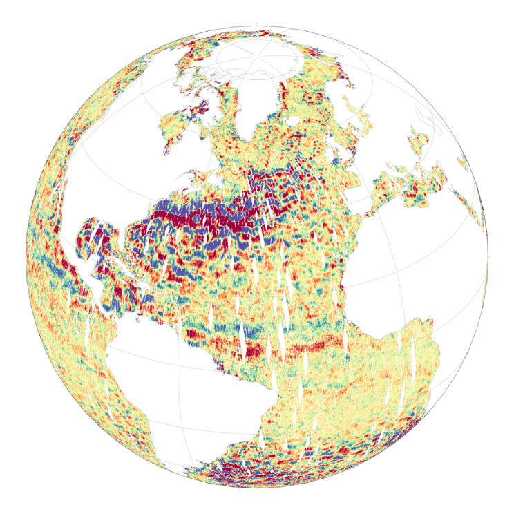
The Level-2 Ka-band Radar Interferometer (KaRIn) low rate (LR, ocean) sea surface height (SSH) data product from the Surface Water and Ocean Topography (SWOT) mission, also referenced by the short name L2_LR_SSH, provides ocean topography measurements from the low rate ocean data stream of the KaRIn instrument, spanning 60 km on either side of the nadir altimeter with a nadir gap. The L2_LR_SSH product is available continuously and globally, although different versions of the product may be produced at different latencies and/or through different reprocessing with refined input data. Note that L2_LR_SSH does not include SSH data from the SWOT nadir altimeter. The SWOT L2_LR_SSH product is organized in four files, the L2_LR_SSH ['WindWave'] is described in this metadata sheet. The 3 other file types (['Basic'], ['Expert'], ['Unsmoothed']) are described by 3 different metadata sheets that can be accessed via the links below. The ['WindWave'] file is intended for users interested in wind and wave information. The ['Basic'] file is intended for users who are interested in SSH measurements and who will use the KaRIn measurements as provided. The ['Expert'] file is intended for expert users who are interested in the details of how the KaRIn measurements were derived and who may use detailed information for their own custom processing. The ['Unsmoothed'] file, also intended for expert users, is provided on a finer 'native' grid of 250-m (with minimal smoothing applied), and has a significantly larger data volume than the other files. The ['WindWave'] L2_LR_SSH includes measured significant wave height (SWH), normalized radar cross section (NRCS or backscatter cross section or sigma0), wind speed derived from sigma0 and SWH, wind and wave model information, and quality flags on a 2 km geographically fixed grid. May 2025: v3.0 (version D) Production and distribution of the L2_LR_SSH version D products: - PID0 for forward-processed version D products: from May 6, 2025 onward, - PGD0 for reprocessed version D products: from March 30 to July 10, 2023 (phase CalVal) and from July 26, 2023 to May 19, 2025 (phase Science) is ongoing. August 2024: v2.0 (version D) L2_LR_SSH version C products declared as validated by the SWOT project. March 2024: v2.0 (version C) Production and distribution of the pre-validated L2_LR_SSH version C products: - PIC0 for forward-processed version C products: November 23, 2023 to present, - PGC0 for reprocessed version C products: from March 30 to July 10, 2023 (phase CalVal) and from July 26, 2023 to January 25, 2024 (phase Science) November 2023: v1.0 The beta pre-validated L2_LR_SSH version 1.0 product (summer 2023 reprocessing release) is available only for the 1-day CalVal orbit phase, from March 29 to July 10, 2023, and the 21-day Science orbit phase from September 7 to November 21, 2023.
-

The Level-2 Ka-band Radar Interferometer (KaRIn) low rate (LR, ocean) sea surface height (SSH) data product from the Surface Water and Ocean Topography (SWOT) mission, also referenced by the short name L2_LR_SSH, provides ocean topography measurements from the low rate ocean data stream of the KaRIn instrument, spanning 60 km on either side of the nadir altimeter with a nadir gap. The L2_LR_SSH product is available continuously and globally, although different versions of the product may be produced at different latencies and/or through different reprocessing with refined input data. Note that L2_LR_SSH does not include SSH data from the SWOT nadir altimeter. The SWOT L2_LR_SSH product is organized as a collection of four subproducts, the L2_LR_SSH ['Basic'] is described in this metadata sheet. The 3 other file types (['WindWave'], ['Expert'], ['Unsmoothed']) are described by 3 different metadata sheets that can be accessed through the links below. The ['Basic'] file on this metadata sheet, is intended for users who are interested in SSH measurements and who will use the KaRIn measurements as provided. The ['Basic'] L2_LR_SSH includes corrected sea surface height (SSH), sea surface height anomaly (SSHA), data quality flags, geophysical reference fields, and height correction information on a 2-km geographically fixed grid. The ['WindWave'] L2_LR_SSH is intended for users interested in wind and wave information. The ['Expert'] L2_LR_SSH is intended for expert users who are interested in the details of how the KaRIn measurements were derived and who may use detailed information for their own custom processing. The ['Unsmoothed'] L2_LR_SSH, also intended for expert users, is provided on a finer 'native' grid of 250-m (with minimal smoothing applied), and has a significantly larger data volume than the other files. May 2025: v3.0 (version D) Production and distribution of the L2_LR_SSH version D products: - PID0 for forward-processed version D products: from May 6, 2025 onward, - PGD0 for reprocessed version D products: from March 30 to July 10, 2023 (phase CalVal) and from July 26, 2023 to May 19, 2025 (phase Science) is ongoing. August 2024: v2.0 (version D) L2_LR_SSH version C products declared as validated by the SWOT project. March 2024: v2.0 (version C) Production and distribution of the pre-validated L2_LR_SSH version C products: - PIC0 for forward-processed version C products: November 23, 2023 to present, - PGC0 for reprocessed version C products: from March 30 to July 10, 2023 (phase CalVal) and from July 26, 2023 to January 25, 2024 (phase Science) November 2023: v1.0 The beta pre-validated L2_LR_SSH version 1.0 product (summer 2023 reprocessing release) is available only for the 1-day CalVal orbit phase, from March 29 to July 10, 2023, and the 21-day Science orbit phase from September 7 to November 21, 2023.
 Catalogue PIGMA