 Catalogue PIGMA
Keyword
Seasonal
Type of resources
Topics
Keywords
Contact for the resource
Provided by
Years
Formats
Representation types
From
1
-
1
/
1
-
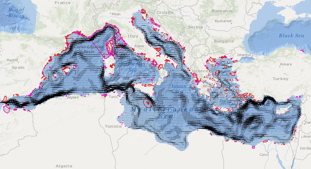
In order to assess the connectivity oceanographic data will be used. A shape map will be created combining data on MPAs adequacy and distribution of MPAs and temperature, currents seasonal GIS layers (The temperature and currents are INGV climatological products made available to CH2.