RDATA
Type of resources
Available actions
Topics
Keywords
Contact for the resource
Provided by
Years
Formats
-
To assess the pressures exerted by scientific research at the Lucky Strike vent field, we compiled a comprehensive inventory of all research activities conducted from 1992 to 2024. These activities included sampling, in situ measurements, mooring deployments, submersible dives, and litter deposition on the seafloor. The type of sampling activities was identified (i.e., biological, rock, sediment, fluid) to evaluate their respective pressures. Litter assessments focused primarily on metallic deadweights, which are currently needed for submersible operations and mooring deployments. These include shuttles —a container deployed to facilitate instrumentation deployment/recovery and sample storage during dives— as well as instrumentation platforms such as the Seamon monitoring nodes, moorings and surface buoy. A census allowed an exhautive list of all available samples, moorings, submersible navigations and litter deposited on the seafloor. In addition, an interactive map allow the visualisation of all these activites, enabling filtration upon the year and type of activity. Rasters for all these activities are also made available (TIF) to be able to import these in GIS projects. In addition, R scripts are joined to analyse these data and compute an Integrated Research Pressure Index (IRPI) and the resulting database is made available in the repository. Temporal and spatial evolution analysis of the IRPI is also available in the scripts. A bibliometric database compiling all publications related to Lucky Strike until 2023 is also available along with a R script to analyse the temporal evolution of publications related to research efforts (IRPI).
-
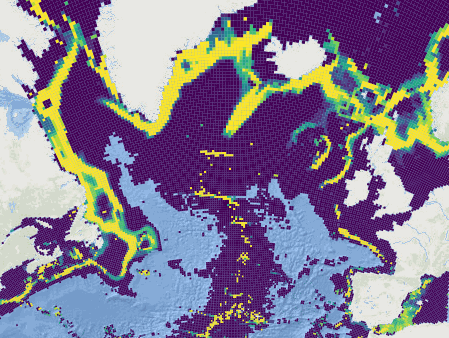
This dataset was built to feed a basin-wide spatial conservation planning exercise, targeting the deep sea of the North Atlantic, in the framework of the ATLAS H2020 project. This approach aimed to inform Marine Spatial Planning and conservation initiatives for the deep sea of the North Atlantic, by identifying conservation priority areas for the Vulnerable Marine Ecosystems (VMEs) and deep fish species and discussing the efficiency of the current spatial management context relatively to conservation stakes. This publication provides (1) the links to spatial datasets used as an input, (2) the R scripts used to run the final conservation scenarios together with associated table of targets and connectivity matrix, that can be run on the input data, and (3) the outputs of the final scenarios constructed and computed for ATLAS. Produced by IFREMER.
Catalogue PIGMA