 Catalogue PIGMA
CSV
Type of resources
Available actions
Topics
Keywords
Contact for the resource
Provided by
Years
Formats
Representation types
Update frequencies
status
Scale
Resolution
-
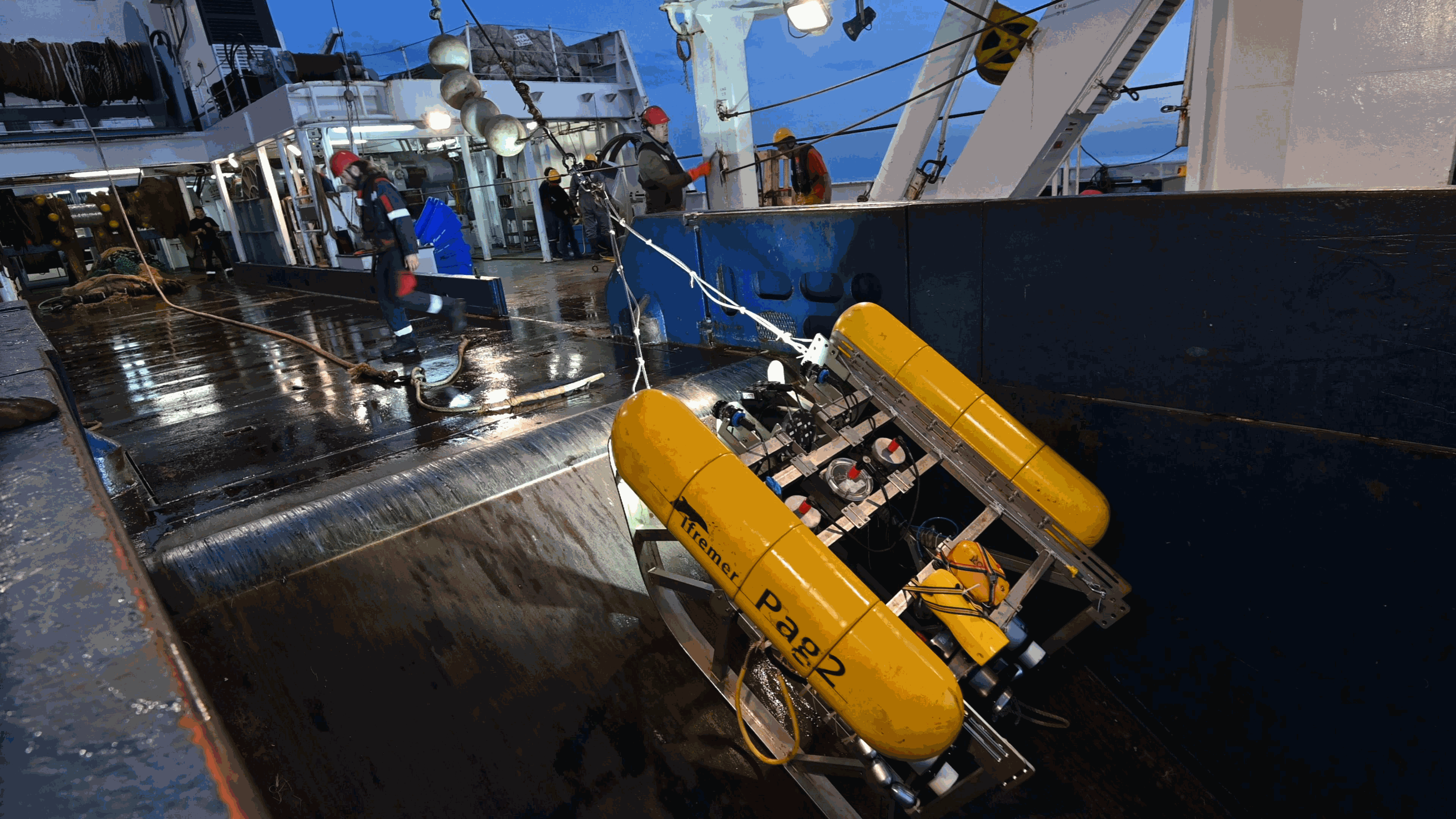
This folder contains two examples of PAGURE datasets, corresponding to three surveys: -CGFS conducted in 2018 in the English Channel (Northeast Atlantic) -EPIBENGOL conducted in 2019 in the Gulf of Lion (Western Mediterranean) -EVHOE conducted in 2020 in the Bay of Biscay and Celtic Shelf (Northeast Atlantic) Files include metadata for the sampling stations, annotation files. A readme tex file contains the links to the voyage metadata This folder is aimed at providing an example of documented underwater imagery dataset. These data are part of the data exchange conducted in the QuatreA collaboration between the French Research Institute for the Exploitation of the Sea (Ifremer), the Commonwealth Scientific and Industrial Research Organisation (CSIRO), and the University of Tasmania (UTAS).
-

This is the FAO Fishery and Aquaculture Reference Data repository: Codes and reference data for fishing gear, species, currencies, commodities, countries and others.
-
210Pb, 226Ra and 137Cs were measured by non-destructive gamma spectrometry on marine sediment cores, collected during RIKEAU 2002 cruise on board r/v Thalia, on the shelf of the Bay of Biscay
-
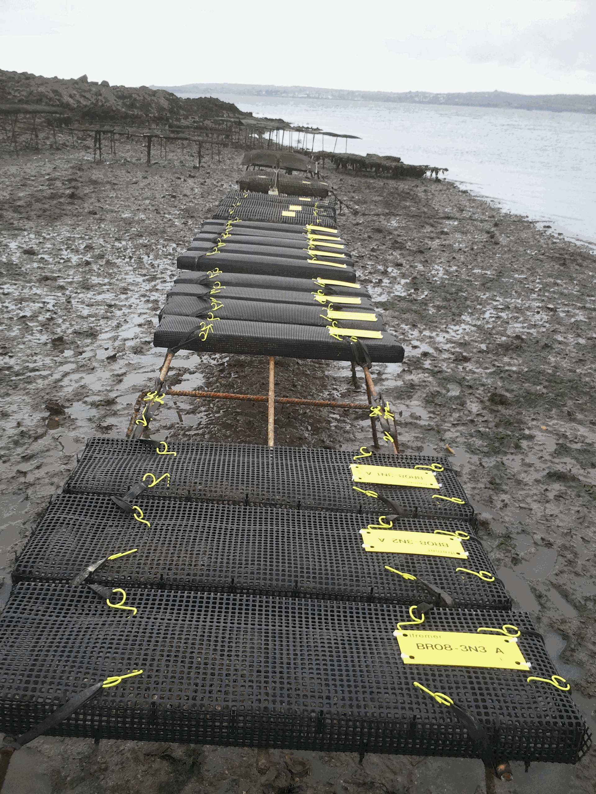
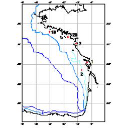
The network was initiated by IFREMER from 1993 to 2009 (under the acronym REMORA) to study the rearing performance of the Pacific oyster Crassostrea gigas at a national scale. To do so, the network monitored annually the mortality and growth of standardized batches of 18-month-old oysters. Starting in 1995, the monitoring of the rearing performance of 6-month-old oyster spat was integrated into this network. These sentinel batches were distributed simultaneously each year on 43 sites and were monitored quarterly. These sites were distributed over the main French oyster farming areas and allowed a national coverage of the multiannual evolution of oyster farming performances. Most of the sites were located on the foreshore at comparable levels of immersion. Field studies were carried out by the "Laboratoires Environnement Ressources" (LER) for the sites included in their geographical area of investigation. Following the increase in spat mortality in 2008, the network evolved in 2009 (under the acronym RESCO). From this date, the network selected 13 sites among the 43 sites previously monitored in order to increase the frequency of visits (twice a month) and the number of sentinel batches. More precisely, sentinel batches of oysters corresponding to different origins (wild or hatchery, diploid or triploid) and to two rearing age classes (spat or 18-month-old adults) were selected. The monitoring of environmental variables (temperature, salinity) associated with the 13 sites was also implemented. The actions of the network have thus contributed to disentangle the biotic and abiotic parameters involved in mortality phenomena, taking into account the different compartments (environment / host / infectious agents) likely to interact with the evolution of oyster rearing performance. Finally, since 2015, the network has merged the RESCO and VELYGER networks to adopt the acronym ECOSCOPA. The general objective of this current network is to analyze the causes of spatio-temporal variability of the main life traits (Larval stage - Recruitment - Reproduction - Growth - Survival - Cytogenetic abnormalities) of the cupped oyster in France and to follow their evolution on the long term in the context of climate change. To do this, the network proposes a regular spatio-temporal monitoring of the major proxies of the life cycle of the oyster, organized in three major thematic groups: (1) proxies related to growth, physiological tolerance and survival of experimental sentinel populations over 3 age classes: (2) proxies related to reproduction, larval phase and recruitment of the species throughout its natural range in France, and: (3) proxies related to environmental parameters essential to the species (weather conditions, temperature, salinity, pH, turbidity, chlorophyll a and phytoplankton) at daily or sub-hourly frequencies. Working in a geographical network associating several laboratories, ECOSCOPA provide these monitoring within 8 sites selected among the previous ones to ensure the continuity of the data acquisition. Today, these 8 sites are considered as ecosystems of common interest, contrasted, namely : - The Thau lagoon - The Arcachon basin - The Marennes Oléron basin - The Bourgneuf Bay - The bay of Vilaine - The bay of Brest - The bay of Mont Saint Michel - The bay of Veys The ECOSCOPA network is therefore one of the relevant monitoring tools on a national scale, allowing to objectively measure through different proxies the general state of health of cultivated and wild oyster populations, and this for the different sensitive phases of their life cycle. This network aims at allowing a better evaluation, on the long term, of the biological risks incurred by the sector but also by the ecosystems, in particular under the increasing constraint of climatic and anthropic changes. Figure : Sites monitored by the ECOSCOPA network
-
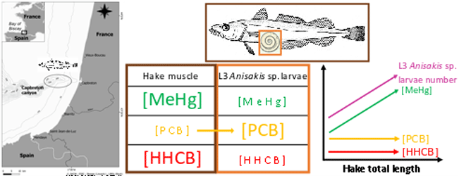
This dataset gathers isotopic ratios (carbon and nitrogen) and concentrations of both priority (mercury species and polychlorinated biphenyls congeners) and emerging (musks and sunscreens) micropollutants measured in a host-parasite couple (hake Merluccius merluccius muscle and in its parasite Anisakis sp) from the south of Bay of Biscay in 2018. In addition, the hake infection degree measured as the number of Anisakis sp. larvae was added for each hake collected.
-

In October 2019 we chose 15 sites from the 2019 EVHOE survey for environmental DNA (eDNA) sampling. The French international EVHOE bottom trawl survey is carried out annually during autumn in the BoB to monitor demersal fish resources. At each site, we sampled seawater using Niskin bottles deployed with a circular rosette. There were nine bottles on the rosette, each of them able to hold ∼5 l of water. At each site, we first cleaned the circular rosette and bottles with freshwater, then lowered the rosette (with bottles open) to 5 m above the sea bottom, and finally closed the bottles remotely from the boat. The 45 l of sampled water was transferred to four disposable and sterilized plastic bags of 11.25 l each to perform the filtration on-board in a laboratory dedicated to the processing of eDNA samples. To speed up the filtration process, we used two identical filtration devices, each composed of an Athena® peristaltic pump (Proactive Environmental Products LLC, Bradenton, Florida, USA; nominal flow of 1.0 l min–1 ), a VigiDNA 0.20 μm filtration capsule (SPYGEN, le Bourget du Lac, France), and disposable sterile tubing. Each filtration device filtered the water contained in two plastic bags (22.5 l), which represent two replicates per sampling site. We followed a rigorous protocol to avoid contamination during fieldwork, using disposable gloves and single-use filtration equipment and plastic bags to process each water sample. At the end of each filtration, we emptied the water inside the capsule that we replaced by 80 ml of CL1 conservation buffer and stored the samples at room temperature following the specifications of the manufacturer (SPYGEN, Le Bourget du Lac, France). We processed the eDNA capsules at SPYGEN, following the protocol proposed by Polanco-Fernández et al., (2020). Half of the extracted DNA was processed by Sinsoma using newly developped ddPCR assays for European seabass (Dicentrachus labrax), European hake (Merluccius merluccius) and blackspot seabream (Pagellus bogaraveo). The other half of the extracted DNA was analysed using metabarcoding with teleo primer. The raw metabarcoding data set is available at https://www.doi.org/10.16904/envidat.442 Bottom trawling using a GOV trawl was carried out before or after water sampling. The catch was sorted by species and catches in numbers and weight were recorded. No blackspot seabream individuals were caught. Data content: * ddPCR/: contains the ddPCR counts and DNA concentrations for each sample and species. * SampleInfo/: contains the filter volume for each eDNA sample. * StationInfo/: contains metadata related to the data collected in the field for each filter. * Metabarcoding/: contains metabarcoding results for teleoprimer. * Trawldata/: contains catch data in numbers and weight (kg).
-
Global Fishing Watch is working across the globe to provide governments and authorities with actionable reports and capacity building to help strengthen fisheries monitoring and compliance. Our global team of experts produce analyses to inform monitoring, control and surveillance of fisheries in five key areas: - Illegal, unreported and unregulated fishing - Transshipment - Port controls - Marine protected areas - Operation support Collaboration and information sharing are integral to achieving well-managed fisheries. By working with stakeholders and making analyses available to national, regional and intergovernmental partners, Global Fishing Watch is enabling fisheries agencies to make more informed and cost-efficient decisions. Topics: - Commercial fishing, Global Fishing Watch is harnessing innovative technology to turn transparent data into actionable information and drive tangible change in the way that fisheries are governed. - Transshipment, Through publicly sharing map visualisations and creating data and analysis tools, we seek to inform management and policy efforts and provide a more complete picture of transshipment at sea. - Marine protected areas, Global Fishing Watch is harnessing the data and technology revolution to support the effective design, management and monitoring of marine protected areas.
-
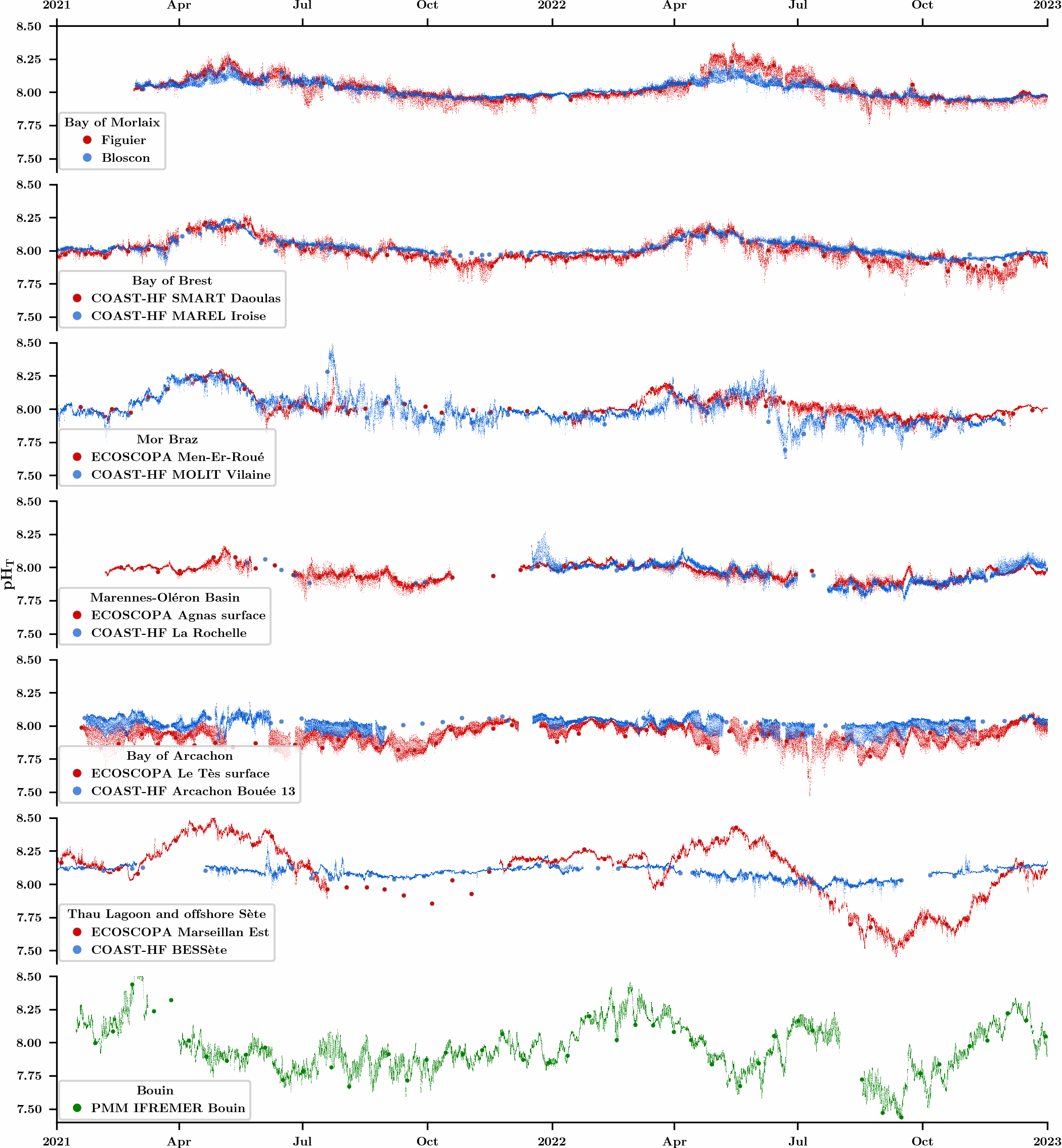
An observation network was initiated in 2021 in the framework of the CocoriCO2 project to monitore carbonate parameters along the French coastal systems. Six sites were selected along the French Atlantic and Mediterranean coastlines based on their importance in terms of shellfish production and the presence of high- and low-frequency monitoring activities. At each site, autonomous pH sensors were deployed both inside and outside shellfish production areas, next to high-frequency CTD (conductivity-temperature-depth) probes operated through two operating monitoring networks (SNO COAST-HF and Ifremer ECOSCOPA). pH sensors were set to an acquisition rate of 15 min and discrete seawater samples were collected biweekly in order to control the quality of pH data (laboratory spectrophotometric measurements) as well as to measure total alkalinity and dissolved inorganic carbon concentrations for full characterization of the carbonate system. While this network has been up and running for more than two years, the acquired dataset has already revealed important differences in terms of pH variations between monitored sites related to the influence of diverse processes (freshwater inputs, tides, temperature, biological processes).
-
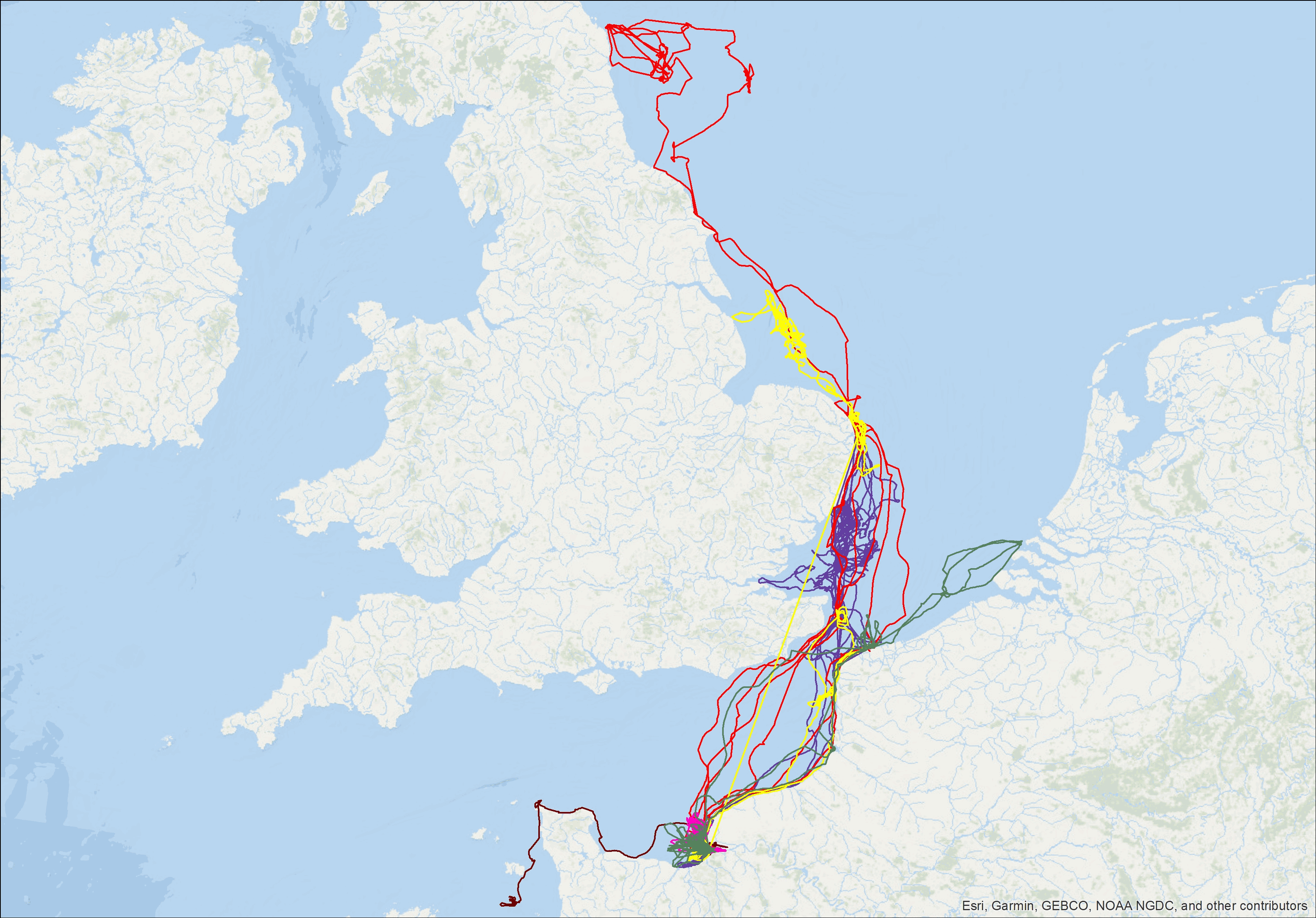
Tracking data of 7 grey seals were obtained from the deployment of Fastloc GPS/GSM tags developed by the Sea Mammal Research Unit (UK). Full tag description is available at: http://www.smru.st-andrews.ac.uk/Instrumentation/GPSPhoneTag/. The tags include a wet-dry sensor from which haulout events are recorded, a pressure sensor providing detailed dive data, as well as a Fastloc GPS recording irregular locations when the seal is not underwater. Data is stored onboard and transmitted via the GSM network when the seal is in the reception range. The data provided here are the individual GPS locations of the seals fitted with these tags for an average duration of 135 days.
-
############# # Data description # ############# This dataset have been constructed and used for scientific purpose, available in the paper "Detecting the effects of inter-annual and seasonal changes of environmental factors on the the striped red mullet population in the Bay of Biscay" authored by Kermorvant C., Caill-Milly N., Sous D., Paradinas I., Lissardy M. and Liquet B. and published in Journal of Sea Research. This file is an extraction from the SACROIS fisheries database created by Ifremer (for more information see https://sextant.ifremer.fr/record/3e177f76-96b0-42e2-8007-62210767dc07/) and from the Copernicus database. Biochemestry comes from the product GLOBAL_ANALYSIS_FORECAST_BIO_001_028 (https://resources.marine.copernicus.eu/?option=com_csw&view=details&product_id=GLOBAL_ANALYSIS_FORECAST_BIO_001_028). Temperature and salinity comes from GLOBAL_ANALYSIS_FORECAST_PHY_001_024 product (https://resources.marine.copernicus.eu/?option=com_csw&view=details&product_id=GLOBAL_ANALYSIS_FORECAST_PHY_001_024). As fisheries landing per unit of effort is only available per ICES rectangle and by month, environmental data have been aggregated accordingly. ############### # Colomns description # ############### rectangle - The 6 ICES statistical rectangles used in the study. time_m - Time in months, from the beginning to the end of the study. annee = year mois = month (from 1 to 12) Poids = Weight of red mullet landed valeur = Temps_peche = fishing time Nb_sequence = number of fishing sequences Moy / Med / Var / StD Quartil_1 / Quartil_3 / min / max / CV / IQR = statistical descriptors of landing by rectangle and by month log_cpue = log of Med colomn mean_surface_s = mean of surface salinity by month and by rectangle median_surface_s = median of surface salinity by month and by rectangle mean_surface_t = mean of surface temperature by month and by rectangle median_surface_t = median of surface temperature by month and by rectangle si / zeu /po4 / pyc / o2/ nppv / no3 and nh4 mean and median concentration by rectangle and by month pc3 / pc2 / pc1 - projections of previous biochemestry variables on the three first axes of a PCA