 Catalogue PIGMA
Oxygen
Type of resources
Available actions
Topics
Keywords
Contact for the resource
Provided by
Years
Formats
Representation types
Update frequencies
status
Scale
-
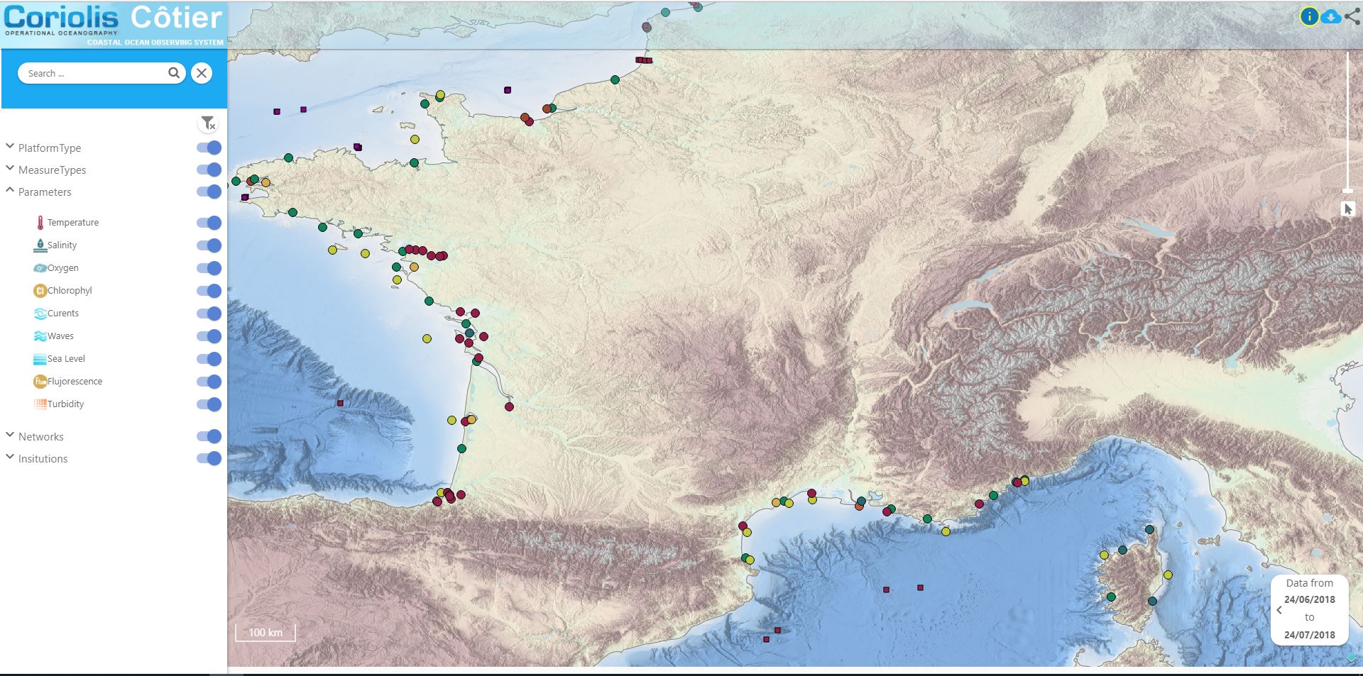
Data available in the French Coast
-
ICES hosts data collected from both net trawl surveys (primarily bottom trawling), and from echo sounding (acoustic sampling in the pelagic zone). The net trawls are primarily hosted in the DATRAS data portal, and the acoustics in the acoustic trawl surveys portal. DATRAS (the Database of Trawl Surveys) stores data collected primarily from bottom trawl fish surveys coordinated by ICES expert groups. The survey data are covering the Baltic Sea, Skagerrak, Kattegat, North Sea, English Channel, Celtic Sea, Irish Sea, Bay of Biscay and the eastern Atlantic from the Shetlands to Gibraltar. At present, there are more than 45 years of continuous time series data in DATRAS, and survey data are continuously updated by national institutions. The acoustic database hosts information on fisheries observations collected from various pelagic surveys coordinated by ICES and falls into two categories: acoustic data, derived from readings taken on vessels, and those obtained through trawls in the open ocean – pelagic – zone. Combined, this provides key biological data on fish stocks such as herring, mackerel and blue whiting as well as krill and other prey species. The data from both systems are used for stock assessments and fish community studies by the ICES community and form the basis of management advice to the relevant regulatory bodies.
-
Data from FerryBoxes on ships of opportunity going on permanent routes are stored inside this database (ferrydata.hzg.de). Parameters are temperature, salinity, chlorophyll-a fluorescence, oxygen and different others. The data model is transect oriented. A data portal to access and visualise the data is also provided.
-
GLODAP is an internally consistent data product for interior ocean “carbon relevant” variables, but in practice this means “everything that is measured from water samples” taken on hydrographic cruises that takes measurements of biogeochemistry, including inorganic carbon measurements. GLODAP was first published in 2004, and a new massively increased version, GLODAPv2, was published in 2016. A new version – GLODAPv2.2018 – will be published in early 2019. GLODAP have three main products: 1) A collection of individual cruise file in a consistent format and 1st level QC, 2) A product that has been bias corrected through 2nd level QC procedures, and 3) an interpolated product on a regular grid.
-
The in-situ TAC integrates and quality control in a homogeneous manner in situ data from outside Copernicus Marine Environment Monitoring Service (CMEMS) data providers to fit the needs of internal and external users. It provides access to integrated datasets of core parameters for initialization, forcing, assimilation and validation of ocean numerical models which are used for forecasting, analysis and re-analysis of ocean physical and biogeochemical conditions. The in-situ TAC comprises a global in-situ centre and 6 regional in-situ centres (one for each EuroGOOS ROOSs). The focus of the CMEMS in-situ TAC is on parameters that are presently necessary for Copernicus Monitoring and Forecasting Centres namely temperature, salinity, sea level, current, waves, chlorophyll / fluorescence, oxygen and nutrients. The initial focus has been on observations from autonomous observatories at sea (e.g. floats, buoys, gliders, ferrybox, drifters, and ships of opportunity). The second objective was to integrate products over the past 25 to 50 years for re-analysis purposes... Gathering data from outsider organisations requires strong mutual agreements. Integrating data into ONE data base requires strong format standard definition and quality control procedures. The complexity of handling in situ observation depends not only on the wide range of sensors that have been used to acquire them but, in addition to that, the different operational behaviour of the platforms (i.e vessels allow on board human supervision, while the supervision of others should be put off until recovering or message/ping reception)°
-
GO-SHIP, the Global Ocean Ship-Based Hydrographic Investigations Program, is conducting repeat hydrography with high accuracy high precision reference measurements of a variety of EOVs through the whole water column. A selection of continent-to-continent full depth sections are repeated at roughly decadal intervals. The data archive for CTD data and bottle data is currently at CCHDO, although the CTD data from European cruises are available at Seadatanet as well.
-
EMODnet Physics provides a combined array of services and functionalities to obtain free-of-charge data, meta-data and data products on the physical conditions of European sea basins and oceans as recorded by more than 20.000 platforms (fixed stations, surface loads, ARGOs, HF radars, etc.) The system provides full interoperability with third-party software through WMS services, Web Services and Web catalogues in order to exchange data and products according to the most recent standards. EMODnet Physics builds on and is based on the cooperation and collaboration with the three established pillars of the European Oceanographic Community: 1) EuroGOOS and its Regional Operational Oceanographic Systems (ROOSs); 2) Copernicus Marine Environment Monitoring Service (CMEMS) , and in particular with the In Situ Thematic Assembly Center (INSTAC); 3) SeaDataNet network of National Oceanographic Data Centres (NODCs). Data are made available by EMODnet Physics, funded by the European Commission Directorate General for Maritime Affairs and Fisheries, in collaboration with Copernicus Marine Service (CMEMS) and EuroGOOS ROOSs INSTAC. Delayed mode data integrates the best available version of in situ data. These data are collected from national observing systems operated by EuroGOOS ROOS members, SeaDataNet NODCs completed by main global networks
-
The mission of OceanSITES is to collect, deliver and promote the use of high-quality data from long-term, high-frequency observations at fixed locations in the open ocean. OceanSITES typically aim to collect multidisciplinary data worldwide from the full-depth water column as well as the overlying atmosphere. OceanSITES delivers high-quality data from long-term, high-frequency observations at fixed locations in the open ocean.
-
SeaDataNet is a standardized infrastructure for managing the large and diverse marine data sets collected at sea by the oceanographic fleets, the ships of opportunity and the automatic observation systems. The SeaDataNet infrastructure network sand enhances the currently existing infrastructures, which are the national oceanographic data centres or data focal points of 34 countries, active in data collection. The networking of these professional data centres, in a unique virtual data management system provides integrated data sets of standardized quality on-line. As a research infrastructure, SeaDataNet contributes to build research excellence in Europe. SeaDataNet connects together more than 100 data centres aiming at preserving and making re-useable marine observations ranging from ocean physics to chemistry and biology. SeaDataNet infrastructure was implemented during the SeaDataNet project (2006-2011), grant agreement 026212, EU Sixth Framework Programme. The second phase, SeaDataNet 2 project (2011-2015), grant agreement 283607, EU Seventh Framework Programme has upgraded the SeaDataNet infrastructure into an operationally robust and state-of-the-art Pan-European infrastructure for providing up-to-date and high quality access to ocean and marine metadata, data and data products by: setting, adopting and promoting common data management standards, realizing technical and semantic interoperability with other relevant data management systems and initiatives on behalf of science, environmental management, policy making, and economy. SeaDataCloud project (2016-2020), grant agreement 730960, EU H2020 programme, aims at considerably advancing SeaDataNet Services and increasing their usage, adopting cloud and High Performance Computing technology for better performance.
-
EMODnet (European Marine Observation and Data Network) is the long term marine data initiative supported by the European Commission since 2009 to ensure that European marine data will become easily accessible, interoperable, and free on restrictions on use. EMODnet Chemistry provides access to standardized, harmonized and validated chemical data collections for water quality evaluation at a regional scale, as defined by the Marine Strategy Framework Directive (MSFD). The data portal has adopted and adapted SeaDataNet standards and services, establishing interoperability between the data sets from the many different providers (more than 60 in EMODnet Chemistry network). Concentration maps of nutrients, chlorophyll-a and dissolved oxygen are computed on a standard grid, providing information at a regular time interval, per season and over several vertical layers, including the deepest one. Dedicated OGC standard services for browsing, viewing and downloading chemistry observation, data and data products for the European waters have been developed, and are actively maintained and monitored.