Keyword

Lowest Astronomical Tide

127 record(s)
 
Type of resources
Available actions
Topics
Keywords
Contact for the resource
Provided by
Years
Formats
Representation types
Scale
Resolution
From 1 - 10 / 127
  • Lidar data taken on the Netherlands side of Sint Maarten, on land and shallow sea.

  • Gridded data for the ESS-ULYX-PP-2023-2 cruise.

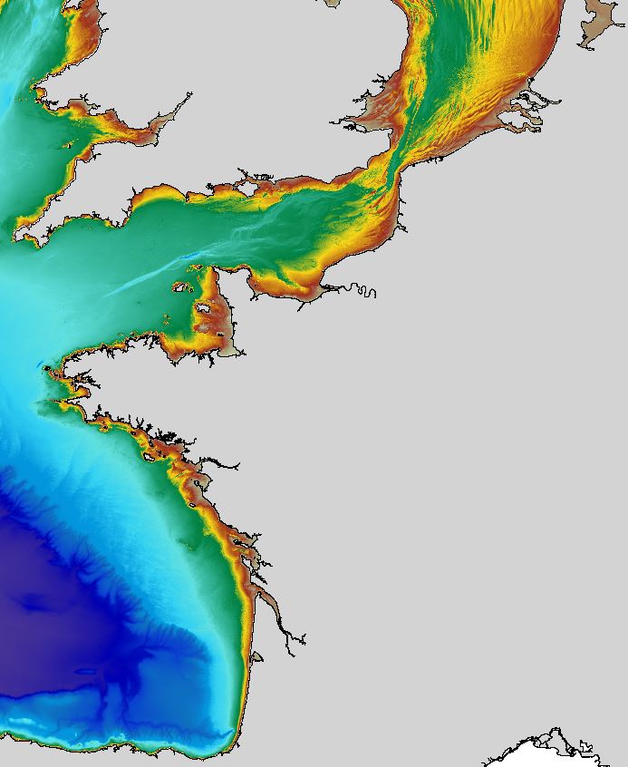
  • The regional bathymetric Atlantic – Channel – North-Sea DTM has a resolution of 0.001° (~111m). Its geographic coverage includes the Bay of Biscay, the English Channel and a part of the North Sea. The DTM extends from the coast to the continental slope (about of 4800m deep). This DTM is produced in the framework of the HOMONIM project which aims at improving operational forecast capabilities for the national coastal flood warning system. This DTM is offered openly on the Shom diffusion website (http://diffusion.shom.fr/produits/bathymetrie/mnt-facade-atl-homonim.html). http://dx.doi.org/10.17183/MNT_ATL100m_HOMONIM_WGS84

  • Multibeam bathymetry of Haifa Bay. Description of processed data sources: the data come from the Israel Oceanographic and Limnological Research R/V Etziona (www.ocean.org). Acquired with a Kongsberg-Simrad EM1002 (90 kHz, 111 beams). The data is the property of the Israeli Government, Ministry of National Infrastructures, which was renamed the Ministry of Energy and Water. The original data is classified. The navigation is all with real-time corrections and is <1 m. The appropriate oceanographic measurements were made with my AML CTD as well as a Valeport SV. The analysis was all done with CARIS HIPS/SIPS.

  • The data have been acquired with a Seabat 8101 (240 kHz) multibeam echosounder mounted on board of a little boat (chief scientist F.L. Chiocci; party chief A. Bosman). The main objective of the cruise was the recognition of the submarine hazard features placed offshore the Cirò Marina-Punta Alice (Ionic Calabrian Coast).

  • Digital Terrain model of the coastal areas of mainland Portugal obtained from a survey with LiDAR technology during the year 2011. This information can be found in the reference system PT-TM06 (ETRS89) .This project is a partnership between the General Directorate of Territory (DGT) and the Portuguese Environment Agency (APA), within the scope of the National Strategic Reference Framework.

  • The data have been acquired with a Seabat 8160 (50 kHz) multibeam echosounder mounted on board of the CoNISMa research vessel "Universitatis" (chief scientist Paolo E. Orrù; party chief Paolo E. Orrù). The main objective of this cruise was to study the instability processes along continental margins of South Sardinia (Sardinia channel).

  • Digital Terrain model of the coastal areas of mainland Portugal obtained from a survey with LiDAR technology during the year 2011. This information can be found in the reference system PT-TM06 (ETRS89) .This project is a partnership between the General Directorate of Territory (DGT) and the Portuguese Environment Agency (APA), within the scope of the National Strategic Reference Framework.

  • The data have been acquired with a Seabat 8160 (50 kHz) multibeam echosounder mounted on board of the CoNISMa research vessel "Universitatis" (chief scientist Paolo E. Orrù; party chief Paolo E. Orrù). The main objective of this cruise was to study the instability processes along continental margins of South Sardinia (Sardinia channel).

  • The data have been acquired with a Seabat 8160 (50 kHz) multibeam echosounder mounted on board of a little boat (chief scientist M.R. Senatore). The main objective of this cruise was the production of the Geological Map of Italy, sheet n. 508 (Policoro).