 Catalogue PIGMA
Oceans
Type of resources
Available actions
Topics
Keywords
Contact for the resource
Provided by
Years
Formats
Representation types
Update frequencies
status
Scale
Resolution
-
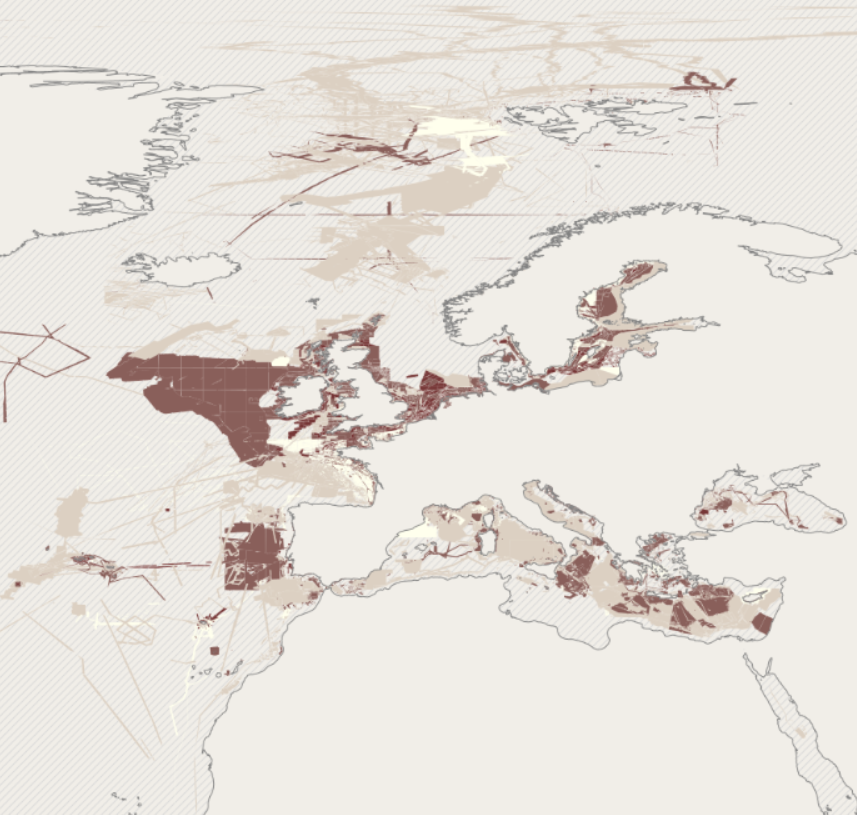
EMODnet bathymetry is composed of a multitude of datasets from a multitude of data providers. Users of the resulting grid and associated datasets need to be able to evaluate at the grid node level the quality of the bathymetric data and product they will be using. For this EMODnet Bathymetry has introduced a Quality index (QI). The QI is available as a WFS service providing vector data and as WMS providing the QI as an image service. The aim of the quality index is to: • help data users to evaluate quickly the dataset they are about to request, • indicate to the EMODnet Basin coordinators what are the limitations of the dataset they are about to merge while building the EMODnet DTM and to • be used as the basis of the evaluation of the quality of the EMODnet DTM. Service URL: https://ows.emodnet-bathymetry.eu/wfs
-
Benthic Non Native Species Tool (Cefas)
-
The mean and time-varying position of the main Southern Ocean polar fronts has been calculated from a combination of gridded altimetric sea level anomalies and a new climatology of mean sea level constructed from historical data and ARGO T / S profiles.
-
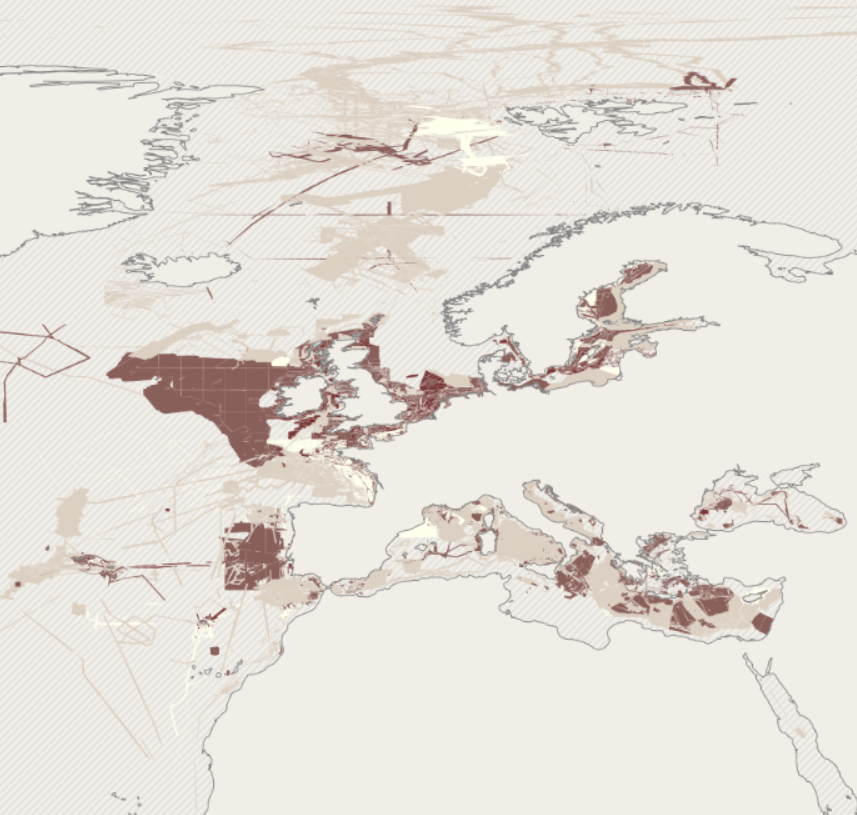
EMODnet bathymetry is composed of a multitude of datasets from a multitude of data providers. Users of the resulting grid and associated datasets need to be able to evaluate at the grid node level the quality of the bathymetric data and product they will be using. For this EMODnet Bathymetry has introduced a Quality index (QI). The QI is available as a WFS service providing vector data and as WMS providing the QI as an image service. The aim of the quality index is to: • help data users to evaluate quickly the dataset they are about to request, • indicate to the EMODnet Basin coordinators what are the limitations of the dataset they are about to merge while building the EMODnet DTM and to • be used as the basis of the evaluation of the quality of the EMODnet DTM. Service URL: https://ows.emodnet-bathymetry.eu/wfs
-
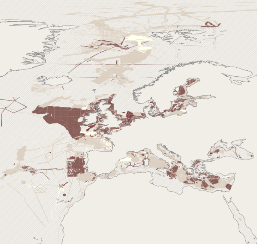
EMODnet bathymetry is composed of a multitude of datasets from a multitude of data providers. Users of the resulting grid and associated datasets need to be able to evaluate at the grid node level the quality of the bathymetric data and product they will be using. For this EMODnet Bathymetry has introduced a Quality index (QI). The QI is available as a WFS service providing vector data and as WMS providing the QI as an image service. The aim of the quality index is to: • help data users to evaluate quickly the dataset they are about to request, • indicate to the EMODnet Basin coordinators what are the limitations of the dataset they are about to merge while building the EMODnet DTM and to • be used as the basis of the evaluation of the quality of the EMODnet DTM. Service URL: https://ows.emodnet-bathymetry.eu/wfs
-
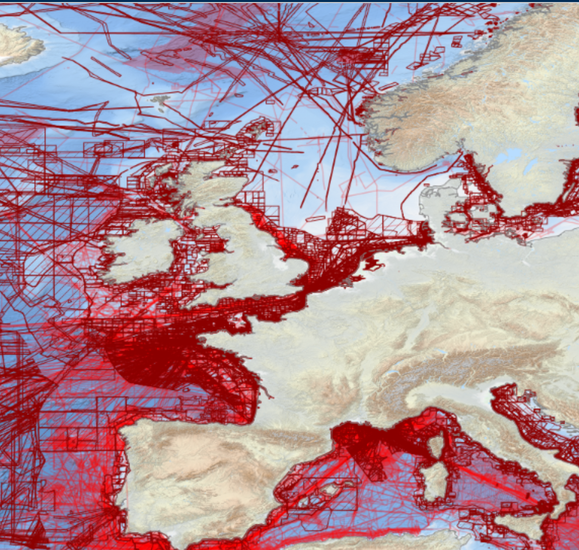
EMODnet Bathymetry has adopted the CDI Data Discovery & Access service as developed and operated by SeaDataNet, the pan-European network of NODCs, to bring together and provide access to available high resolution bathymetric survey data sets from many data providers, such as National Hydrographic Institutes, Research Institutes, and Survey companies. All bathymetric survey data are described with INSPIRE compliant metadata, following the CDI metadata profile, based on ISO 19115 – 19139 standards. This way, the CDI service gives users a highly detailed insight in the availability and geographical spreading of bathymetric survey data sets that are acquired and managed by an increasing group of data providers and for which users can request access for downloading. The CDI metadata are public domain and freely available for all users. However, a major part of the survey data sets is not freely available and requires negotiation with the data owners. The SeaDataNet CDI search, shopping and tracking mechanism facilitates identifying and requesting access to these background data sets from data providers. Note that all data sets are used internally with permission of the data owners for contributing to the EMODnet Digital Terrain Model (DTM) for the European sea regions. The service URL is : https://geo-service.maris.nl/emodnet_bathymetry/wfs?service=WFS&request=GetCapabilities. The layer in the Map Viewer facilitates users to view the locations of the CDI entries and to retrieve details of individual surveys by clicking on the map. From there users are linked to the actual CDI Data Discovery and Access service (https://cdi-bathymetry.seadatanet.org/search) for performing more queries and submitting requests for data access.
-
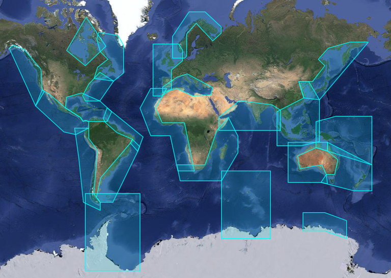
X-TRACK, is a regional altimeter products for coastal applications. It has been developed in order to optimize the completeness and the accuracy of the sea surface height information derived from satellite altimetry in coastal ocean areas. 1hz alongtrack SLA are available in 23 regions for different altimetric missions (Topex, Jason-1&2, Geosat, Ers2, Envisat). SLA is computed on a reference track. X-TRACK SLA files hold alongtrack SLA data together with MSSH, FES2012 tide, Dynamic Atmospheric Corrections and distance to coast parameters. Users can both retrieve filtered and non-filtered data. X-TRACK areas : | short name | long name | |:------------|:---------------------------------| | adelie | Adelie-Mertz | | amazon | Amazon | | asa | Atlantic South America | | chinasea | China Sea | | drake | Drake passage | | eaustralia | East Australia | | gom | Gulf of Mexico - Caribbean Sea | | gulfstream | Gulf Stream | | hudson | Hudson Bay | | humboldt | Humboldt current | | kerguelen | Kerguelen Islands | | labrador | Labrador Sea | | medsea | Mediterranean Sea | | nea | North East Atlantic | | nindian | North Indian Ocean | | norway | Norway | | nwa | North West America | | nwp | North West Pacific | | sea | South and East Africa | | wafrica | West Africa | | waustralia | West Australia | | wla | West Latin America - California | | wtp | West Tropical Pacific |
-
X-TRACK, is a regional altimeter products for coastal applications. It has been developed in order to optimize the completeness and the accuracy of the sea surface height information derived from satellite altimetry in coastal ocean areas. 1hz alongtrack SLA are available in 23 regions for different altimetric missions (Topex, Jason-1&2, Geosat, Ers2, Envisat). SLA is computed on a reference track. X-TRACK SLA files hold alongtrack SLA data together with MSSH, FES2012 tide, Dynamic Atmospheric Corrections and distance to coast parameters. Users can both retrieve filtered and non-filtered data. X-TRACK areas : | short name | long name | | :----------------- | :---------------------------------- | | adelie | Adelie-Mertz | | amazon | Amazon | | asa | Atlantic South America | | chinasea | China Sea | | drake | Drake passage | | eaustralia | East Australia | | gom | Gulf of Mexico - Caribbean Sea | | gulfstream | Gulf Stream | | hudson | Hudson Bay | | humboldt | Humboldt current | | kerguelen | Kerguelen Islands | | labrador | Labrador Sea | | medsea | Mediterranean Sea | | nea | North East Atlantic | | nindian | North Indian Ocean | | norway | Norway | | nwa | North West America | | nwp | North West Pacific | | sea | South and East Africa | | wafrica | West Africa | | waustralia | West Australia | | wla | West Latin America - California | | wtp | West Tropical Pacific |
-
X-TRACK, is a regional altimeter products for coastal applications. It has been developed in order to optimize the completeness and the accuracy of the sea surface height information derived from satellite altimetry in coastal ocean areas. 1hz alongtrack SLA are available in 23 regions for different altimetric missions (Topex, Jason-1&2, Geosat, Ers2, Envisat). SLA is computed on a reference track. X-TRACK SLA files hold alongtrack SLA data together with MSSH, FES2012 tide, Dynamic Atmospheric Corrections and distance to coast parameters. Users can both retrieve filtered and non-filtered data. X-TRACK areas : | short name | long name | |:------------|:---------------------------------| | adelie | Adelie-Mertz | | amazon | Amazon | | asa | Atlantic South America | | chinasea | China Sea | | drake | Drake passage | | eaustralia | East Australia | | gom | Gulf of Mexico - Caribbean Sea | | gulfstream | Gulf Stream | | hudson | Hudson Bay | | humboldt | Humboldt current | | kerguelen | Kerguelen Islands | | labrador | Labrador Sea | | medsea | Mediterranean Sea | | nea | North East Atlantic | | nindian | North Indian Ocean | | norway | Norway | | nwa | North West America | | nwp | North West Pacific | | sea | South and East Africa | | wafrica | West Africa | | waustralia | West Australia | | wla | West Latin America - California | | wtp | West Tropical Pacific |
-
X-TRACK, is a regional altimeter products for coastal applications. Along-track tidal constants (amplitude, phase lags and associated estimation errors for 73 constituents) derived from the X-TRACK T/P and Jason 1&2 is available every 6-7 km along the satellite ground tracks. X-TRACK areas : | short name | long name | |:------------|:---------------------------------| | adelie | Adelie-Mertz | | amazon | Amazon | | asa | Atlantic South America | | chinasea | China Sea | | drake | Drake passage | | eaustralia | East Australia | | gom | Gulf of Mexico - Caribbean Sea | | gulfstream | Gulf Stream | | hudson | Hudson Bay | | humboldt | Humboldt current | | kerguelen | Kerguelen Islands | | labrador | Labrador Sea | | medsea | Mediterranean Sea | | nea | North East Atlantic | | nindian | North Indian Ocean | | norway | Norway | | nwa | North West America | | nwp | North West Pacific | | sea | South and East Africa | | wafrica | West Africa | | waustralia | West Australia | | wla | West Latin America - California | | wtp | West Tropical Pacific |