 Catalogue PIGMA
storms
Type of resources
Available actions
Topics
Keywords
Contact for the resource
Provided by
Years
Formats
-
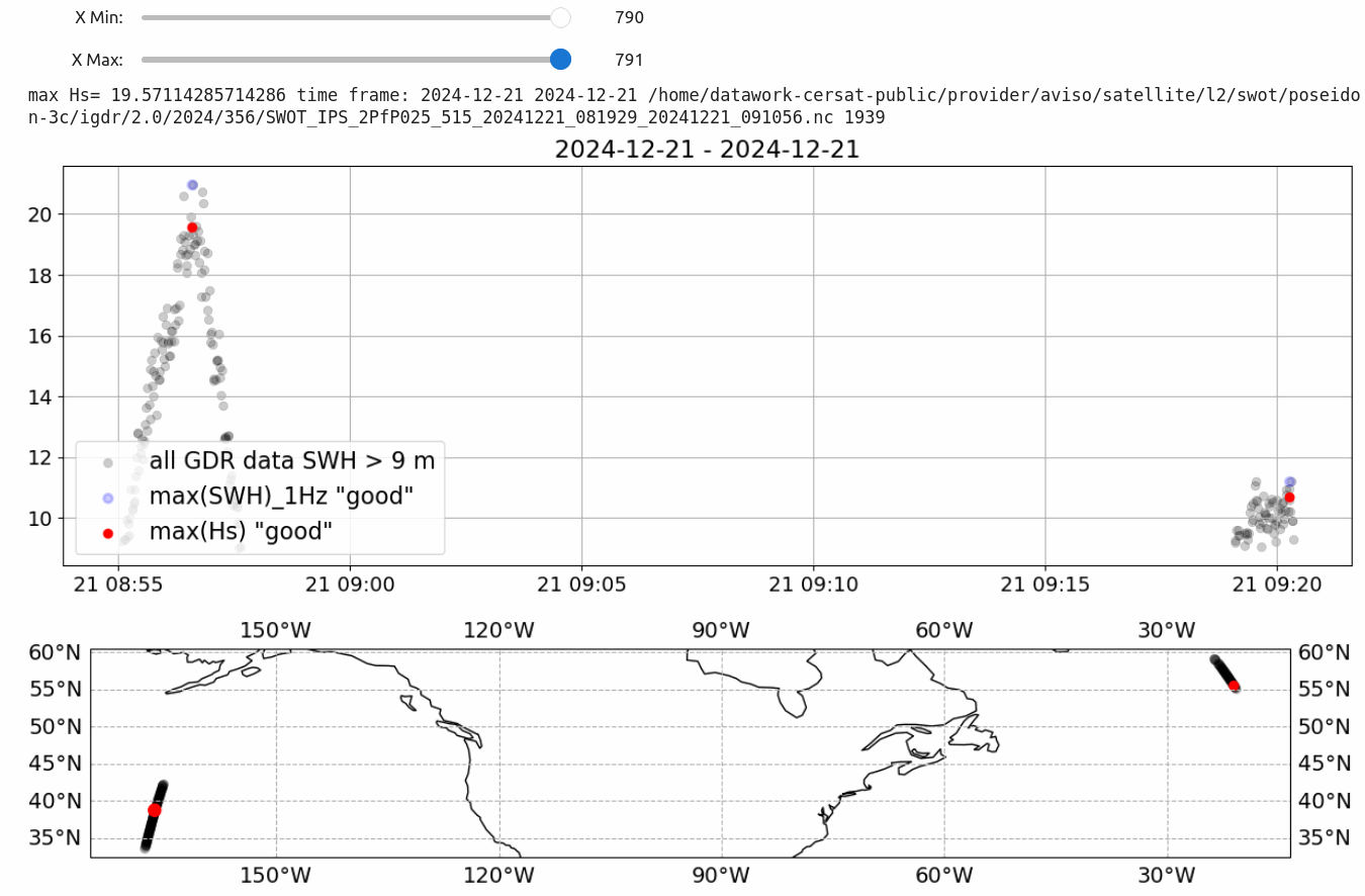
This dataset contains all satellite altimeter wave heights above 9 m, from the following satellite missions: ERS-1, ERS-2, Topex-Poseidon (Topex only), Envisat, SARAL, Jason-1, Jason-2, Jason-3, Sentinel-3A, Sentinel-3B, Sentinel-6A, Cryosat-2, CFOSAT, SWOT. Storm event identification used the DetectHsStorm package developed by M. De Carlo and F. Ardhuin ( https://github.com/ardhuin/) . This data can be combined with modeled storm tracks (see F. Ardhuin, M. De Carlo, Storm tracks based on wave heights from LOPS WAVEWATCH III hindcast and ERA5 reanalysis, years 1991-2024, SEANOE (2025). doi: 10.17882/105148 )
-
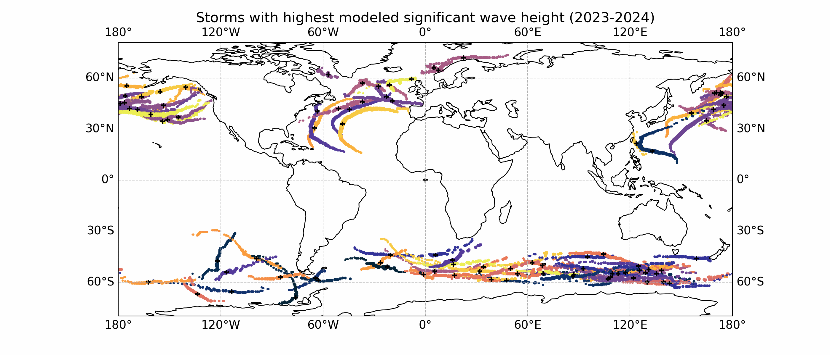
These storm tracks were obtained from tracking the maxima of significant wave heights. The method was adapted from storm tracking methods that typically use sea level pressure.