 Catalogue PIGMA
ArcASCII grid
Type of resources
Topics
Keywords
Contact for the resource
Provided by
Years
Formats
Representation types
Scale
Resolution
-

Composite DTM of the Israel National Bathymetric Survey at 0.10824 minutes resolution
-
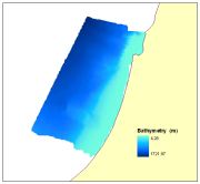
Composite DTM of the Israel National Bathymetric Survey at 0.25 minutes resolution
-

Multibeam bathymetry of the deeper, western half of the Israel EEZ. This dataset was collected, processed, and delivered by the Department of Marine Geology at IOLR. The survey was funded by the Israeli Ministry of National Infrastructure, Energy and Water Resources and carried out during the summer of 2016 onboard the IOLR Research Vessel, R/V Bat-Galim using a gondola mounted Kongsberg EM302 Multibeam echosounder. Project manager: Dr. Gideon Tibor Hydrographers: Tomer Ketter and Asaf Giladi
-

Multibeam bathymetry of the deeper, western half of the Israel EEZ. This dataset was collected, processed and delivered by the department of Marine Geology at IOLR. The survey was funded by the Israeli Ministry of National Infrastructure, Energy and Water Resources and carried out during the summer of 2016 on board the IOLR Research Vessel, R/V Bat-Galim using a gondola mounted Kongsberg EM302 Multubeam echosounder. Project manager: Dr. Gideon Tibor Hydrographer: Tomer Ketter
-

Multibeam bathymetry of Haifa Bay. Description of processed data sources: the data come from the Israel Oceanographic and Limnological Research R/V Etziona (www.ocean.org). Acquired with a Kongsberg-Simrad EM1002 (90 kHz, 111 beams). The data is the property of the Israeli Government, Ministry of National Infrastructures, which was renamed the Ministry of Energy and Water. The original data is classified. The navigation is all with real-time corrections and is <1 m. The appropriate oceanographic measurements were made with my AML CTD as well as a Valeport SV. The analysis was all done with CARIS HIPS/SIPS.